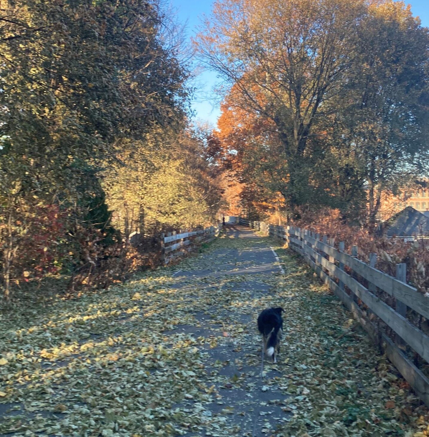
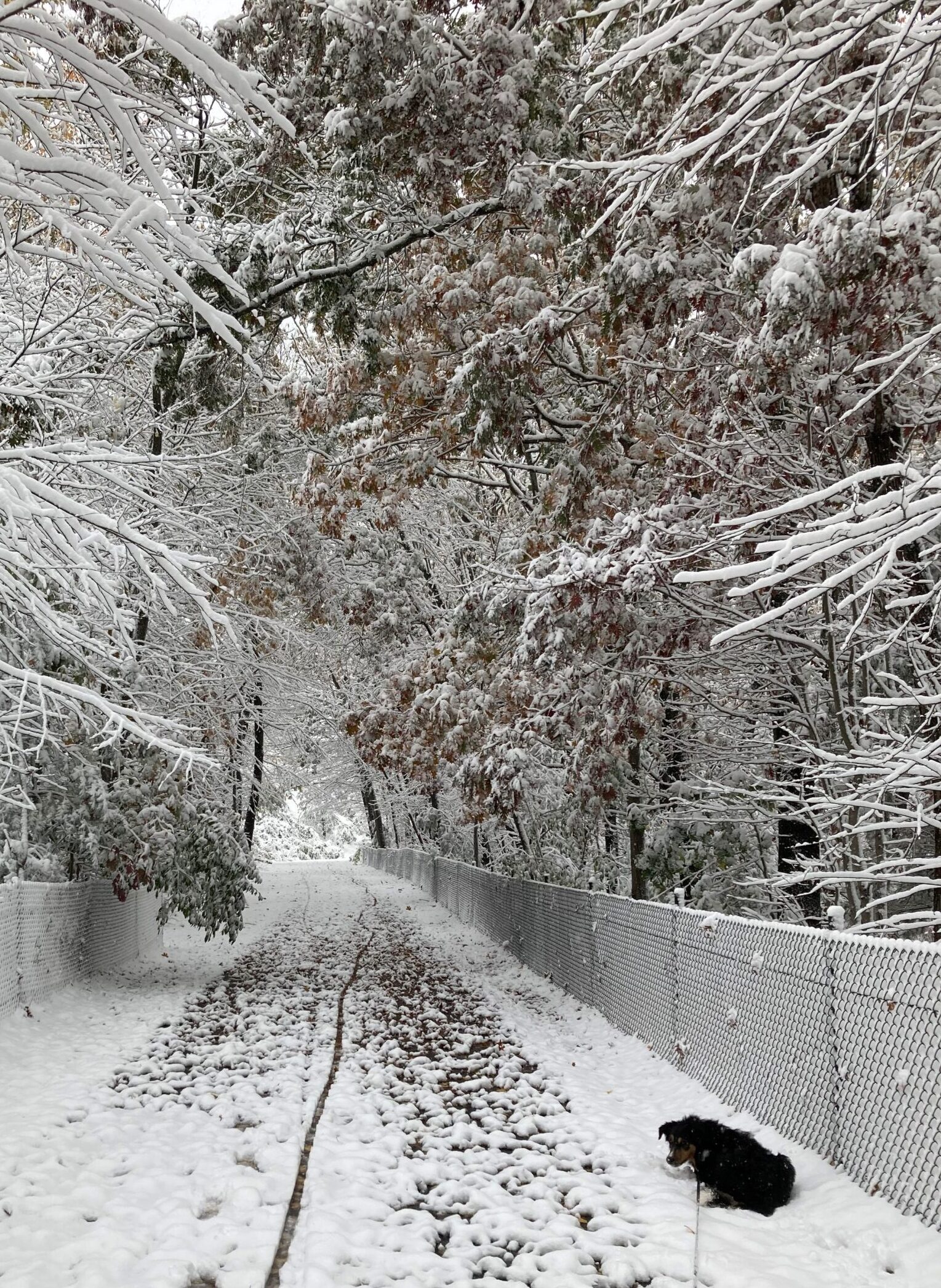
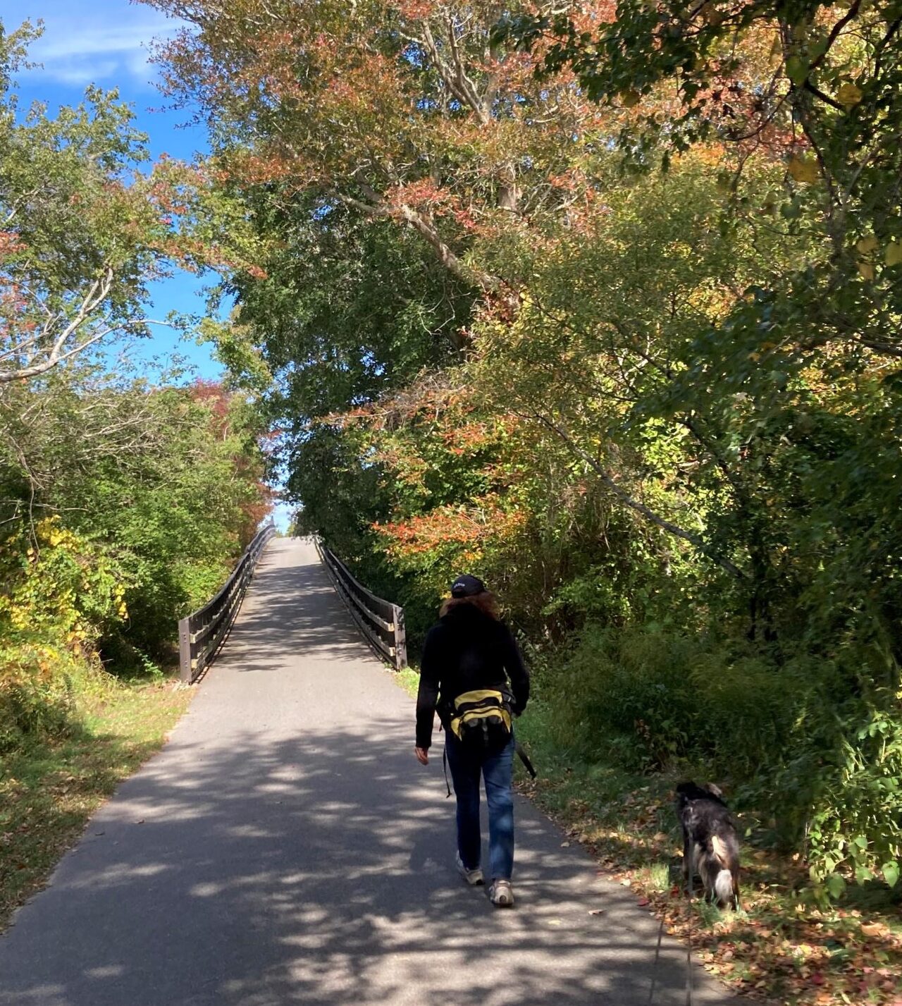
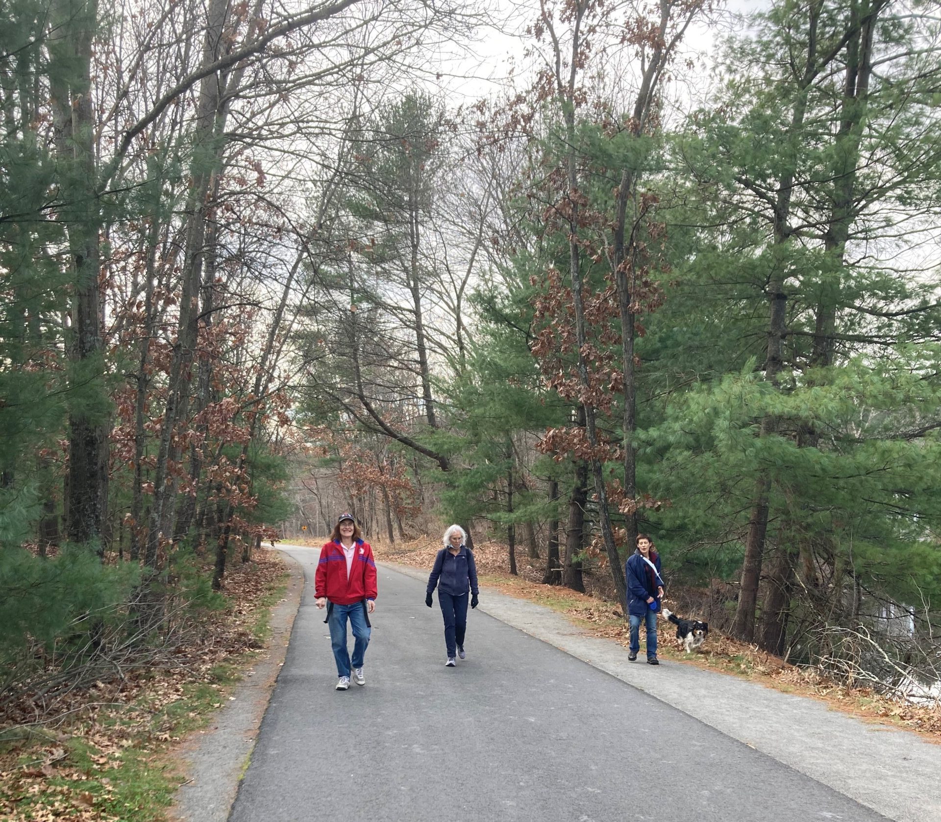
Byron Brumbaugh

December 29, 2020

This trail is wide!


Walking is the best possible exercise.  Habituate yourself to walk very far.

-Thomas Jefferson


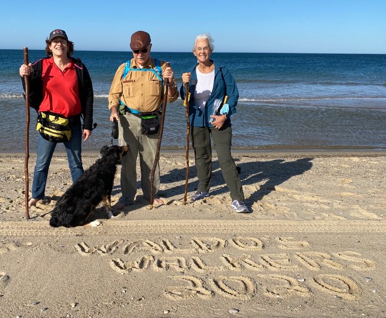
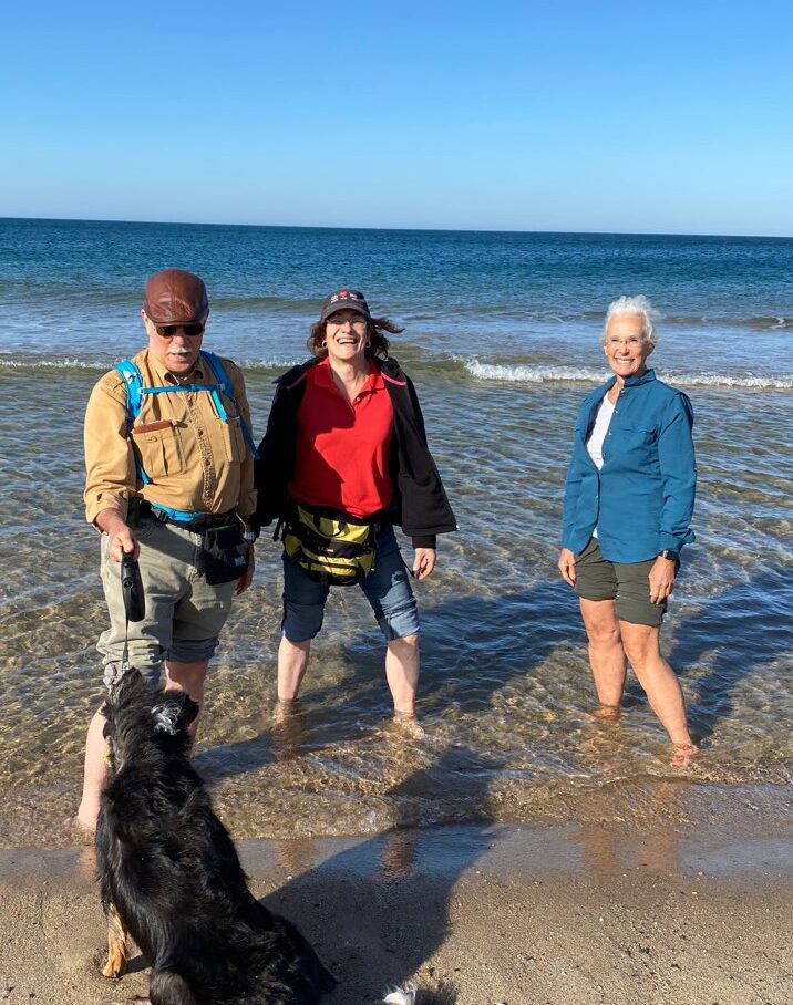
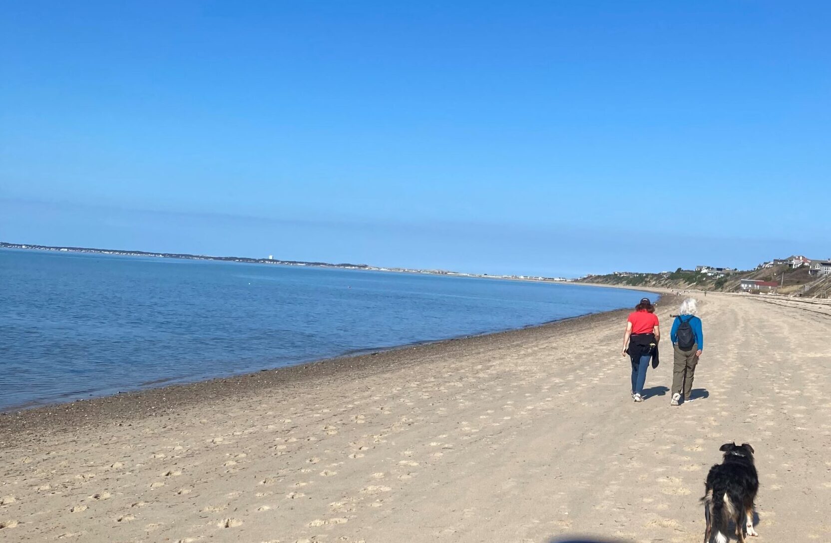
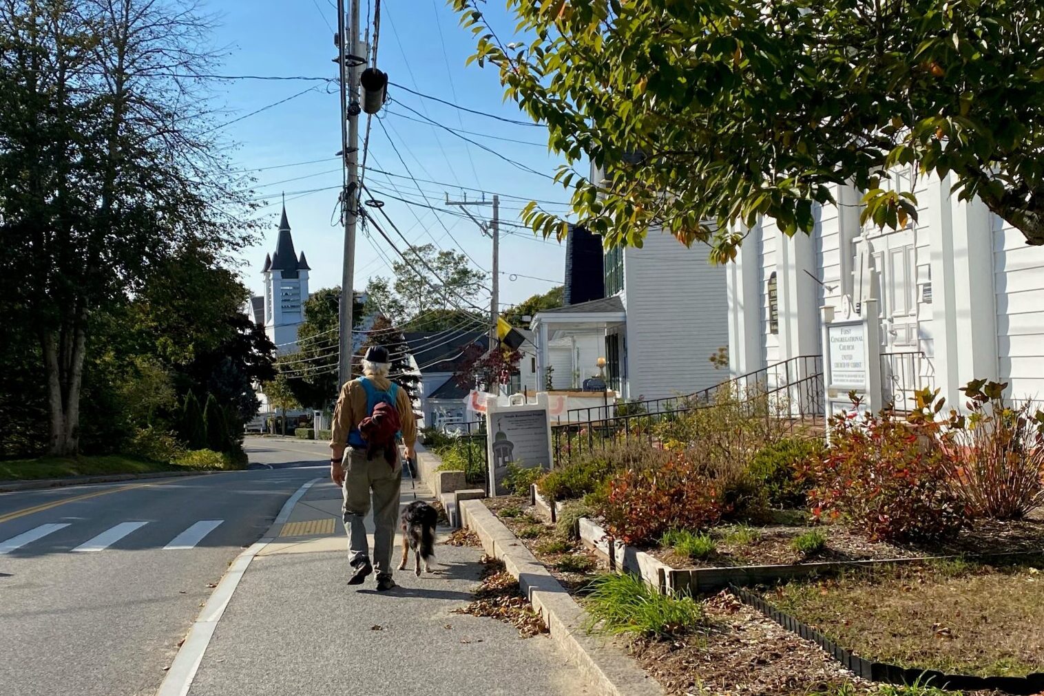
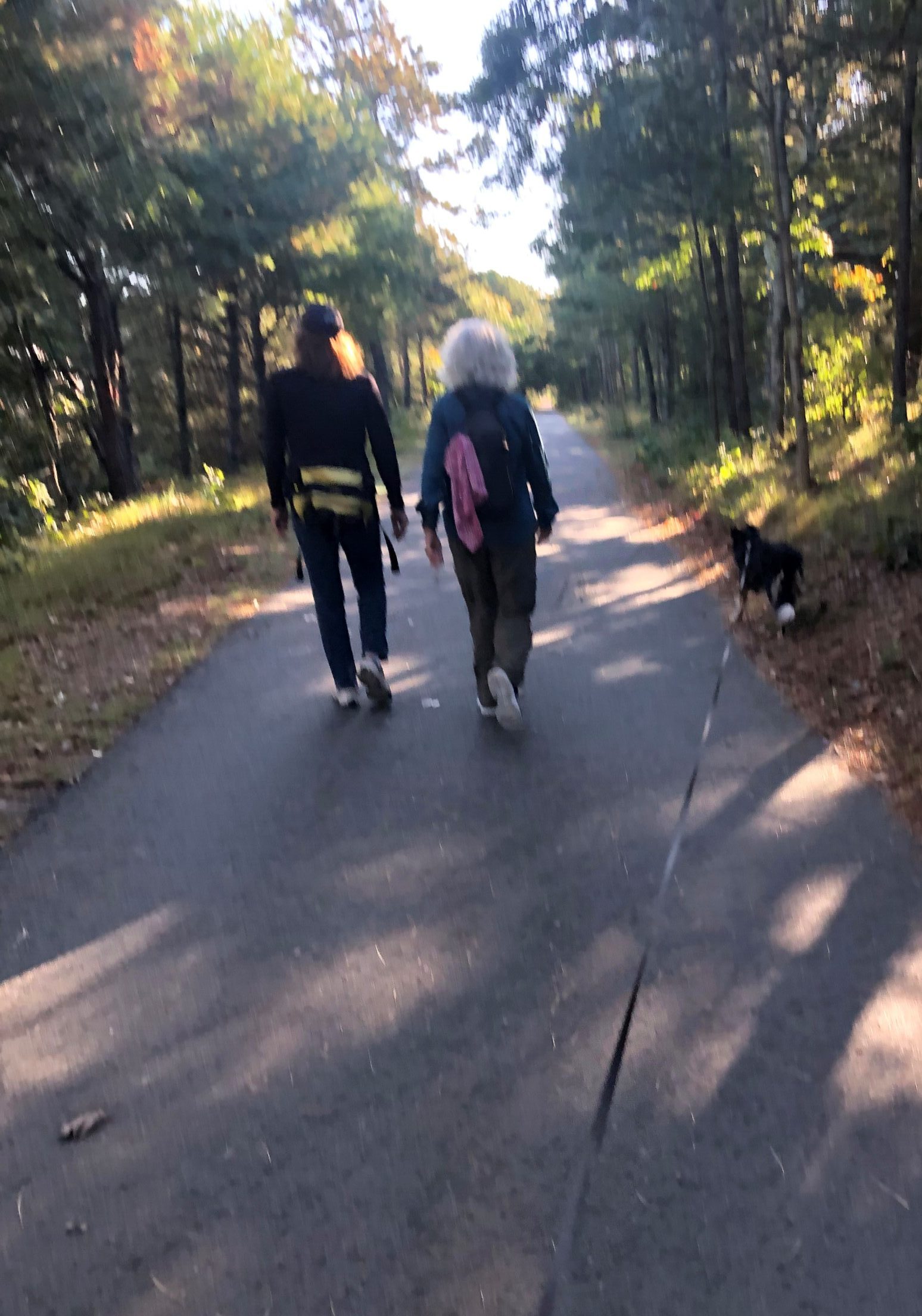
Phyllis, Christine, Waldo and I get together once or twice a week to walk somewhere between 10 and 14 miles.  The idea is to keep our endurance up until we can decide on our next project.  In the past, Phyllis walked 22 miles along the Boston Marathon route and then stopped only because her companions wouldn’t go any farther.  Christine, Waldo and I have done about 15.5 miles, while we were on our way to Provincetown, and were not interested in trying to see if we could make it 16.  Phyllis walks and bikes daily, Waldo and I do six miles a day, and Christine gets plenty of daily exercise taking care of her rescue cows, horses, dogs, cats, and birds.  But still, we’d like to stay in good enough shape so we can walk long distances comfortably.   There are a lot of rail-trails in the area that suit our needs, and even more hiking paths, so there is no want for places to stroll.  Today, we are going on the Bruce Freeman Rail Trail which runs from Acton up to Lowell, some 11.7 miles.  It gets its name from a state legislator who championed the establishment of the trail in the mid-1980s.

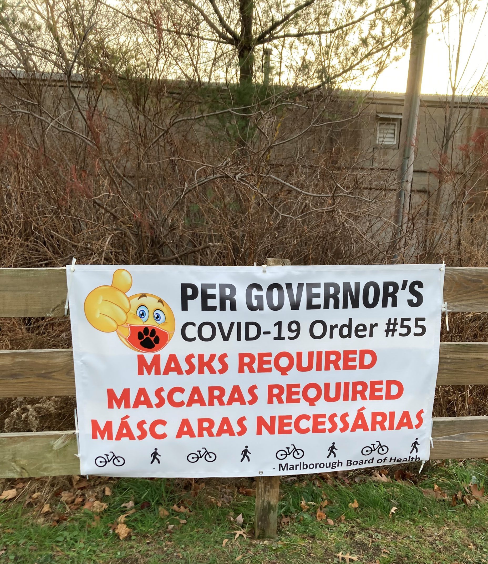
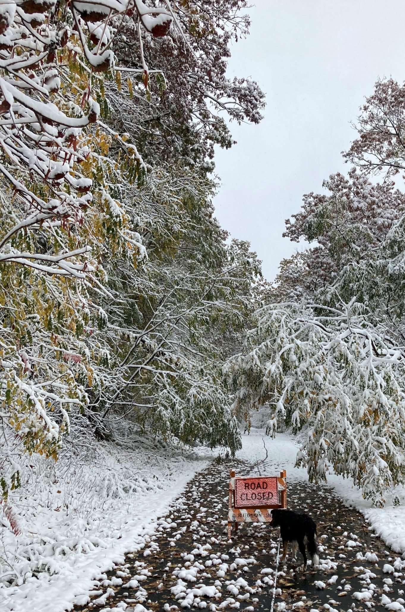
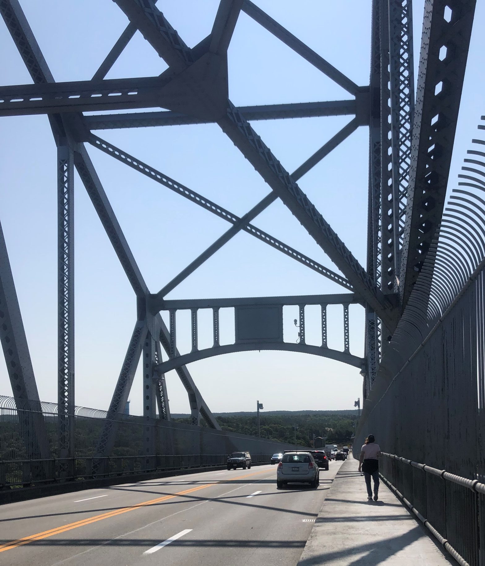
The day is warm, in the mid-fifties, and I am quite comfortable in my hoodie.  There is a parking lot at the trailhead in Acton, where we leave one car, and it has a surprising number of cars in it.  At the end, in Lowell, we leave another car in a parking lot that is also almost full.  We pass many people on the trail, presumably belonging to those cars, who, seemingly, are trying to go on a few more good walks before the bad weather sets in.  These include walkers, with and without dogs, and bikers.  Most are wearing masks; all are pleasant and friendly.

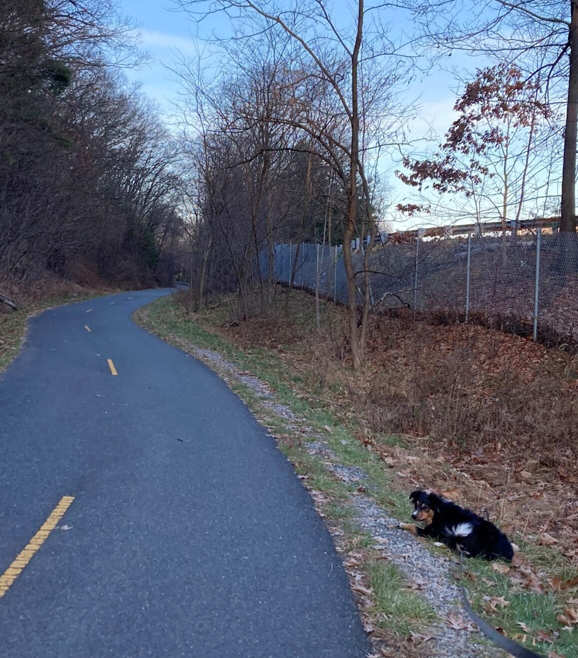
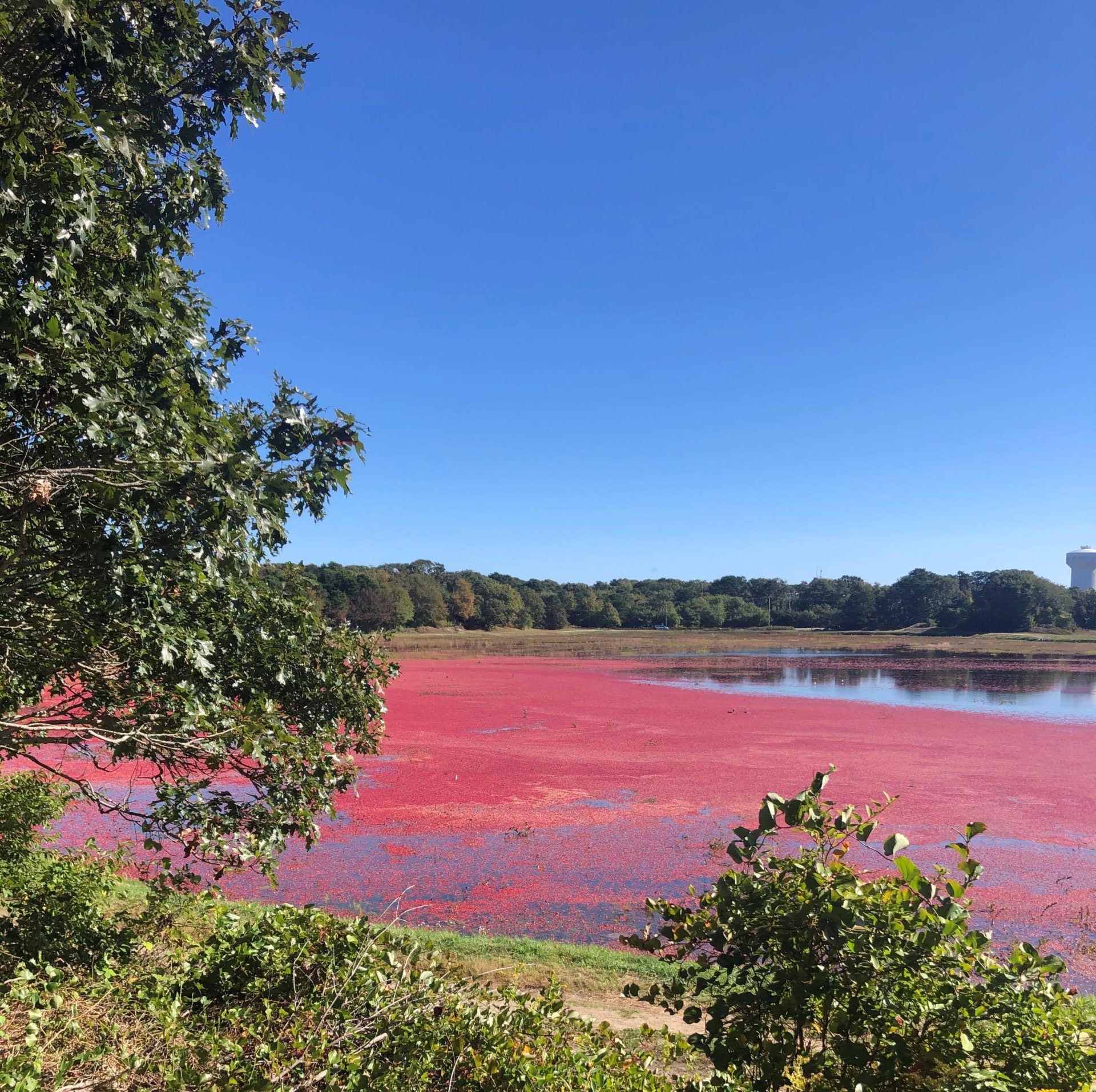
Each rail-trail we’ve walked on has its own character.  This one is paved, flat and wide, as well as popular.   It runs north from Acton and, after only a few minor turns, it passes through swampy areas, alongside a few lakes and ponds, and next to some residential developments.  Most of it is in the country, but as it gets close to Lowell, it does pass through some urban areas.  In fact, it runs right next to the center of downtown Chelmsford.  One of the things that these trails provide is a long path, in or near urban areas, surrounded by wilderness that you can’t see from roads and sidewalks.  I love the fact that I can go a mile from my house, turn right, and end up in a forest that I can saunter into for miles.  Waldo likes that too.

Dogs naturally like to walk.  When they do, they get exposed to a wonderous quantity of odors, a few things to chase, on occasion, and a way to burn off their pent-up physical energy.  They need to exercise their minds too, through play or training, but walking is a great way for them to get physical exercise.  Many dogs are limited as to how far they can comfortably go, but Waldo, well, if he has a limit, I haven’t found it yet.  Once we return home, he seems quite satisfied with what we do, though.

Me, I’m 71 years old, going on 72.  There’s a lot that implies, but one thing is for sure.  I can’t do what I was able to do at 20 and it now takes me longer to get into whatever shape I can achieve.  It also means I lose endurance much faster than when I was younger.  I therefore have to keep walking, every day.  From the time our ancestors became bipedal, walking has been a natural way to exercise.  I can feel my entire physical being strengthen and my endurance improve when I walk regularly.  Because of his relatively big brain, man has created environments to live in where walking is not only not required, it’s inhibited.  This may mean that we have more time to create art, engineer labor-saving machines and learn some of the secrets of the universe, but we’ve also lost the benefits of walking.  Now that I’m retired, I have the time to walk regularly and far.  I just have to make sure I don’t rest too much between jaunts.  The rail-trails have proven to be excellent for this, and Waldo, Christine and Phyllis have proven to be great companions.

But, although I feel this pressure to keep walking, that’s not the core reason why I do it.

I just like to walk with Waldo, and my friends, and do it out in nature.


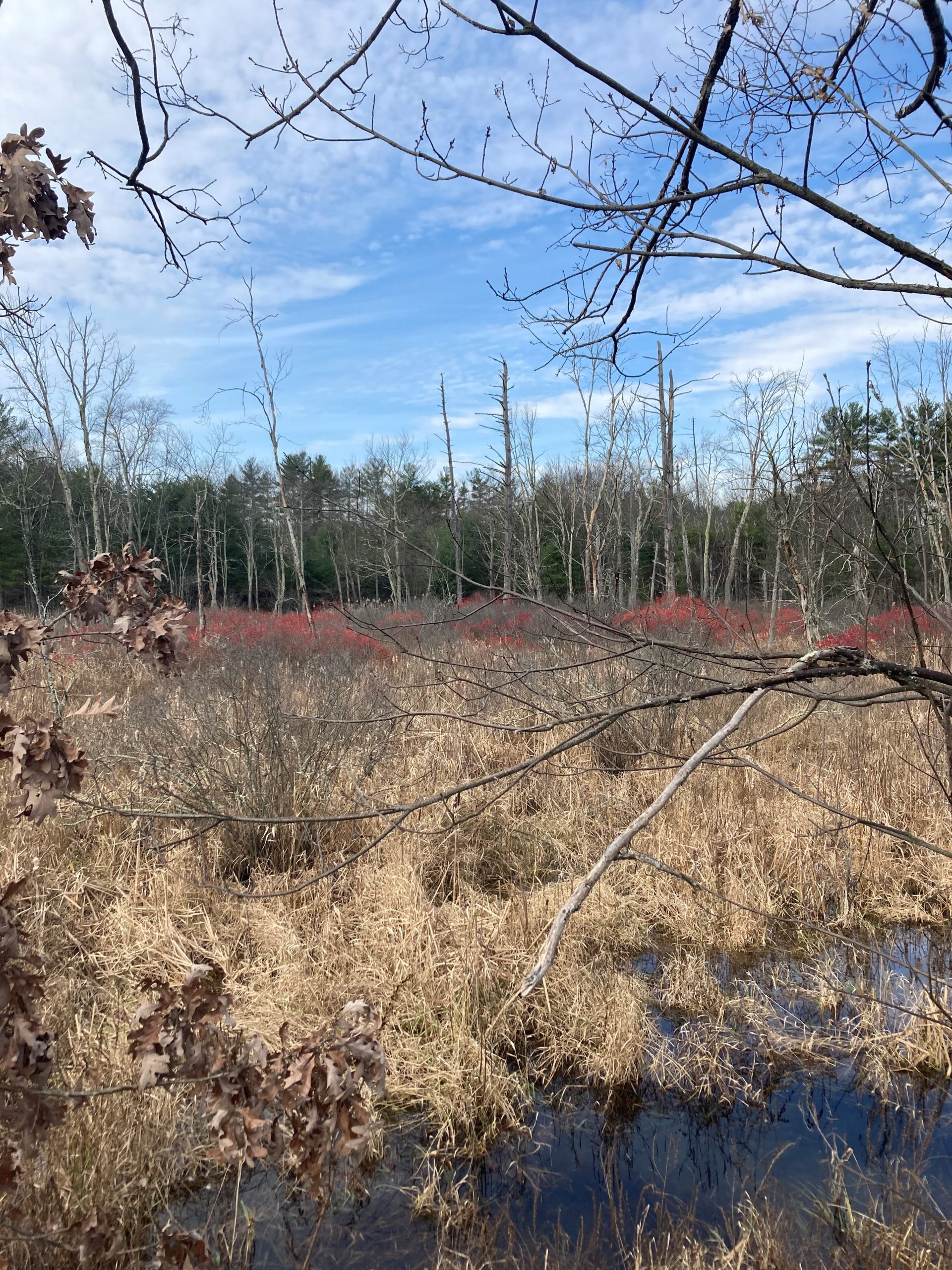
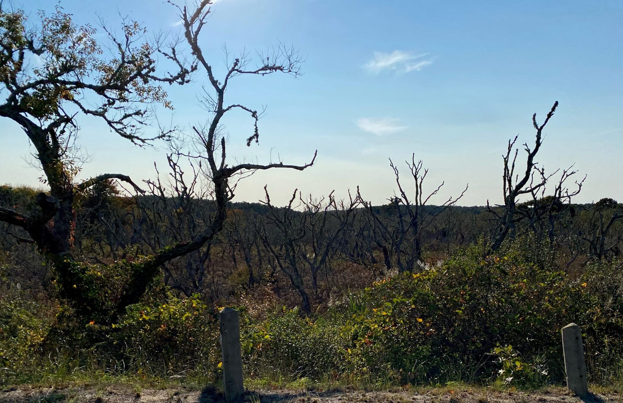
They be swamps here!

Posted by Byron Brumbaugh in Walking with Waldo, 0 comments

December 22, 2020

This is serious, now.


Behind the mask beats a loving heart, willing to save others.

-Helene Munson


It’s right around noon when Waldo and I start our walk on the Marlborough Rail Trail.  It’s overcast with a light breeze and not cold enough to wear a parka.  Brown decaying leaves covering the ground under hibernating trees have become a familiar sight by now and Waldo no longer has voluptuous green bushes to plunge under and into for God-knows-what.  He still has plenty to smell and he is as absorbed, as always, in being out in nature.

Not one quarter mile into our walk and something new appears.  It is a large white sign tied to a rail-fence.  Black and red writing, in capital letters, tells anyone passing by on the trail that the Governor of Massachusetts has ordered that masks are now required.  Up until now, I have been careful to wear a mask, usually a cloth neck gaiter that I can easily and quickly pull up over my mouth and nose, whenever I’m in public indoors, but now I’ll do the same even when walking Waldo outdoors.  I keep the gaiter down around my neck until I see someone approaching, or hear them coming up from behind, then the slip the mask in place well before the recommended six feet of separation is reached.  I keep it there until I’m once again alone for a significant distance.

This I do not only for the protection of myself and others, but also to help decrease the spread of the virus.  I do it as an expression of support for our authorities who are using the meager tools they have available to get this thing under control.  What rational person wouldn’t?  Covid-19 is spread through the air, it is very contagious, it kills (the overall death rate in the world is about 2.3%), there is no natural immunity, and there is no treatment for the virus (although there are some effective supportive measures that can keep some people alive until their bodies can overcome the infection).  It is a potentially catastrophic situation that has only infected about 8 percent of the world’s population (4.2% of the US population).  The infections won’t stop until about 70% of the world’s population is immune.  In the United States alone, if there were no vaccine, that would mean about 230 million people infected and 4.6 million dead.  But there are several vaccines on the horizon and we can reach the 70% immunity by vaccine and avoid 4.3 million deaths in the US, if we can just hold out long enough for the vaccine to become widely available.  This is expected to happen by May of 2021.  Until then, it only makes sense to do whatever we can to limit the spread.  This means following the guidelines provided by the experts who study this stuff and are the most knowledgeable.  Wear your mask, avoid gatherings, etc.

From what I can learn, wearing a mask outdoors doesn’t make much difference.  But it also costs so little – just a little temporary discomfort.  Very little.  The risk to benefit ratio is clearly on the side of the mask.  Apparently, most of the people we pass on the trail agree with me as they are either wearing masks or pull them into place, as I do, when we get close.  There are a few who are not wearing masks, but they give us a wide berth and pass quickly.  All seem to be very friendly and I see none arguing about wearing or not wearing masks.  Judging by what I read and hear from the media, this is not universally true.  At the rate things are going now, some 300,000 Americans will be dead from Covid before Christmas. That’s more than the number of American soldiers who were killed in combat during World War II (291,557).  And Covid has only been killing people for nine months.  America was involved in WW II for three years and nine months.  History will not judge kindly those who oppose following the guidelines.

I have two grandchildren who had the virus and will remember what that was like.  They will also remember how the disease changed all our lives.  Although they aren’t old enough to fully understand the implications of shut downs and job losses, they will remember what it was like to have to stay at home, wear masks in public, and to be denied in-person schooling.  They will remember not being able to shop in the malls and meet with their friends as much as they would like.  They will remember living in a world full of other human beings who could only be touched through digital devices.  But how, I wonder, will they ever explain to their children and grandchildren how it was that so many people fought to avoid the guidelines and allowed the virus to surge to what it is today?  I can’t get my own mind around it.

My family and I, we do what we can and keep on trucking.

At least I can still walk with Waldo, even if it is with a mask.


Despite the pandemic, we are still able to responsibly go for a walk.

Posted by Byron Brumbaugh in Walking with Waldo, 0 comments

December 15, 2020

And suddenly, all the leaves are on the ground.


Winter is an etching, spring a watercolor, summer an oil painting and autumn a mosaic of them all.

-Stanley Horowitz


Meanwhile, back at the Marlborough Rail Trail, the leaves have finally fallen from the trees.  Fractal stick-figure fingers reach for the sky and leave a thick blanket of orange and tan, dead and rotting, leaves on the ground below.  The temperatures are still jumping all over the scale and Waldo and I often wait for the afternoon, for warmer temperatures, before we start our walk.  Sometimes, we wait too long and we can’t finish before dark.  That’s not very hard to do since sunset is now around 4:30 PM.  Today is one of those days.

We walk along, Waldo out in the lead as always, in the long shadows of late afternoon.  I’m dressed in a hoodie and my rain jacket and I’m wearing light-weight gloves.  It’s warm enough.  Waldo, seemingly more comfortable in the cooler temperatures, trots along, carrying his ubiquitous stick.  He’s doing his Waldo thing and I, well, my mind wanders.

Over the past month or so, I’ve watched leaves go from green to a dull orange and yellow.  Then parts of maples let loose their brilliant reds and bright oranges and the oaks turn a splotchy tan.  I watch and wait, wondering which of the deciduous trees will be the last to hang onto their leafy shawls.  All seem to lose their photosynthetic food-source from the bottom up.  Maybe they’re hanging the longest onto those that are most exposed to the sun and its life-giving light.  Leaves fell for weeks, yet, for a long while, some trees still seemed quite green.  Even in four inches of snow.  After that, there were more weeks where plenty of oak leaves lay on the ground, yet their source canopies remained broad and full, although quite tan.  It’s as if nature was culling the foliage to make room for the strong.  Then, over no more than a couple of days, leaves flew like fur in a cat fight.  After that, branches became bare, except for a very few die-hard, brown hangers-on.  As far as I could tell, the last to go naked were the oaks and maples, but they seemed to keep to the same schedule.

White pine is a New England native conifer and there are some around our trail.  These keep our walks ever green, but there aren’t so many of them that it feels like we’re in a lush verdure.  Their needles give a light pine-green stippled tinge to vistas instead of the heavy broad-stroked, opaque, dark forest-green of leafy mid-summer.  Now stripped of their veils, trees reveal defoliated stalks of poison ivy, and other vines I’ve yet to identify, winding their way up many a trunk.  Some are large and as thick as your arm, while others are mere straw-sized tendrils twisting around anything that rises from the ground.  There seem to be more of them near the trail, quickly dropping off to none, thirty feet or so away.  Maybe they need the sunlight provided by the relative openness of the tarmac.  The puffy green blanket of summer now lies flat, yellow and tan on the ground and you can clearly see the skeletal core of the forest.

As the afternoon progresses, shadows lengthen until what light there is becomes diffuse and gray, causing the contrast of light and shadow to blur and making the world seem two-dimensional.   Just after sunset, the air near the western horizon glows with a peachy hue that fades to orange and then blue as your eye tracks overhead and then to the east.  It’s not long, about a half-hour after the sun has disappeared, and even this fades to darkness.  It’s not the abysmal ebony of moonless, cloudy nights deep in primordial forests far from civilization.  Even though the rail trail doesn’t have lights, the ambient city glow provides some low-level light — enough so I can see where I’m going without too much difficulty.  The shades of gray that make up the night are a black-and-white rendition of the pastel late autumn tints of daytime.  But, like black-and-white photographs, the scene has a beauty of its own.  Waldo, mostly black as he is, though, is lost to view as he explores under the bushes on the side of the trail.  He can see better in the dimness than I can and doesn’t seem to notice much of a change.  But then, why would he when he sees the world through his nose?  I wonder if things smell different after the sun goes down.  Maybe so.  The temperature and humidity changes could make a difference.

In not too many days or weeks, all will be monotonously gray and white, even in daytime, with only an overhead icy, deep blue to add color to the world.

I will miss fall.


It gets kinda dark around here.

Posted by Byron Brumbaugh in Walking with Waldo, 0 comments

December 08, 2020

We made it, sticks and all.


Everywhere is walking distance if you have the time.

-Steven Wright


The forecast is for clouds and a light breeze, with temps in the low 60’s, for the last leg of our journey to the far end of Cape Cod.  There’s a parking lot at the beach at Race Point where we leave Christine’s pickup.  This is the last part of our journey and I wanted everyone to have a souvenir to remember it by, so I bought each of us a wooden walking stick.  In the parking lot, I perform a corny ceremony before giving each their pole.  Asking Christine and Phyllis to take a knee, I recite:


“By trial of miles and blisters, and by effort of stubbornness of purpose, you have gained great merit.

“In the name of ibn Battuta, one of the greatest travelers of all time, and through the power vested in me by Waldo, the Branch Manager, I hereby proclaim you to be an honored member of Waldo’s Wandering Walkers. 

“Rise and take up your staff of honor.

“May the Earth roll softly beneath your feet.”


I hand each their staff, give Waldo a stick and the four of us pile into my car to return to Pilgrim Monument and start our walk.

Once afoot, each with staff in hand (Waldo, with stick in mouth), we walk along Conwell Street, cross over Rte 6, then, shortly thereafter, find a nice serpiginous, paved, bike path that winds its way through the coastal sand dunes.   There’s loose, dry sand everywhere.  There are no oak trees here, they were left back aways, before we hit the dunes.  Here, there is just short scrub pine growing in the sand.

In four miles, we come to the truck and take off our shoes and socks.  We walk barefoot the short distance to the beach.  There’s a chill breeze blowing in off the Atlantic, but it’s not too cold.  We roll up our pant legs and wade into the three-inch surf that’s rolling ashore over a shallow bottom.  The water is cold, but not freezing.  I hoped Waldo learned his lesson about drinking seawater, but he didn’t, so I can’t stay in the water long.

We made it.  Some seven months ago, we started out on a lark.  In total, we walked about three hundred miles and saw a healthy cross-section of Massachusetts.  From the hills of the western part of the state, across the Connecticut River, through farmland, past the Quabbin Reservoir, down rural roads and paths, along highways, backstreets, trails and old railroad beds, over bridges and, finally, onto the sandy beaches at the eastern extreme of the state, we trod along the same ground as many of our ancestors.  Our national history runs deep here; we followed many of the same paths and learned some of the history of our early countrymen. And we did it in the middle of a pandemic.  We met many people in passing, at a distance, and all of whom were friendly and supportive.

When we started this trip, I was asked why?  Why do it?  What’s the purpose?  I had no good answer then; it just seemed like an interesting thing to do.  But now?  Now, I can say what it did.  It rooted me, you know?  It bound me to history, to the soil, to our shared human struggle.  It bound me to my fellow Americans, past and present, and gave me a better feeling for who’s out there in all of their diversity.  It’s one thing to see the country over TV and film, to see it from the air or from inside the metal cocoon of a car.  It’s quite another to wear blisters and strain tired muscles, expose your skin to sun and wind, hot and cold, to meet random people along your path with openness and friendliness, and actually be in the places you move through.  And in so doing, travel through some of our collective past.  To visit places where George Washington slept, to walk the same ground as Daniel Shays, to pass through the town named after Daniel Webster.

As for Waldo?  At the very least, he broadened the range of his olfactory knowledge of his environment, learned more of what’s possible.  He’s at a time in his life where he’s still exploring what’s out there, what there is to experience.  I’m more in a place where I’m working on perspective, trying to tie life’s experiences up in a neat bundle.  I know, good luck with that.  It’s like a friend of mine once told me, “It’s not that I don’t have my shit together, I just can’t hold it all at once.”

After the photo ops, and champagne (we celebrated with a nice bottle of Veuve Clicquot Yellow Label Brut) on the beach, after some local seafood (Waldo got some fish too), we get back home and settle in to the big question.

So, what’s next?


Our requisite wade into the Atlantic.

Posted by Byron Brumbaugh in Walking with Waldo, 1 comment

December 01, 2020

It is snowing!


Snow brings a special quality with it – the power to stop life as you know it dead in its tracks.

-Nancy Hatch Woodward


Winter has come like a sucker punch.  One day, we are walking on the beach at Cape Cod, enjoying the warm fall sun and feeling like we have accomplished something challenging, then, just a couple of days later, we’re floundering in cold wet rain.  Within a week, four inches of snow arrives and the temperature drops to the low twenties.  Ouch!  Now, Waldo and I walk no matter what the weather is, but Christine, Phyllis and I decided to postpone the last leg of our trek, from P’town to Race Point, until after this frosty blast has passed.  We want to avoid walking in the surf, barefoot, in frigid gale force winds — we really would like to enjoy the capstone of our journey, not just tolerate it.

So, here we are, Waldo and I, walking on the Marlborough Rail Trail in the middle of a snowstorm.  In the icy cold wind.  I’m wearing a tee shirt, under a heavier shirt, my parka with the hood up, and my rain jacket over all.  I also put a pair of gaiters on over my walking shoes to keep the snow out.  I’m toasty, except for the exposed skin of my face which is somewhat numb.  The white stuff isn’t so deep, nor so slippery, that it takes a lot of work to walk in it and we make good progress.  Waldo, of course, is enjoying the early wintery whiteness, bounding and rolling in it and scooping up mouthfuls of soft, but heavy, snow.

We aren’t entirely alone, either.  There aren’t any other dogs that we pass, but there are a few walkers, joggers and even two bicyclists out and about.  Many of the trees have a lot of leaves still hanging onto their branches (apparently, they missed the memo too).  The leaves and branches grab onto the heavy snow as it falls, weighing them down and causing them to bow over the trail and touch the ground.  These, we have to meander around, which isn’t much of a problem because they don’t completely block the trail.  It does seem a little strange, though, to see so much snow on the trees while they still carry so many leaves.

The undergrowth has died back by now, exposing the landscape beyond.  I can see a lot farther through the tree trunks than I can in midsummer.  In most places, I can see all the way to the edge of civilization – streets, houses and traffic.  Still, there are deep gullies that fan out from where I stand and into the distance, revealing snow-drenched foliage out as far as a mile or so.  The usual squirrel or chipmunk is nowhere in sight and the birds that haven’t gone south must be holed up in their nests, all fluffed out in their wintery down, because I neither see nor hear them.  I don’t know how, but Waldo is still able to sus out sticks and he has two in his mouth most of the time.

In not too many more weeks, this kind of walk will be the rule.  Months will go by without the snow and ice completely disappearing from the ground.  Snow banks and slushy walks will make it impossible to return home without wet feet.  Cold winds will threaten to frostbite my nose and fingers.  There will be days when the snow is so deep, it will take a full hour to plod through it for even a mile.  On some days, I won’t be able to find a place to park before we start our walk because the lots won’t yet be plowed.  Spring will beckon like a coquette, causing me to count the days until it’s warm enough to walk in shirtsleeves.  But that time isn’t yet.  The forecast is for sunny, warm days with temperatures in the high sixties just a week from now.  Not for long, just for a couple of days.  But long enough for us to complete our New York Border to Cape Cod trek.

In shirtsleeves!


Road? What road?

Posted by Byron Brumbaugh in Walking with Waldo, 0 comments

November 24, 2020

On the Beach. Provincetown in the distance on the left.


Nothing soothes the soul like a walk on the beach.

-Anonymous


It’s 6:30 AM on a foggy Sunday in Marlborough.  The air is still and damp in the predawn darkness when the four of us, Christine, Phyllis, Waldo and I, meet in the Hannaford parking lot next to exit 24 off Interstate 495.  The chance of rain was forecast to be 5%, but a very light drizzle, more of a heavy mist, really, left everything solid covered with a thin sheet of moisture.  Gassed up, we leave one car behind in Marlborough and take the other two down 495, then onto its extension, Rte 24, and over the Bourne bridge to US 6 and Cape Cod.  Two and a half hours after we left Marlborough, we arrive in Provincetown.  Following our well-oiled routine, one car is parked at our end point, in the lot below the Pilgrim Monument that towers above the town like a massive Egyptian stele.  By that time, the sun has been up for a good two hours, the sky is blue, not a cloud in sight, the temperature hovers around 60 degrees and a gentle breeze tickles at the small hairs on my face and arms.  From Provincetown, we take Christine’s king-cab pickup, Waldo and I in the back seat, Christine and Phyllis in front, to where we start the day’s walk – a parking lot just off US 6 in Truro.

On May 15, 1602, coming from the mainland, Bartholomew Gosnold landed near Provincetown.  Later that day, he caught a great deal of cod and, as a result, decided to call the area Cape Cod.  The name stuck.  On November 9, 1620, the Mayflower sighted Cape Cod on their way to the Colony of Virginia, where they hoped to settle.  After two days of trying to fight strong winter seas and failing to sail south, they returned to the safety of what is now known as Provincetown Harbor.  The Mayflower Compact was drawn up and signed and, as they say, the rest is history.  The Cape served the colonists with its excellent fishing grounds and its deep-water harbor, considered the best along the coast.  Provincetown was incorporated in 1727, but had only a small population throughout most of the eighteenth century.  After the Revolutionary War, Provincetown grew as a fishing and whaling center.  As early as the 1890s, the town developed a resident community of artists and writers, as well as summer tourists, that flourishes today.  Notable residents include Norman Mailer, Eugene O’Neill, Kurt Vonnegut, and Tennessee Williams, but the list is very long.  A gay community grew in the liberal artistic atmosphere, and today, 163.1 per 1000 couples are same-sex, the largest in the country.

Our trek starts out on Castle Road, a narrow, paved street that heads, in a general winding kind of way, toward the western beaches of Cape Cod Bay.  It isn’t long and we can see the blue waters of the bay drawing us onward like honey bees to asters.  We find a path, that is no more than two ruts drawn in the sand, called “Old Colony Way” and follow it north.  A left turn then takes us down a long set of wooden steps to a broad, smooth, beach with sand that’s solid-ish and easy to walk on.  The water is shallow with little surflets that lap at the shore with waves no more than a few inches high.

Waldo is, at first, a little skittish about the water.  After less than a minute, however, he overcomes his first reaction of “what the hell is that?” and gingerly approaches the water’s edge. The waves roll in toward him and he soon is playing tag with the undulating waters.  It’s cute to watch, it always warms my heart to see him having fun, as he wades in and splashes about.  Until he starts lapping it up.  I envision a sandy, wet, sick, puking puppy producing really foul-smelling diarrhea the consistency of seawater for the entire two-and-a-half-hour drive home and decide I have to cut his fun short.  I try to give him fresh water from the supply I carry for him, but he isn’t all that interested.  He longs for a taste of the sea.

We walk for a good eight or nine miles on that beach.  For much of the way, Christine and Phyllis are out front a good piece, absorbed in conversation, and periodically have to wait for Waldo and his anchor.  There are a handful of other dogs and people doing as we are, sauntering along, walking in the sand next to the sea, enjoying a beautiful day.  The entire time, we can see the Pilgrim Monument in the distance — a stone needle thrusting high up into the blue sky above Provincetown.  Deep blue water lay between us and that spire as the beach gently arcs to our left around a quarter circle.  Slowly, as we plod along, the monument grows in stature until we are so close, it disappears behind the wooden buildings of the town.  Stiff and tired, we climb another long set of wooden stairs, walk down a narrow alley and pop up on Commercial Street, the narrow one-way main street of Provincetown.  It comes as no surprise that the place looks like the archetypal artist community, with many small tourist and art shops and restaurants.  We stop and have the most delicious grilled cheese lobster sandwich and a slice of cheese pizza, sit and chill in the shade on a park bench, then get in the car to head home.  Waldo makes it home with no undo ill effects.

This is maybe the best walk, on the best day, of the entire journey.


Commercial Street, Provincetown.

Posted by Byron Brumbaugh in Walking with Waldo, 0 comments

November 17, 2020

Downtown Wellfleet.


Leave the roads; take the trails.

-Pythagoras


Today, we walk from Wellfleet to Truro, about 12 miles north along the path we’re taking.  From here on out, the Cape narrows so there aren’t many roads or streets that run north and south, taking us from where we last left off to our goal.  We want to avoid the main road, Rte 6, which does run north/south, as it has heavy traffic and, honestly, it’s kinda boring.  There are a lot of roads that run from Rte 6 to the shore on both sides of the Cape, but few, on either side, that run lengthwise up toward Provincetown.  But we did find a serpentine path, going first toward the Atlantic coast, then crossing over Rte 6 and nudging close to Cape Cod Bay.  At the end of today’s trek, we have to go close to, but not on, Rte 6 to avoid a salt marsh.  This meandering adds a good 4 miles or so to our walk over what we’d travel on Rte 6, but, hey, we’re not in a hurry.  The object is the walk, not the goal.

Over half of the land area of Truro is part of the Cape Cod National Seashore, established in 1961 by President John F. Kennedy.  The Pilgrims originally considered the Provincetown and Truro area as a place to settle, but then decided that the area was unsuitable.  Some 7,000 Wampanoag Indians lived there at the time.  In the 1690s, it was settled by Europeans, with fishing, whaling and shipbuilding being the major industries.  Cape Cod has always been a popular location for artists because of its light (there are also a whole lot of people who feel that it is just a beautiful, peaceful place to live).  Its many beaches attract a seasonal tourist trade that thrives today (even with Covid).  Truro is the site of Cape Cod’s first lighthouse, erected in 1797.  Its population today is 12,607.

We start our trek with a right turn from the CCRT trailhead and walk down a back road toward the Atlantic Ocean.  Phyllis is back with us, so Waldo has three sheep to herd today.  The temperature hovers around 60 and is a little cool, although it’s two PM.  There is a 10-knot sea breeze blowing – just strong enough to make that 60 degrees feel quite nippy.  At first, we all wear light jackets against the chill, except Waldo, of course, who wears his all-weather sable birthday suit.  It isn’t long, though, and we shed our coats and carry them, once we work up some good body-heat.  The sea air is invigorating and we soon make a left turn, just north of the Marconi Wireless Station, and parallel the shore.  Looking up, we see several parasails flying just above the surf.  At first, we think they’re kites that propel surfboards, but as we get close, we can see that there are people suspended beneath them.  What we’re watching is a group of six or more paragliders sailing in the soft wind just inshore.  An adventure for the future?  Possibly…

We talk about all manner of things as we plod along, and today, the conversation revolves around what kind of a civilization could be built, knowing what we know now, if there were only seven million human beings alive on Earth instead of seven billion.  It seems like a relevant thing to think about, given Covid and all, and I’ve often wondered about it in a Utopian kind of way.  Think about it.  A lot of our problems would just go away, but we’d have to give up some things too.  Many of our needs could be supplied by robotic industries, including farming.  But would there be enough people around to continue researching medical interventions, like medication?  The production of medicines could be automated, but the research?  Doubtful, with what we have to work with now.  Just how much would such a civilization have to give up?  How much of that would be worth it in order to reap the benefits of a smaller population?  The miles fly beneath our feet.

Turning back west, we walk just north of Long Pond and are soon crossing over Rte 6.  A right turn down Main Street, a two-laned narrow road, takes us through downtown Wellfleet.  It’s a quaint New England town with small wooden shops lining the street.  After that, we’re on a narrow back road, with little traffic, that skirts salt marshes and runs close to the shore on the Bay side of the Cape.  We’re inland far enough that we can’t see the bay and our path is surrounded by short scrub pines.  In a little over four hours from the trailhead, we’ve come to our car where we left it in the parking lot of the Truro Historical Society.  Today’s trek was twelve miles, though it didn’t feel like it was that far.

Beautiful days, cool temperatures, smooth paths and good company will do that, you know.


A forest of dead trees near the western shore.

Posted by Byron Brumbaugh in Walking with Waldo, 0 comments

November 10, 2020

Nice, shady, smooth walk to Wellfleet..


Our Memories of the ocean will linger on, long after our footprints in the sand are gone.

-Anonymous


Four days after our Centerville to South Dennis walk, we’re back at it.  Our goal is Orleans, about 13.4 more miles down the CCRT (Cape Cod Rail Trail).  Phyllis has decided to join us again, which makes the trip so much more pleasant.  The sun is out and the temperature is cool without being cold; it’s a beautiful day for a walk on the cape.  Waldo is eager to go and seems very happy to be out here, but then he’s always up for a good walk.  His shepherding instincts show themselves, when one of us ventures off to water the weeds, by anxiously trying to follow with a bewildered “Where are you going?” look smeared across his hairy face.  The rest of the time, he’s trotting along on the side of the tarmac, looking for sticks to carry – two or three at a time.

We pass through Brewster, a town first settled in 1656 and incorporated in 1803.  The town was named after Elder William Brewster, the first religious leader of the Pilgrims at Plymouth Colony.  It had the first water-powered grist and woolen mill in the country, founded in the late 17th century.  Helen Keller and her teacher, Anne Sullivan, visited the town in 1888.  The population of Brewster is 1,961.

Our destination, Orleans, was first settled by Pilgrims in 1693 and incorporated in 1797.  Not wanting a English name, as they were captured twice by the British during the Revolutionary War, they named their town after Louis Phillipe II, Duke of Orleans.  In 1918, Brewster was shelled by a German submarine, the only attack on the continental US during WWI.  I’m guessing they’ll not be eager to give the town a German name anytime soon.  It is now home to 1,867 souls.

I’ve grown to really appreciate the rail trails in our country.  What a great idea to convert old, unused railroad beds into paths that walkers and bikers can use.  They’re all over the country and can be found easily on websites like www.traillink.com, or www.alltrails.com.  The parent organizations provide maps and guidebooks and, through donations, are making even more trails available that run along the steam locomotive roadbeds of the not so distant past.  In any event, we follow the CCRT, pass through some corrugated culverts and walk past flooded cranberry bogs.  Waldo walks along the tarmac, surrounded by sandy berms bearing scrub pine and oak.  His nose is to the ground and I wonder if he’s fascinated by the different smells of the seashore.  If he is, he doesn’t show it.  But, then, he lives in an olfactory world and seems fascinated by all odors.  After 13.4 miles, make it to Orleans at the Dunkin’ Donuts where we left our car.  We have a refreshing large iced tea, an iced decaf with oat milk for Phyllis, and a bagel with cream cheese, and we drive home.

Three days later, it’s on to the end of the CCRT in Wellfleet.  On the way, we pass through Eastham.  In 1620, a hunting party from the Mayflower, which was anchored in Provincetown harbor after a rough Atlantic crossing, met the local Indians, the Nauset, at First Encounter Beach.  Eastham’s population is now 4,893.  Further along our route is Wellfleet.  Wellfleet achieved town status in 1763.  Originally, oyster beds drove the local economy, along with whaling and fishing.  The first transatlantic radio transmitter was built by Guglielmo Marconi, yes, that Marconi, on a coastal bluff in South Wellfleet in 1901-02.  The first radio telegram was sent from America to England, from President Theodore Roosevelt to King Edward VII, on January 18, 1903.  Former residents include Noam Chomsky, John Dos Passos, Guglielmo Marconi, Anthony Perkins, and many artists.  Its population today is 3,481.

Phyllis was not able to join us on this leg, but plans to join us for the rest of the trip.  It’s another fine day with warm, but not hot, temperatures, cloudy skies and only light winds.  We are quite comfortable in our shirtsleeves, yet Waldo doesn’t require a lot of water.  This walk is not as long as many of our more recent treks and we’re done in just over four hours.  On the way, we pass by salt marshes and plod down long straight, narrow stretches of tarmac shaded by trees rooted in the soft sand.  Oaks are only beginning to drop their leaves, which are mostly still green, and many others are conifers – scrub pine and western red cedar.  A lot of bicycles pass us; this part of the trail seems to be quite popular with cyclists.  Finally, we come to mile marker 22.0 and the CCRT ends.  We’ll miss it, it was a beautiful path to follow.

Only two more legs to P’town, then a short walk to Race Point.


We pass by a brackish inlet in mid fall..

Posted by Byron Brumbaugh in Walking with Waldo, 0 comments

November 3, 2020

Waldo, Christine and Phyllis. I am in my anchor place.

I only went out for a walk and finally concluded to stay out till sundown, for going out, I found, was really going in.

-John Muir


And we have a new walker, Phyllis, a 73-year old woman, recently met, who said she wanted to join us when our journey was mentioned (we are kinda proud of it).  She is very fit, likes to go on long walks, has bicycled far in Europe and loves to explore.  Have we ever got a trek for her!  Even though she didn’t start with us at the New York border, lo these seven months ago, she says she’s interested in walking with us to the end, and then, who knows?  We have spent some time discussing what we will call the end of this trek and decided it will be Race Point, a beach at the northernmost tip of the cape.  After that, we’re talking about walking back down the Cape on its Atlantic beaches to the elbow at Chatham.  But that is TBD.

Our walk starts where we left off at Centerville.  Centerville is one of seven villages making up the town of Barnstable.  The other six villages are the village of Barnstable, Cotuit, Marston Mills, Osterville, West Barnstable and Hyannis.  Barnstable was named after Barnstaple, Devon, England.  It was incorporated in 1639 and was originally a farming community.  Salt works and fishing soon added to the town’s industries and by the end of the 19th century, some 804 ships called it home.  By that time, it became the tourist destination it is today – the Kennedys still use their compound in Hyannis.  Jack Kerouac and Kurt Vonnegut have also called it home.  The population is 44,477.

The first part of our track takes us down a wide sidewalk separated a short distance from a highway.  On the road, the traffic is heavy and moving fast; it makes Waldo nervous.  The route is complex and I have to stop periodically to make sure we take the appropriate turns to get us to the beginning of the Cape Cod Rail Trail, about 8 miles from where we started.  Always open to making new friends, Christine, Waldo and I are really enjoying getting to know Phyllis as we plod along.  She is an engaging conversationalist, we talk about all manner of things, and we get so wrapped up in it that we miss a turn and end up adding a good two miles to the route.  We pass by the east side of the Barnstable Municipal Airport and, shortly thereafter, come to the rail trail.  For the rest of this leg, it will be much easier to walk and talk at the same time without getting lost.

The CCRT (Cape Cod Rail Trail) is a total of 22.0 miles long, running from near the Barnstable Airport to Wellfleet.  It’s paved from one end to the other and the going is smooth, with only a couple of places where we have to leave it, for short distances, for city streets and roads.  Bordered by many of the same kinds of trees we’ve encountered on our walk so far, our way is shaded by our old friends, white pine, pitch pine, white oak, red oak, black oak, sumac, maples of various kinds, Chinese Arborvitae and others.  The weather is partly cloudy with only a slight breeze and there is a constant, but not overpowering smell of the sea.  The Atlantic Ocean is only a couple of miles from us to our right and the Cape Cod Bay lies just about the same distance from us to our left.  We pass by a few salt marshes and they have their own salty odor that belies their presence before we get to them.  The walk is, thankfully, bugless.

We pass through Yarmouth and end up at a parking lot just off the trail in South Dennis.  Yarmouth was incorporated in 1639.  The Indian name of the area was Mattacheese, which means “old land by the borders of water.”  The town was named after Yarmouth, England and, today, brewery and tourism play the biggest part in its economy.  Its population is 23,381.  Dennis was originally part of Yarmouth and was incorporated in 1793.  The town was named after resident minister Josiah Dennis.  Seafaring was the major industry in its early history and the place is now a popular seaside resort town.  The actress Bette Davis was “discovered” at the Cape Playhouse, one of the oldest summer theaters in the US, while working as an usher.  Author Mary Higgins Clark is from Dennis as well.

It takes us a little over five hours to complete our walk, the pace being set by my slow plod.  Christine, Phyllis and Waldo are up front and I’m in my usual position, dragging anchor.  I can walk faster, but why should I?  I’m enjoying myself out here.  This isn’t a race.

After all, the real value is in the walk, not in attaining the goal.


Flooded cranberry bog getting ready for harvest.

Posted by Byron Brumbaugh in Walking with Waldo, 0 comments

October 27, 2020

Cape Cod Canal, looking south toward the Atlantic, from the Bourne Bridge.


But the beauty is in the walking – we are betrayed by destinations.

-Gwyn Thomas


From Wareham, our trek finally leads to the Cape Cod Canal at Buzzards Bay, only 4.3 miles away.  Cape Cod is a peninsula that juts straight out into the Atlantic Ocean, then bends around in the shape of a human arm flexed at a right angle.  The elbow is near Chatham, and at the extreme end of the cape, where it curls around into Cape Cod Bay like a furled fist, is Provincetown.  The Cape Cod Canal is a manmade slice of water that cuts the cape at the shoulder, passing between the towns of Sagamore and Sandwich in the north, and Buzzards Bay and Bourne in the south, making the cape an island.  Without the canal, shipping would have to travel up to an additional 150 miles to get around the peninsula.  Originally conceived by Myles Standish in 1623 and occasionally reconsidered afterwards, nothing much happened until dredging started in 1909.  The canal was opened on a limited basis seventeen days before the opening of the Panama Canal on July 24, 1914.  It is 7 miles long, the longest sea-level canal in the world, 480 feet wide and its maximal depth is 32 feet at mean low water.  There are three bridges which span the watery gap, the Sagamore Bridge to the north and the Bourne Bridge, plus the Cape Cod Railroad Bridge, to the south.  Construction for all three began circa 1933.

Our route takes us from Wareham along city streets to the canal at Buzzards Bay.  There, we follow a bicycle path that runs next to the water, to the Bourne Bridge where we cross.  At the bridge, the road rises in an arc and we pause at the apex, high above the canal.  Behind us, mainland Massachusetts stretches west some 200 miles in the sidewalks, streets, highways, trails, rail-trails, and foot paths we pounded step by step.  In front of us lies about 60 miles of more of the same.  Beneath us flows a wide body of water that served as a beckoning milestone for almost seven months.  A body of water that, in one direction, bends around in a gentle curve and then gets lost in trees.  In the other direction, it passes under the nearby railroad bridge, then widens out into Buzzards Bay and the Atlantic Ocean.  We take one more step east and, finally, after all this time, we’ve made it to the Cape!  Filled with a sense of accomplishment, but with our eyes on the prize, we continue on to another bike path, also running next to the water.  We’ve made it to the cape, but we still have more to go.

The three of us just keep plodding along until, 13.6 miles from Wareham, exhausted and sore, we finally make it to our car in Sandwich.  Sandwich was settled in 1637 by approximately sixty families from Saugus.  It was named after Sandwich, Kent, England.  It and Yarmouth are the oldest towns on Cape Cod.  In the 1650s, the Religious Society of Friends (Quakers), were attracted to the area.  The Massachusetts Bay Colony banished them and in 1659, executed some.   Despite the persecution, the Quakers never completely left and, today, Sandwich’s Quaker Meetings are the oldest continuous Monthly Quaker Meetings in America.  In 1826, the Boston and Sandwich Glass Company arrived and doubled the population.  In 1854, the factory was open 24 hours a day, employed 550 workers and produced 5,200,000 pieces of glassware annually.  Today, the town is part of the Cape Cod resort industry and sees thousands of itinerant visitors each year.  The population as of 2020 is 2,866.

Three days later, we walk from Sandwich to Centerville.  I look for routes on Google maps that have back roads or, when possible, walking trails.  In order to select such a route, I have to force the program to make it track where I want to go.  This splits up the route into segments and the software does not list an overall distance.  I have to guess the distance from the time Google says it will take us to walk it.  My guess for this leg was about 13 miles.  I am wrong.  It turns out to be 15 miles.  Man, I thought the last leg was long!  Unfortunately, there are no places to park a car that wouldn’t significantly shorten the trip.  Even though it proves to be longer than desirable, we did find and follow interesting trails, some of which didn’t appear on non-Google map software.  Christine, Waldo and I just keep plodding along, putting one foot in front of the other, until we finally make it to our destination, a Dunkin’ Donuts in Centerville, after over five hours.  Man, was I ever glad to sit in the car seat when we got there.

These last two legs have been brutal, but we are getting close to our goal.  We definitely want to get to the P’town beaches before the wintery cold weather sets in.  I don’t think I want to go swimming in the Atlantic, but I would like to wiggle my bare toes in the seawater and wet sand without them getting frostbit.  Christine just might brave a dip, wearing a wetsuit.  And Waldo, he’s never seen so much water!

It’ll be really interesting to find out how Waldo reacts to the surf when we get to the end of our trek.


The moment we crossed over to the Cape.

Posted by Byron Brumbaugh in Walking with Waldo, 0 comments