

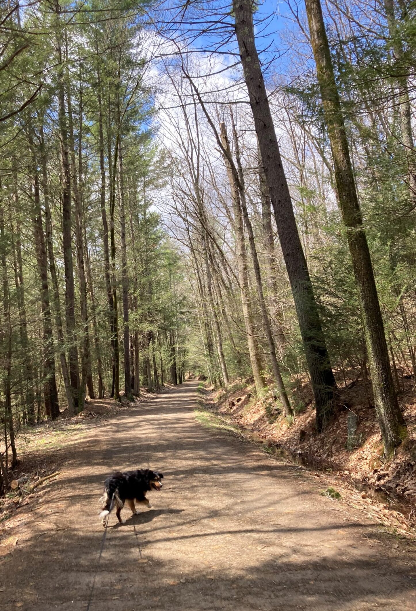
On the railroad bed.
Jobs fill your pockets but adventures fill your soul.
-Jaime Lynn Beatty
I found a 4.9-mile piece of the Mass Central Rail Trail that runs from West Boylston to Holden. Today, Christine joins us for a round trip distance of 9.8 miles (we decided to do the round trip so we could use it for our daily 6-mile self-imposed obligation). We start at about noon, in West Boylston, and head west, going upriver along the Quinapoxet River. The day is cool, but warm enough for shirtsleeves, and the weather dry. The path is wide, compacted and solid, but unpaved. It starts where the river empties into the Wachusett Reservoir, just north of Worcester, and gently winds through stands of white pine that have been there for around a hundred years.
About a mile from the trailhead, there’s a place where the Springdale Woolen Mill once stood. At one time, raw wool was processed there and then sent on by rail. All that’s there now are some blocks of stone that made up its foundation. What’s left is slowly being swallowed by the surrounding forest as it reclaims its own. It seems to be an odd place to have a mill, in the middle of a forest miles from anywhere, but, I guess, all kinds of industry sprang up alongside rivers whose flows were a dependable source of power. The Quinapoxet isn’t a big river, but big enough, I guess. The mill opened in 1864 and, in 1905, the State of Massachusetts bought the mill and razed it to ensure the water quality of the Wachusett Reservoir. The reservoir’s dam is in Clinton, Mass and the reservoir was finished in 1905. It was first filled in 1908 and serves, even today, as a major source of water (along with the larger Quabbin Reservoir, further west) for Boston and its surrounding towns.
Not long after we pass the mill, we cross under Interstate 190 that runs south from Leominster to Worcester. The highway is very high above us, supported on a huge cement trestle. This trail is sort of an item on my bucket list. I’ve spent many trips traveling to Worcester, looking down from on high, and thinking this would be a nice trail to walk. It seemed sheltered and isolated, shaded and friendly. It has proven to be all that and more.
All along both sides of this part of the trail are towering white pines, none of which is older than about 100 years (based on their diameter). Oaks and maples stand further in the surrounding forest, but the rail-trail is swathed in pine. The resulting ambience is that of an old European forest, like the Black Forest (Schwarzwald) of southern Germany, with lots of shade. The river water flows briskly over rocks in its bed, providing a background symphony of white noise that is calming and soothing. The atmosphere is peaceful and begs for a contented sigh.
Waldo enjoys the walk with its plentiful supply of sticks and many other people to say hello to. This must be a popular trail for people from Worchester – we pass about twenty or so. They provide Waldo with congenial pets and pats and give Christine and me smiles and kind words of greeting. As we walk along, we idly converse about subjects so important that I can’t now, as I write this, remember much of their gist. The perfect kind of conversations to have while walking with Waldo. Some of the places our minds wander into are explaining why the trees are segregated as they are. Christine believes the railroad bed must have, at one time, been open space. Then, as they are wont to do, the pines moved in and, eventually, they’ll be replaced by the local brand of deciduous trees, including maples and oaks. Real Earth moving, portentous stuff like that.
After a couple of miles, the trail takes a sharp 135 degree turn to the right and begins a serpentine climb over a ridge. Clearly, we’re off the railroad bed as no train could possibly make it around these turns. The trail remains broad enough to allow for a car and the steepness of the climb, although it does slow us down a bit, isn’t taxing. Over the top of the ridge, the path continues in much the same way down to State Route 31, where it ends. We turn around and head back the way we came, sorry that there’s no more to explore, but glad we still have the walk back to enjoy. This is a walk we would very much like to repeat sometime.
But there are so many paths to venture down…
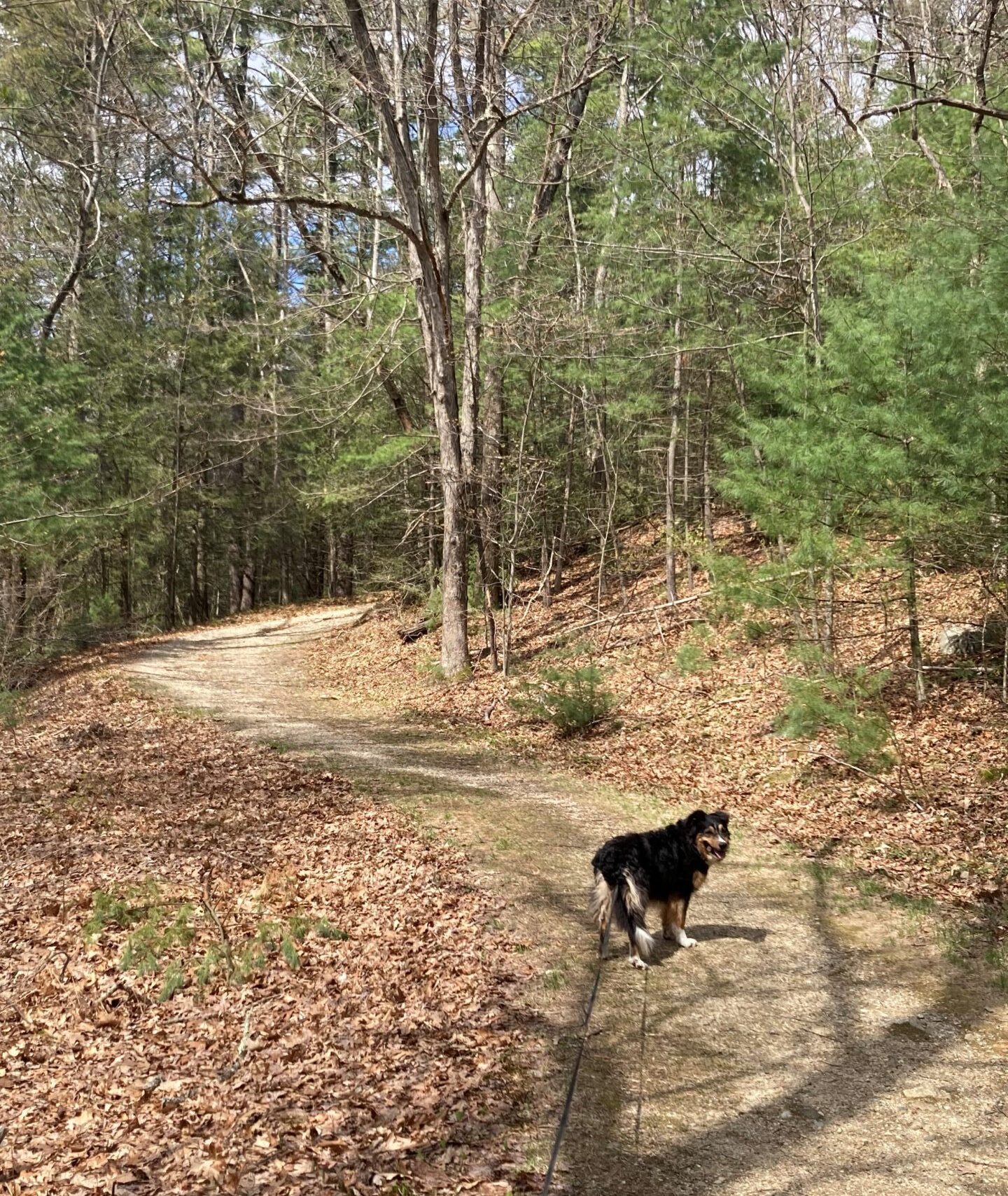
Off the railroad bed, downhill.