

Sometimes, all you have to do is cross the road and the whole world changes.
The older I get, the more I realize how rare it is to meet a kindred spirit.
-Ethan Hawke
It’s amazing how something as simple as crossing the road can change so much. I was a little hesitant to continue our trek on the Mass Central Rail Trail today after struggling so much on the last leg, on one side of the road, in all the brush and briar. The path we have yet to take, on the other side of the road, is all “proposed” and a bit longer. Given what we just weathered, it seemed likely it would be even more arduous. Ugh. But, as I stepped through the curtain of foliage at the edge of the road, I saw a clear path that continued on down the rails for as far as I could see. You never know what the path on the other side of the road is like until you walk it. There’s a bumper sticker in there somewhere, I think.
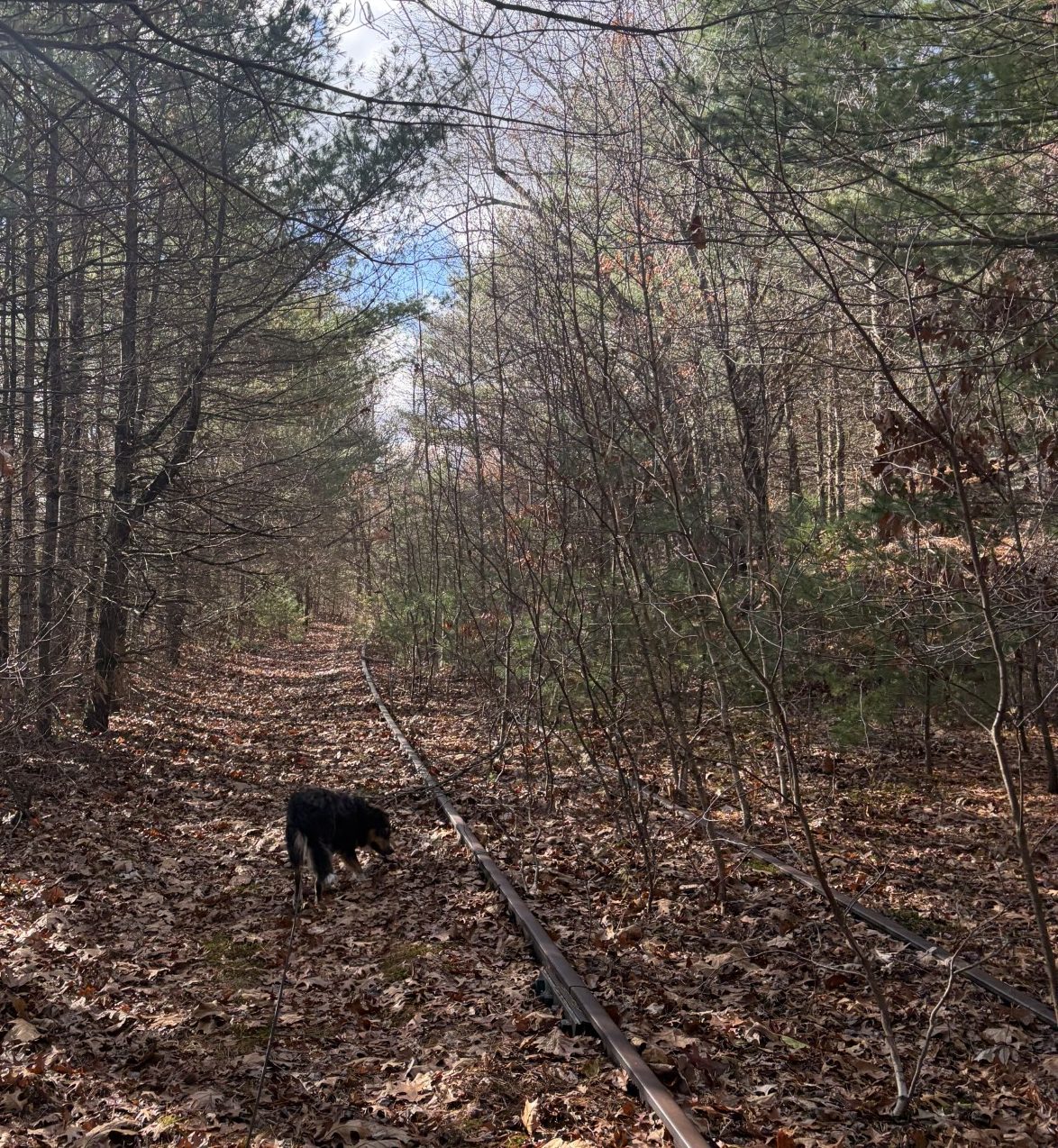
Waldo is off and gone at the forward end of the leash, trotting along and clearly happy at being on another adventure. I follow at a comfortable pace and we’re making good progress. The surrounding country is not that much different from that on the other side of the road; I don’t understand why the tracks are so much clearer. It’s not long and we cross a small bridge that spans a creek. It has the same 3-inch open spaces between the ties that the bridge over the Ware River had. Waldo doesn’t balk a bit. He seems to have learned that it isn’t as threatening as he first thought. A little touch of hubris, I think, because, at one point, a back foot goes through the gap between the ties and he lands on his butt. He extricates himself, none the worse for wear, and continues on, just a bit more slowly. It seems he’s learned not to put his weight on a foot until it makes contact with something more solid than the ether. Hmmm. Another bumper sticker?
After crossing over a street on another bridge, we pass next to a residential area known as Duckville, a part of Bondsville. We’re really out in the sticks, here, and I can’t help but wonder what industry supports the people that live here. We’re miles from any sizeable city, yet there are not only homes, but apartment complexes as well. The railroad bed runs close enough to these private properties that I was worried, when I looked at the map, that it would be disrupted and hard to follow. But the trail continues on as before, until we get to the Swift River. There, the trail ends at a bridge abutment, sans bridge, about 50 feet above the water. The river is, roughly, 50 feet wide and moving leisurely, north to south, over a weir. On the other side is an embankment at least as high as the one we’re standing on, but the brush is so thick, I can’t see where the railroad bed continues.
We climb down to a street that runs along the water and head downriver to a bridge, about a half-mile away. On the other side is a trail, not the rail trail, that we follow back upriver to a point close to being opposite to where we were. I look up the embankment and can’t see anything that looks like an old bridge abutment and decide to climb to the top and look for a railroad bed there. It’s a steep climb, covered in slippery dead leaves, but we make it without too much trouble. At the top, we push through the brush until we come across something resembling a path. We follow that until it abuts a road, maybe 1/8th of a mile. On the other side of the road is a large grassy field, no path. We continue in the same direction as the path we just left and cross the field until we come to its edge — brush and trees. There is no more path. We head into the woods and take a 90 degree turn to the north, figuring that the railroad bed must be over there. After about 100 yards, we find what we’re looking for in a deep cut. The path we had been following, apparently, was a red herring.
As we come to the edge of the cut, I see at its bottom, a guy squatting next to a mountain bike, doing something in the dirt. The railroad bed is clear, covered in dead leaves, but it doesn’t look like it would be comfortable place to ride a bike. The rails are all gone, but you can see, under the leaves, old weathered and rotting ties that would make the going washboardy. “Hello!” I call out, as Waldo and I climb down. “Whatcha doing?”
“This is an old railroad,” he says, continuing with his efforts.
“Yeah,” I say. “It was finished in 1887, but I don’t think this part has been used since about 1938. A hurricane came through here that year and a part of the railroad was washed out north of Ware and was never repaired.”
“You’re spot on! Look at this.” He shows me a nail, still in a tie, that has “37” stamped on its head. “Since about 1900, until the 1960s, railroads would put these ‘date nails’ on the ties to show when they were replaced.” He scuffs some leaves around on the ground with his boots. “Here’s another one.”
We talk a bit about our experiences exploring railroad beds. He likes to ride his bike on the remnants of old train tracks, but, obviously, ones a bit more “developed” than the ones we’ve been following. He gives Waldo a friendly pat on the head and Waldo and I trek on. He is the first person that we’ve met anywhere on a “proposed” rail trail. There are kindred spirits!
After about a mile, we come to the end of the day’s trek. We turn around and head back the way we came. Sometimes, when the going is rough, we’ll take to the streets and highways on our way back, but this trail has been easy enough that we just retrace our steps. The guy on the bike passes us, going the other way, and we wish him a good evening. We follow this part of the railroad bed back to the Swift River and I see where we went wrong and followed the wrong path from the river, going the other way.
It’s still daylight when we get back to the car, but it’s dark when we get home. It was a nice walk and we have one more leg done. We now only have 10 more miles, out of 104, to do. The next bit is about 4 miles long each way, 8 miles round trip, and is supposed to be an easy walk.
We’re getting close to the end!
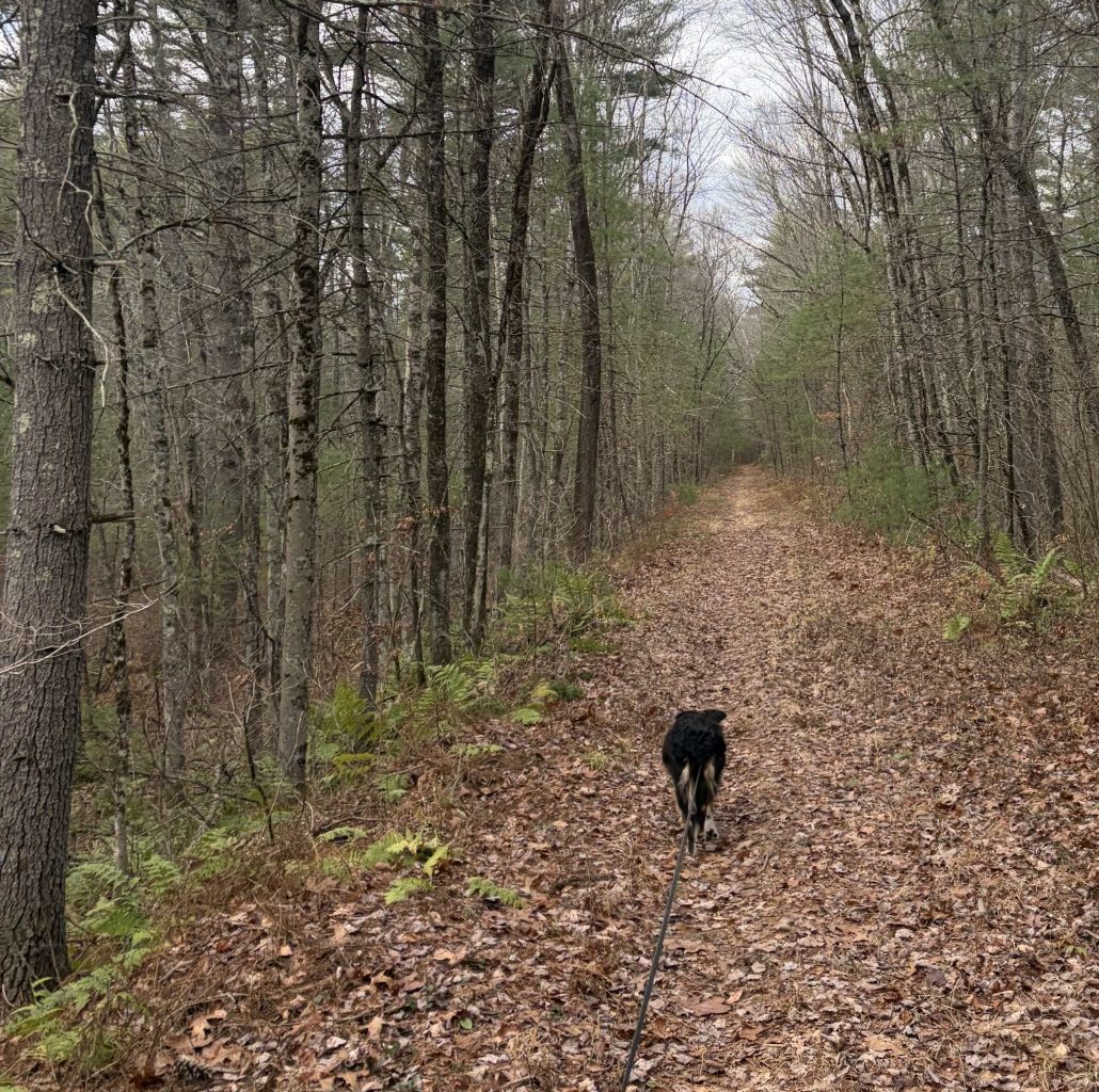
On the other side of the river, the trail continues on as an easy walk.