Want Walking with Waldo in your inbox?
Subscribe today to get news about Byron and Waldo delivered to your inbox. You can unsubscribe at any time.
Subscribe to get Walking with Waldo in your inbox!
Join 24 other subscribers


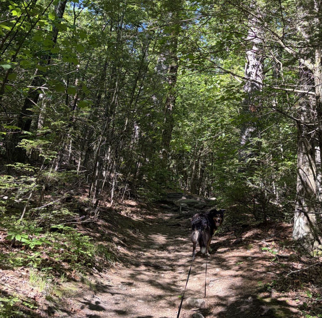
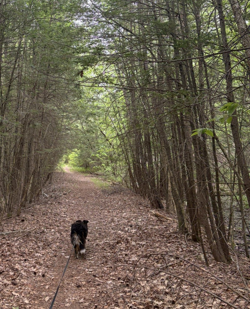
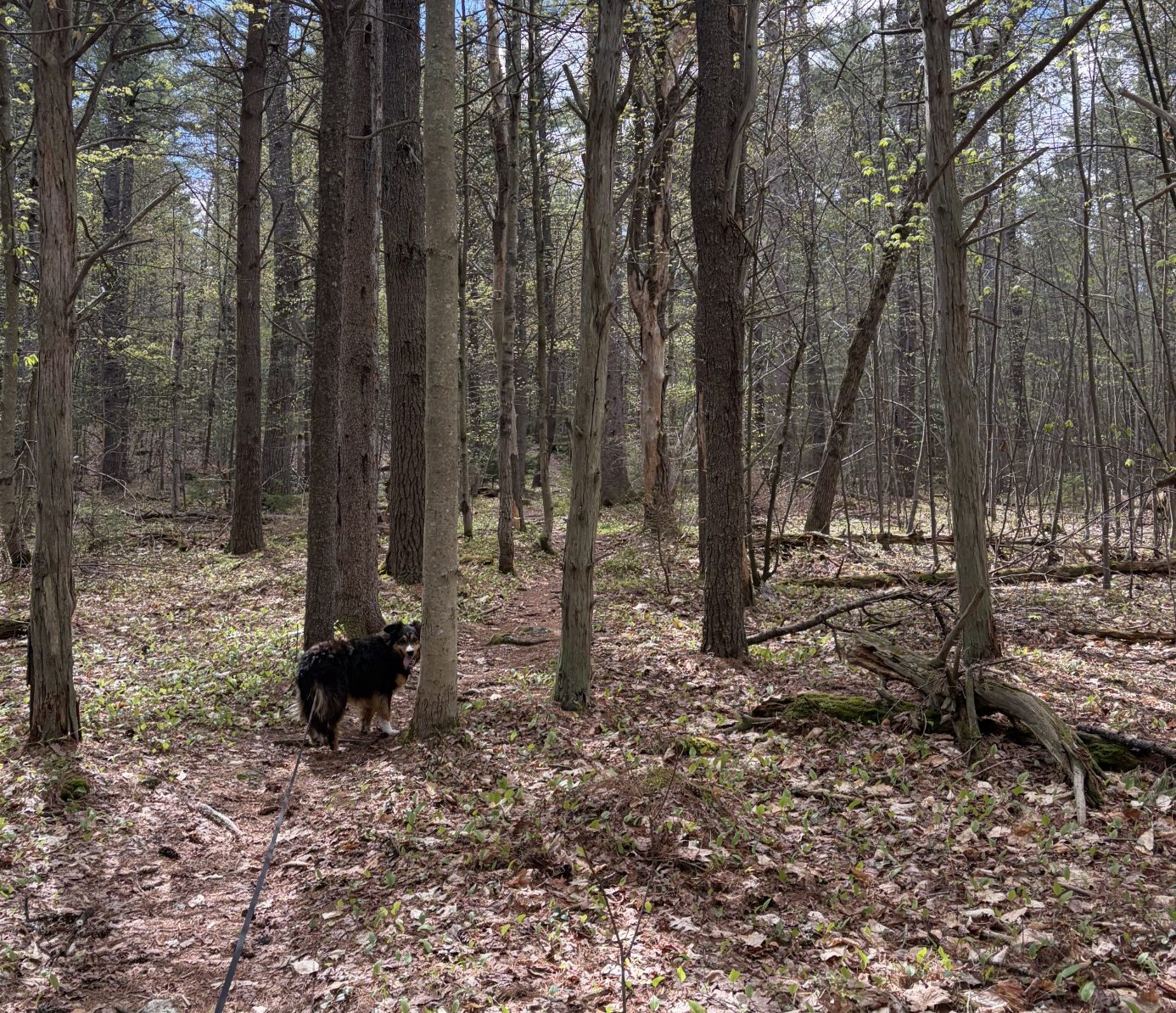
In the beginning, the trail is fairly flat.
Every mountaintop is within reach if you just keep climbing.
— Barry Finlay
Webster says that a mountain is a “landmass that projects above its surroundings and is higher than a hill.” It also says that a hill is a “usually rounded natural elevation of land lower than a mountain.” Now, I have been places, like in the Rockies and the Alps, and on Kilimanjaro, where there is absolutely no question as to what a mountain is. For me, these rounded bumps of land that Waldo and I have been crawling over are, at best, in the gray range. In the Rockies and the Alps, they’d be called foothills. But they are the tallest bits of land anywhere nearby and, when I factor in how much effort I’ve had to put out to get up and down the things, well, okay, I’ll call ’em mountains.
Our next jaunt is over Wachusett Mountain, 2005 ft above sea level. I’ve climbed over it before, in my relative youth (my 50s and early 60s), and I remember the trails leading to the top are very rocky and steep. So I’m expecting a long hard haul (the top is just under 2 miles north and a little over 800 feet up from where we’ll start at the ski lodge) to get to the top. For that reason, I picked an end point about 2 miles from the summit on the down (south) side. That’ll make the day’s trek around 4 miles. Whereas that’s hardly a warmup distance for Waldo and I, I’m sure that, given the topography, we’ll be thoroughly spent by the time we finish.
Christine has once again agreed to shuttle us from where we leave the car to where we start the climb. Damn good thing – I don’t want to have to do any round-trips on the thing. The trail goes up a gentle slope, at first, and wanders around to the west in an arc before getting serious. There aren’t many conifers in these parts, mostly birch, maple and oaks. The trail is covered by crushed leaves and no evergreen needles. The forest is thick and the ground covered in rocks and roots. The rocks are large and granitic, probably left behind when the glaciers of the last ice age receded. There are huge underlying slabs of granite just under the dirt, which should come as no surprise. After all, New Hampshire is called The Granite State, for good reason, and the border is only 30 miles to the north.
As we start, the temperature is in the high 50s to low 60s and the sky is blue. There’s about a 10-mph wind blowing, but that dissolves quickly once we’re deep in the forest. Waldo is eager to go and is pulling at the leash in youthful exuberance. I set an uphill pace that is fast enough to make me breathe hard, but not so fast I need to stop and catch my breath. That’s not fast enough for Waldo and he is bounding uphill, bouncing from rock to rock, insistently urging me on.
After about a mile, the trail makes a hard right turn and goes up with a vengeance. It looks like we’re clambering over an old landslide, there are so many large rocks. In fact, what we’re doing is bouldering – climbing over not just rocks, but boulders. I have hands that can help me out and I take time to find the best route to get over the buggers. Waldo is strictly four-paw drive and is a little intimidated by the lack of good places to plant a paw – but only a little. He pauses only for a few seconds before making a choice of how to continue, but he does hesitate in obvious thought. Waldo’s actually pretty good at finding the best route to take and I, for the most part, follow his lead. We meet a handful of other hardy souls, in twos and threes, and a couple of dogs, making the hike, but not many.
The steep climb continues for a half-mile or so, and then we scramble over a large boulder and we’re at the top, 1.8 miles and 807 feet from the bottom. It has taken us 1:20 to make the climb. Not too shabby.
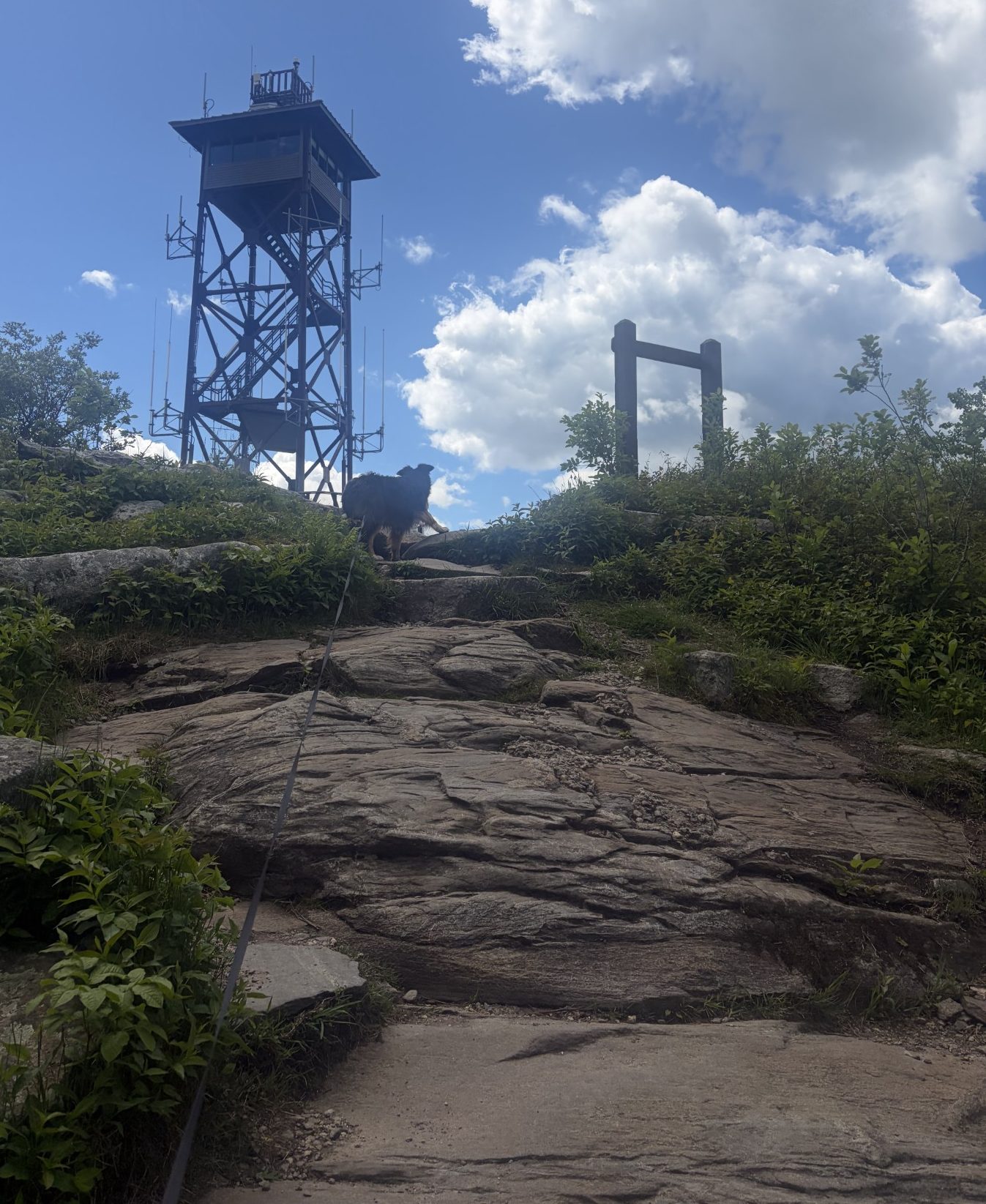
There is a tall watch tower at the very top, but it’s not open to the general public. Its base is a huge concrete block that’s about 15 feet high with a ramp that people are allowed to go up. There’s a gaggle of school age kids who, of course, love Waldo and want to pet him. Waldo calmly obliges, in his Waldo kind of way. The kids are wandering around and on the base – my guess is that they came up here by way of the paved road that wends its way to the top in a gentle slope. Vehicles can drive on that road, but I see no cars or buses around. There a few adults here too, in groups of 2 and 3. On the top of the base, the 360-degree view is spectacular. Off to the east, on the horizon, I can just barely make out the tall skinny buildings of Boston. To the north, I can see the hills of New Hampshire from whence we came. To the south are a few lower hills whither we go. Westward are miles and miles of green rolling country. Where I grew up, in Utah, such a panorama would be painted in shades of yellow and tan, not so much green. The green around here is something that always impresses me deeply.
After a 20-minute break to water the Waldo and rest up a bit, we head down the south side of the mountain. The down-trek is even steeper and more bouldery than the trail we came up. I need to proceed carefully to make sure I can, at my advanced age and decreasing agility, get down from one boulder to the next safely. Even Waldo waits and follows my lead when he makes many of his path choices.
Finally, we make it to flatter ground and then the car. We walked a total of 3.9 miles, made a little over 800 feet in elevation gain and did it in just about 3 hours (with a 20-minute hiatus). Though I am significantly on the spent side of tired, still, that’s not too bad for an old fart. This is last of the big hills we have to negotiate on the Midstate Trail. From here, although there will be some ups and downs, the going should be fairly flat and easy. It’s going to get too hot to continue in about a week or so, so we have to keep going. That way, when we start again in the fall, we have some chance of finishing before the first snow.
So, tomorrow, onward we go!
But it doesn’t last.
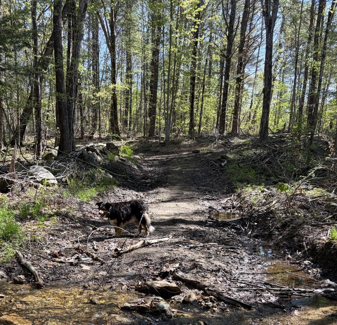
I guess we must be on the right trail.
Great things are done when men and mountains meet; This is not done by jostling in the street.
— William Blake
There is a ski resort on Mount Wachusetts, with several lifts to the top. It replaced a hotel that was at its summit, built in 1870, expanded in 1884 and 1908, and burned down in 1970. There is only a watchtower at the very top now, with a small parking lot at the end of a road. The road starts at the main buildings of the ski lodge at the mountain’s bottom. We reserve the hike over the mountain (not by way of the road) for another day – a day when that is all we have to trek. Today, Christine meets us at the parking lot at the bottom of the mountain, today’s end point, and takes us a few miles north, to the rehab center where we ended our walk yesterday.
I’m looking forward to another easy walk, like yesterday’s. Things start out that way, but after about a mile, we come to a steep slope. Waldo and I scramble over large rocks with frequent stops, so I can catch my breath and rest my leg muscles. Waldo, bless his heart, waits patiently for me when I have to do that and doesn’t make a fuss. He just stands up ahead, where I have yet to go, looks down at me and gives me a, “Come on, old man, you can do it,” look.
“I’m coming,” I tell him. “I’m coming,” and carry on.
The hill isn’t high and its top is overgrown with a lot of vegetation, so there isn’t a great view. Going down the other side is as steep as the side we went up. Soon, we’re at the bottom and following alongside a beautiful mountain stream on a gentle slope. It gurgles and trickles, creating an ambience of white noise most deliciously. Despite the fact that the temperature is only in the low 60s, I’m soaked with sweat from all the work of climbing and the sound alone makes me feel cooler. The trail also passes through a very shady part of dense forest which helps. I swear I can feel the cool refreshing water just by walking next to it.
That doesn’t last. We cross over a bridge and head up yet another, even steeper hill. This hill is topped by a huge slab of granite with an escarpment higher than I am tall. Looking at the trail app, I see that people come up here for rock climbing. I can see why. The path proceeds up the slab through a break in its side. I don’t need rope, pitons and carabiners, but it’s still a steep scramble over huge rocks. On top, I can see, through the foliage, Mount Wachusetts poking its head up in the near distance. The trail takes a sharp turn to the left and over what looks like a cliff. I edge over to the edge and look down. It’s not as steep as it looked a few feet away and it looks doable, but I’m going to have to be careful with my 77-year-old bones. Waldo looks down the same place and balks. I can hear him thinking, You want to go down that? I figure I might have to go down first and coax him down behind me, but as soon as I move forward, he’s in front of me and going down like it’s no big deal at all. I follow him cautiously and there are no mishaps. We make it to the bottom and there’s a picnic table right there in the middle of nowhere. Curious. I wonder who put it there and if it is often used. The trail continues on to the right, along only a gentle slope, and we continue on. Damn, I hope there aren’t any more of those hills we have to climb.
The rest of the hike has a little up and down to it, but they’re short and not nearly as taxing. Which is a good thing, because, unlike yesterday, I am spent. Waldo doesn’t seem bothered, but then I wouldn’t be at his age either (he’s in his early 50s, in human years). He stays up ahead, panting at the front end of his 26-foot leash, and trots along. We continue through the woods, skirt some ponds and a beaver dam, then come to the ski lodge parking lot and the car.
We’ve gone 5.9 miles in 3:44:03and made it over 866 feet of elevation gain. The numbers don’t reflect the effort, though. Those hills were steep! The most telling number just might be the 3:44:03. Going 6 miles, with that much elevation gain, in that amount of time, tells me that I kept up a really good pace. I was pushing hard, right up to the point of exhaustion. I could only do that because I am getting in better mountain hiking shape!
That’s a very good thing, because the next leg is over the top of Mount Wachusetts and I know that’s going to be a hard slog. I’ve done it before – when I was much younger. But, for now, it’s home to dinner and my recliner.
All we need to continue is another cool, dry day.
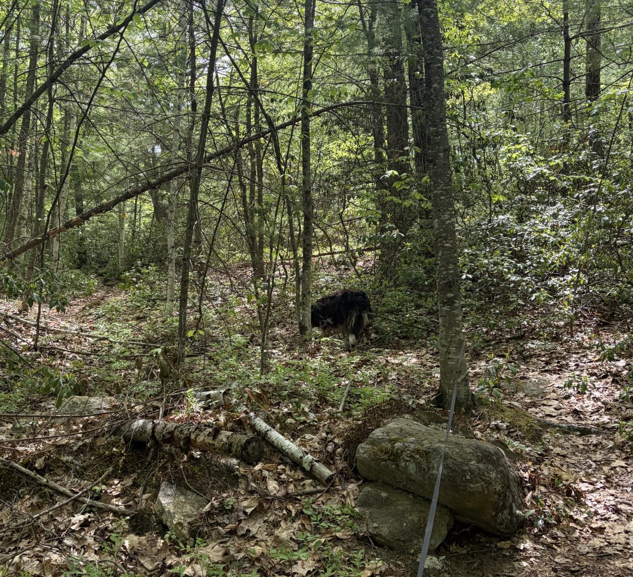
Uh, nope. Can’t go this way!
Sometimes, the trail is obvious.
Between every two Pines is a doorway to a new world.
— John Muir
The walking season is getting short. Soon, there won’t be any days left that have a weather window wide enough to entertain temperatures of 76℉, or less, for long enough to hike very far. Once those days are gone, Waldo and I will have to wait until fall. 76℉? You may say that isn’t very hot. Ah, but when the sun is beating down on you and you’re hiking up and down hills for many miles, it’s too damn hot. Especially when you’re wearing a sable birthday suit and the only way you have to cool off is to pant. When Waldo was younger, he would take hot weather in stride, within reason. But now, he’s apt to lay down in the shade and look up at me with a look that says, “Uh-uh. I’m done. Let’s go back to the car.”
Since we’ve had to do much of this hike on our own, I’ve been looking for end points that are 3 or 4 miles apart, so we don’t have to go more than about 8 miles at a time, round trip. At that rate, it will take us forever to go the full 101.6 miles. We certainly can’t make much progress before the hot gets here. So, I call Christine and ask her if she’d be willing to shuttle us from where we leave our car to where we want to start the day’s trek. Unfortunately, she can’t join us because she’s having problems with plantar fasciitis, which causes a lot of foot pain to walk. She lives about a half-hour away and graciously agrees. She picks us up, where we leave our car at a drug rehab center in Westminster, and drops us off where we left off on our last hike, some 5 or so miles away.
We’re still in the hilly country of north-central Massachusetts, so, although it won’t be as bad as it was around Watatic, there will be hills and I can’t know how challenging it will be. We start out on a paved road and have to follow it for a half mile or so, until the trail hangs a hard left and we’re deep in New England woods. We’re surrounded on all sides by tall deciduous new growth trees, mostly oak. These parts were covered in very large-bole trees in the 18th century, but by the late 19th century, they were almost all gone. Some used for shipbuilding and others were cleared for farming. After the late 18th century, ships were built more and more from iron and steel, propelled by black-cloud belching engines that didn’t need tall masts, and farmers moved west where the ground was more fertile and had fewer rocks. Since the late 19th century, the land was left to regenerate and the trees came back (often with some human help). So what we see now are trees that are, for the most part, less than 100 years old.
Still, the land has had enough time to birth dense enough forests that sunlight does not penetrate, with force, all the way to the forest floor. That means that there isn’t a lot of undergrowth that we have to bushwhack through and the going is easy – except for ubiquitous tree roots and large rocks left over from the receding glaciers of the last ice age. The trail is often not much more than a narrow swath of barely concave dirt, root and rock, filled by dead leaves. You often can tell where the path is only because that’s where the leaves are ground up by passing boots, whereas, elsewhere, the leaves are more intact. Well, that and the yellow triangular trail markers nailed to a trunk, here and there, that occasionally mark the way.
All the same, Waldo is really good at following the trail, until we come to a place where it crosses another trail. He then, more often than not, picks the wrong way to go and I have to redirect him. We sometimes wander off our route, because I’m paying close attention to where I’m putting my feet and don’t notice we’ve gone astray. It doesn’t last long, though, and we correct our mistake.
It occurs to me that I can see where I put my feet and avoid mishap, but Waldo cannot. He can only see where he puts his front feet. Still, he strides forward with great confidence and doesn’t stumble very often. Following him in the snow, I’ve often seen him plant his back feet into tracks left by his front feet. I assumed that four-legged animals evolved spine and leg lengths to make that happen because it optimized their speed. But maybe much of it has to do with being able to put feet you can’t see on ground you know is stable because you just put a foot you can see on that spot. Mother Nature’s design capabilities are fascinating.
We go up and down a few hills, but they aren’t very steep or high and we move at a good pace. 5.3 miles, 2:25:34 after we started and with only 591 feet of elevation gain, we get to our car. Not bad at all and I’m not all that tired. Maybe I should start looking for trail sections 7 or 8 miles long. The next leg will be about 5.5 miles long and will put us at the base of Mt Wachusetts. Now that is a hill. It’s the tallest mountain on the Midstate Trail and has an elevation gain of around 1000 feet in less than 2 miles. I’m planning on only a little over 3 miles for that slog, including going up one side and down the other..
Tomorrow is another cool spring day, so, with Christine’s help, we’re going to add another good distance to our journey.
Mount Wachusetts, here we come!
And at other times, not so much.
This once was a road — I think.
The man who goes alone can start today, but he who travels with another must wait untilthat other is ready.
— Henry David Thoreau
Waldo and I have to wait for a few days because of temperatures in the 80s and some periods of light rain. We won’t melt in the wet, but I really don’t like to live with a swamp-dog, so we wait until things are dryish. Today, the temps are forecast to be in the low 60s, the sky cover is scattered and the winds are light. It’s a beautiful day for a hike in the woods, so we’re going. We only have a limited amount of time until it’s going to be way too damn hot to go for long walks, let alone hikes, so we can’t squander what we’re given.
Looking at the trail app, I find a place to park somewhere around 3.5 miles from where we left off last time. It’s just the two of us today — Phyllis is busy elsewhere and Christine can’t go, so we have to keep the hike short. The terrain looks, on the topographical map, to be fairly flat, so 7 miles (round trip) should be fairly easy. The place I found to park, off Bragg Road, is at the end of a short rutted and rocky dirt track. There, a cable sags between two posts and a large blue plastic barrel. The path past that stretches out northward, through a small grassy meadow. The track is wide enough to accommodate a car (and looks like it once may have) and it runs up a gentle slope. There are many damp, muddy places we have to work around, but it’s not hard picking my way around them and I keep my boots dry. It does mean I have to pay attention to where I step, though. There are also a lot of rocks underfoot and I’m watching the ground closely.
After right around 2 miles, we come onto a small lake, off to our left. Its surface is placid, with foliage growing all the way to the water’s edge. There are no ducks on it and I see no one fishing. By this time, the trail has morphed into a narrow, smooth path, carpeted with needles and leaves, winding through large hedges of 6-foot-high mountain laurel. The trail breaks out onto a clearing next to the lake. In it is a wooden picknick table, a small log shelter and, to one side, a pitched tent. The people belonging to the tent are nowhere in sight, so we continue on.
We have to climb up and down some hills, nothing particularly challenging, until we’ve gone about 3.5 miles. Yeah, that’s not a typo. Today’s trek is a little longer than I expected. At that point, we have to scamper down a bit of a steep slope to get to our turn around point. The last part follows what looks like an old road, maybe used for logging. It goes straight downhill, across a bridge and then onto Route 12, where we ended our last trek. The distance is 4.2 miles, making for a 8.4-mile roundtrip hike. Further than I planned, but I’m feeling pretty good and most of the way is fairly flat, so I’m not concerned.
We stop at the turn-around point, I pull out Waldo’s water bottle and give him a good draft. He’s clearly grateful and laps down almost a liter. Walking in the woods is thirsty work. He seems happy and is enjoying the hike. We haven’t come across any animals, not even a squirrel, but I’m sure there is a lot of animal spoor to keep his nose busy and his interest engaged, just the same. We rouse ourselves and head back up the hill for the return trip.
Going back up the hill is sweaty work, requiring not infrequent stops for me to rest my tired old muscles, but it doesn’t last long. Once on the flat(ish) part, we make good time and are soon back at the lake. There, we come across a man, in his late twenties, and his dog. The dog, named Trevor, is about Waldo’s size and full of energy. Trevor is only a year old and stuffed with puppy romp and nonsense. Waldo is tolerant and lets Trevor bounce around and over him. “I saw your tent on our way up here,” I say. “How long are you staying?”
“Just overnight,” the man says. “It didn’t take as long to get here as I thought it would.”
“Yeah, it’s pretty flat.” Then I notice his tent is pitched in the shelter. “Wasn’t your tent pitched over there?” I pointed to where I’d seen a tent before.
“No, that must have been the people Trevor and I passed on our way up here.”
“Oh, I didn’t know the spot was that popular of a camping spot. Well, enjoy,” I say. “It’s forecast to be really hot tomorrow.”
“Yeah,” he says, “I saw that.”
Waldo and I say our goodbyes to Trevor and his dad and head back into the fields of mountain laurel. Before long, we’re back at the car. My AllTrails app says we did 8.4 miles in 4:26:29 with 577 feet of elevation gain. I’m feeling tired, but nowhere nearly as exhausted as when Waldo and I trekkcd over the Mount Watatic ridge. We head home to rest up for the next leg of the trail.
Now, we just have to wait for this next heat wave to dissipate.
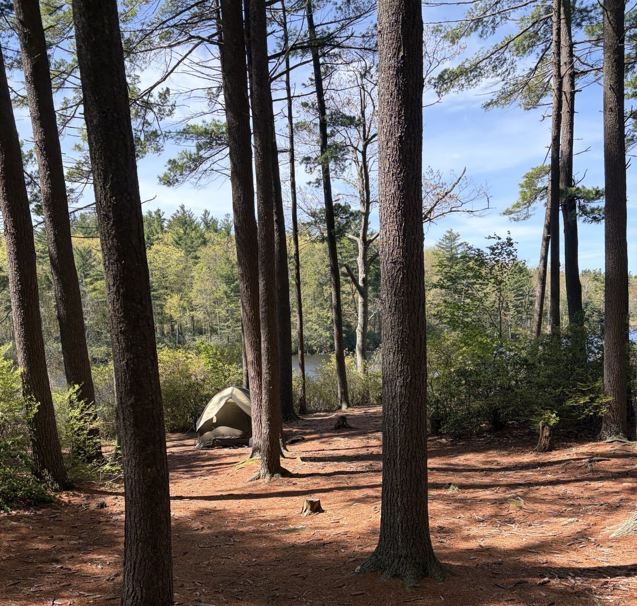
First time we’ve seen anyone camping on the trail.
Waldo knows where he’s going… Mostly.
Of all the paths you take in life, make sure some of them are dirt.
— John Muir
Continued from last week…
The Midstate Trail began in the 1920s. At first, it ran from Mt Watatic to Mt Wachusett, about 22.5 miles. In 1972, a group of people came together to create a trail that goes from the New Hampshire border, south to the Rhode Island border, about 90.6 miles. However, the only way to get to the trail at either border is by hiking, so the effective length of the trail is more like 101.6 miles, running from just north of the New Hampshire/Massachusetts border to just south of the Massachusetts/Rhode Island border. Until today, Waldo and I have only walked about 10% of the way. After we’re done today, that will be expanded to around 17%. A good start, but we have a ways to go.
So far, we’ve gone up and down some hills, but nothing like Waldo and I had to endure around Mt Watatic. We’re climbing up a gentle slope when, out of nowhere, a medium-sized dog with no leash appears in front of us and bounds with youthful puppy energy in our direction. I watch carefully because, if he’s not friendly, we could have a problem. But he’s only interested in meeting Waldo and the two of them do a I’ll-sniff-yours and you-sniff-mine hello. Right behind the leashless dog are two women and two other dogs, also off leash.
We exchange greetings and then I home in on the fact that one of them is wearing a t-shirt that says, “State Police,” on it. “Are you a cop?” I ask. Phyllis gives me a sidelong glance as if questioning the wisdom of the question.
“Yes, I’m a State Trooper,” she says.
“I parked beside Rte 12, at Blackburn Village, is that legal? Am I going to get towed?” I ask. “I’m completely off the tarmac.”
“Rte 12 is a state highway, so it is illegal,” she answers, “but you’ll probably be okay. The law is really there so we have legal recourse if someone is being a nuisance.” That last part would be reassuring if only the first part weren’t there.
We say hello to each other’s dogs and continue on our way.
After less than a mile more, we pass by a lake. A sign says, “Camp Winnekeag.” There are some buildings on the shore nearby and Phyllis and I wonder if they’re likely the ones who built and use the log amphitheater where we rested. The trail follows a road for a few hundred yards, then takes off to the right, back into the woods. By this time, we’ve come almost 5 miles, over hill and dale, and we’re starting to get a little tired. My phone says we’ve only gained about 700 feet in altitude, but that’s enough to make me feel it in my muscles. I turn and look at Phyllis, who is bringing up the rear, so she doesn’t get tangled in Waldo’s leash, and ask, “How you doin’, old girl?”
“I’m fine,” she replies. “I can feel it in my legs that we’ve been climbing some hills, but they aren’t yet that painful.”
“Well, you are old, you know. A whole year older than I am.”
“Oh yeah? How’s your back?”
“It’s doin’ good.” She knows I sometimes have trouble with it. “Beginning to feel a bit tired, though.”
“I noticed you slowed down a notch or two.”
“Yep. Think I’ll just sit here on this rock for a breather.” I sit on a boulder and rest my legs. After only about 2 minutes, I’m back up and plodding along, only now at a noticeably faster pace.
“That’s all it took?” she asks.
“Yep,” I say, “Just needed to rest the old leg muscles for a while.” Even so, for the next two miles, every 30 minutes or so, Phyllis askes how much further we have to go and I reply, “Oh, a mile or two.”
“That’s how you always answer that question,” she says.
I too am looking forward to getting back to the car.
Finally, tired and somewhat sore, we break out of the woods and see the car where we left it, on the side of the road. It was not towed. It’s been 5 hours and 25 minutes since we started, we gained 724 feet in elevation and walked 7.37 miles.
“How’re you feeling?” I ask.
“It was just the right amount of hike,” she answers. “Hard enough to give me a good work out, but not so long that I feel like I’m gonna die. I’m really glad I came.”
“Well, you’re gonna have to join us again soon.”
“I just have to fit it into my schedule.”
“Yes, you do.” I let Waldo in the passenger seat (that’s his place and always has been) and Phyllis gets in the back. “For now, it’s back home for dinner, a rest in the recliner and a nap,” I say.
I rest my weary bones on the driver’s seat, let out an inaudible sigh, and begin the trip home.
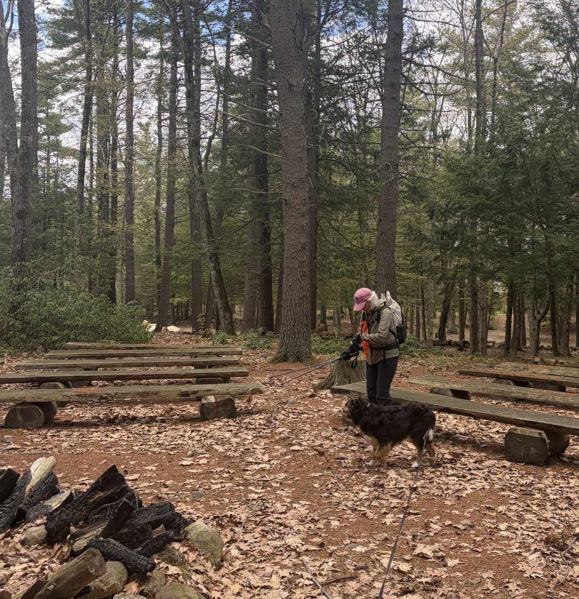
Amphitheater near Lake Winnekeag.
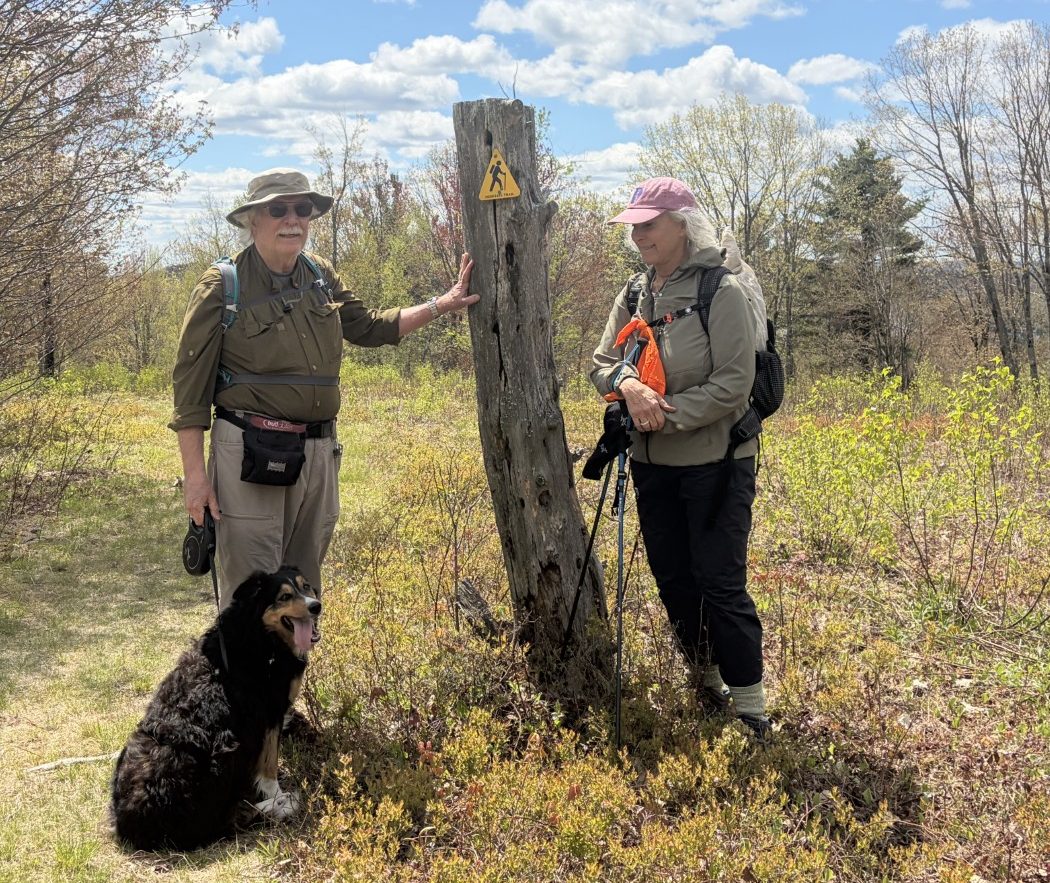
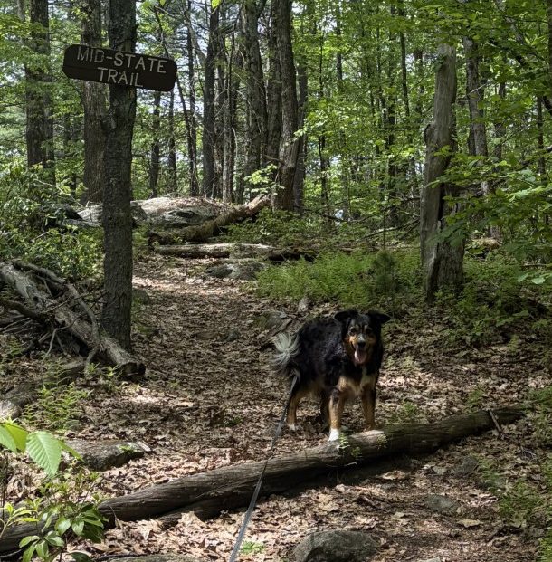
Proof that the three of us are on the Midstate Trail.
Good company makes the way seem shorter.
— Izaak Walton
When Waldo and I go for long walks in the hinterland, some planning is required. First, I look for places I can leave my car (where there is little chance of it getting towed), that’s within the distance I think I might be able to go (sometimes requiring a healthy dose of hubris). That’s not always so easy, because there aren’t always parking lots close to the limit of my endurance. When that happens, I look for places where the trail crosses a road, with the idea of finding a wide spot where I can pull off the tarmac. Sometimes, you just gotta be there to know for sure and sometimes, there’s no guarantee about the towing thing.
Then I look at the weather, looking for a day that is neither too wet, nor too hot. I don’t mind slogging through a bit of mud, but I don’t really like turning Waldo into Swamp-dog. I am not kidding when I tell you he is self-cleaning – an hour or so after he’s black from his toes to his knees and elbows, all of the mud and grime falls off and he has sparkling white feet. But the odor lingers for a bit and I don’t relish bringing that into the car and home. So I try to wait a day or so after the last hard rain before venturing out. It rained only lightly yesterday, the temperature is forecast to be in the high 50s at its peak today, so we’re good to go.
Phyllis has agreed to join us, so we can do a one-way hike, leaving cars at both ends. I figure I can realistically expect to be able to do around 6 miles, with some up and down. I go to the AllTrails app and find we can start at the Mt. Watatic parking lot, where we left off on our last hike, and walk around 6 miles, with something like 600 feet of elevation gain, and end at Rte 12 at Blackburn Village. The app isn’t that accurate, but it should put us in the right ball park and it’s doable.
I leave my car on the side of Rte 12, with some trepidation, and take Phyllis’ car to Watatic. We start out, as eager as a border collie, and are soon winding our way on a dirt path through the weeds, roots, rocks and trees. The ground, at first, is just barely noticeably damp, but not muddy. The temperature is in the low 50s and the sky cover is broken. That means we are oscillating between being grateful for our light jackets, when the sun is behind a cloud, to being definitely over-dressed, as it comes out and shines down on us. Soon, we’re going uphill, although not nearly as steep as when Waldo and I trekked over and around Mt Watatic, and we’re working up a sweat. The jackets come off and go into our packs and we deal with the cooler air in the shade and under clouds.
We’re surrounded by hemlock and spruce. The latter is not so easy to identify because their needle-bearing branches are all up high, beyond where we can see them well. But I know they’re there, because I’m walking over more than a few of their distinctive cones. The leaves on the deciduous trees are still on the small side, but I can recognize the bark of birch, maple and oak. There are very few birds out serenading us as we go – it’s around midday and their choruses are much more plentiful in the early morning and late evening.
“I heard something interesting on a news feed on my way here this morning,” I tell Phyllis. “Apparently, there is a recent study that shows that being involved with the arts increases longevity as much as exercise.”
“I don’t believe it!” she says. “To quote my friend Byron, show me the data!”
“It’s out there, all you have to do is look it up.”
“For it to be credible, a metastudy needs to be done.”
“That’s absolutely not true!” I reply. “Metastudies are only required when you can’t reach statistical significance from the data you have.”
“Well, you have your opinion and I have mine.”
“No. You have an opinion. I have an informed opinion.” We are good friends, but we don’t see eye-to-eye on everything. When we don’t, we do enjoy some playful banter – as we negotiate our aged feet over root and rock, at a white-haired pace, being careful not to stumble.
Waldo just keeps plodding along, restrained only by being at the end of his leash, ignoring the chattering noise behind him. There aren’t a lot of side trails where he can make a wrong turn and he does a fine job of leading the way.
I know it’s what I always say, Phillis, but, really, it’s only another mile or 2 more.
To be continued…
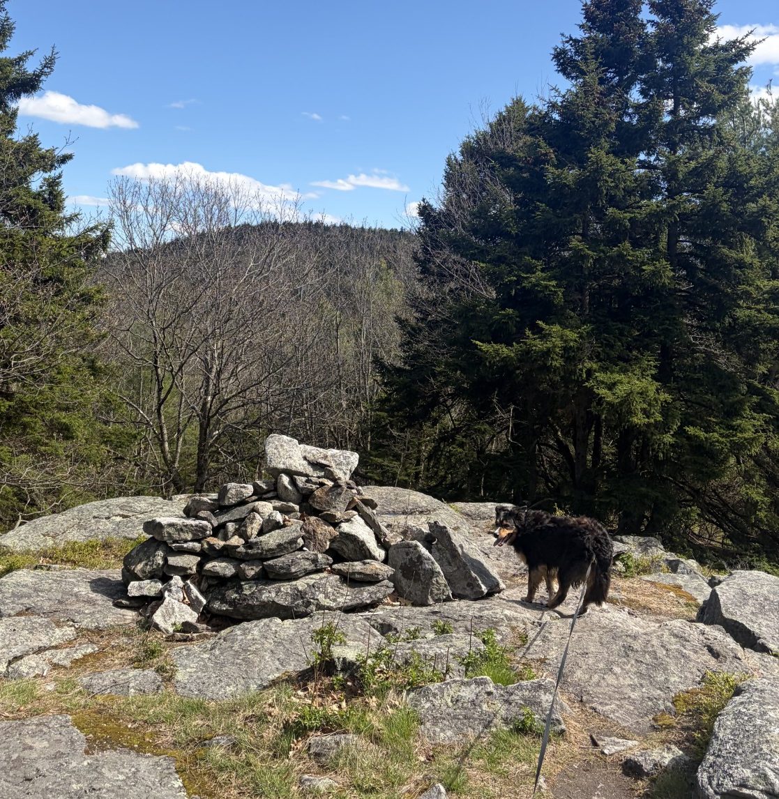
A cairn en route.
Walking With Waldo
There are two fatal that keep great projects from coming to life:
2) Not starting
— Buddha Gautama
Today is the day Waldo and I are going to complete the part of the Midstate Trail that goes over Mt Watatic. It’s a weekday, so there’s room to park in the lot at the trailhead. I once again opt for the route that has a gentler slope for the uphill slog. This is now the third time Waldo and I have walked here and its rocks and roots are familiar. The going is a bit strenuous, but I don’t have to take any breaks, just adjust my pace so I don’t run out of breath. I take one breath for every 3 steps. I’m reminded of the time I hiked up Mt Kilimanjaro — at 19,000 ft, I had to take 3 breaths for every step. That mountain is huge, and we climbed it on a 5-day hike up, 2-day hike down trip. Still, although not as arduous as Kilimanjaro, the going is slower on these hills than on flat ground.
Waldo is enjoying himself out at the front end of the leash. His nose is close to the ground, sniffing the smells left by all the previous passersby and whatever else is out there. He adjusts his pace to fit mine, slowing down as necessary, when the leash gets taut. He lifts a leg now and then, but most of his time is spent seeing the world through his nose. The trail is broad enough for a jeep to use it, so it’s not the canine equivalent of rocket science for him to know where to go. I only need to adjust his path with a simple, “Over here!” when he decides to go on the opposite side of a tree from where I want to go.
The temperature is in the high 50s and there’s adequate sun shining down through the arboreal canopy to keep me warm without a jacket. In fact, we haven’t gone very far before I’ve worked up a sweat. As arduous as the route is, it’s only three miles long and I’m pretty sure Waldo can wait until we get back to the car before being in serious need of water. So I left the backpack in the car and I hike unencumbered.
After about a mile, we come to the shoulder of the ridge that connects Watatic with the mountains to the north that we’ve already hiked over. I recognize the path that heads that way, off to our left, and continue on to the right, up the backside of Mt Watatic. It’s uphill, but not as steep as the path on the other side of the mountain.
The ground is often treeless, covered by large slabs of granite. Here and there, someone has placed trail-markers, large solid triangles of yellow paint, on the stone. In other places there are huge cairns that even a blind man can find. I’m able to maintain a decent pace, without too many stops to catch my breath. After another hour or so, we’re at the apex. Waldo’s nose may be drawn to the ground beneath him, but my eye is driven to scan the vast panorama of the green rolling hills of New England spread out before and below me. I understand why people like to hike to the tops of mountains.
I look to the north, where we started the Midstate Trail, and over the mountains we’ve already hiked and the ridges between them. It’s interesting that, with very few exceptions, mountain ranges in the US run north/south. The Uintah Mountains in Utah are an exception and there are only a couple of others. This is probably due to plate tectonics and glacier motion during the last ice age. So mountains are lined up (more or less) mostly in a north/south direction and are connected by ridges that are higher than the mountains’ bases. It makes sense, then, if you want to hike north/south up several mountains in a row, you would want to stay on the ridge between them, rather than go all the way to the bottom of each mountain, then up the next. That way, you limit the amount of up/down hiking you have to do. I’ve done this before, hiking on a piece of the Appalachian Trail over the Presidential Mountains, further north in New Hampshire. I was preparing for going up Mt Kilimanjaro, some 16 years ago, and wanted to get used to hiking over steep terrain. On one hike, I followed the north/south running ridge that connects Mountains Monroe, Franklin, Eisenhauer, Pierce and Jackson. There are more mountain tops on that ridge, but I had to call it quits because it was getting dark. Mt. Watatic is the last of the big mountains on this ridge and we now have to go down to its base to continue on the trail.
We turn and head down the steeper side of the mountain. Once off the top, we’re surrounded by eastern hemlock trees and brush. The ground is quite steep, uneven and lumpy, with exposed roots and rocks, and I have to step carefully. Unlike Waldo, who, in his youthful exuberance, is jumping and bounding down the hill with abandon. He must get frustrated by the tug of the old-man anchor that creeps down the hill slowly and haltingly. Still, he only occasionally tugs at the leash when he over-estimates how much freedom he has before reaching the end of his tether.
After another hour or so, we’re back to the car. My legs are a bit tired and a little sore, but my back is hardly bothering me at all. I must be getting in some kind of shape after all this mountain climbing! I suppose that my ease could be due to the fact that today, Waldo and I only hiked 3 miles instead of over 9, taking us 3 hours rather than more than 7 and had to go up only 700 feet of elevation gain as opposed to 1,300.
Nah! I’m getting in shape!
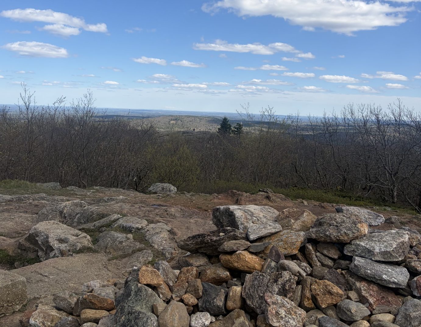
The view from the top of Mt. Watatic.
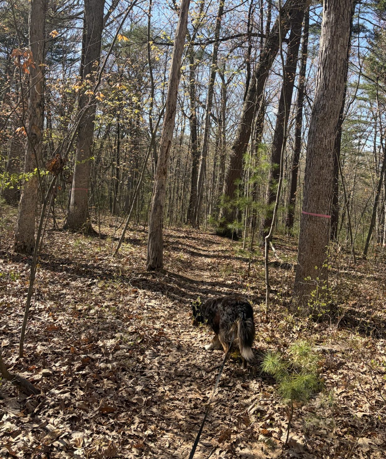
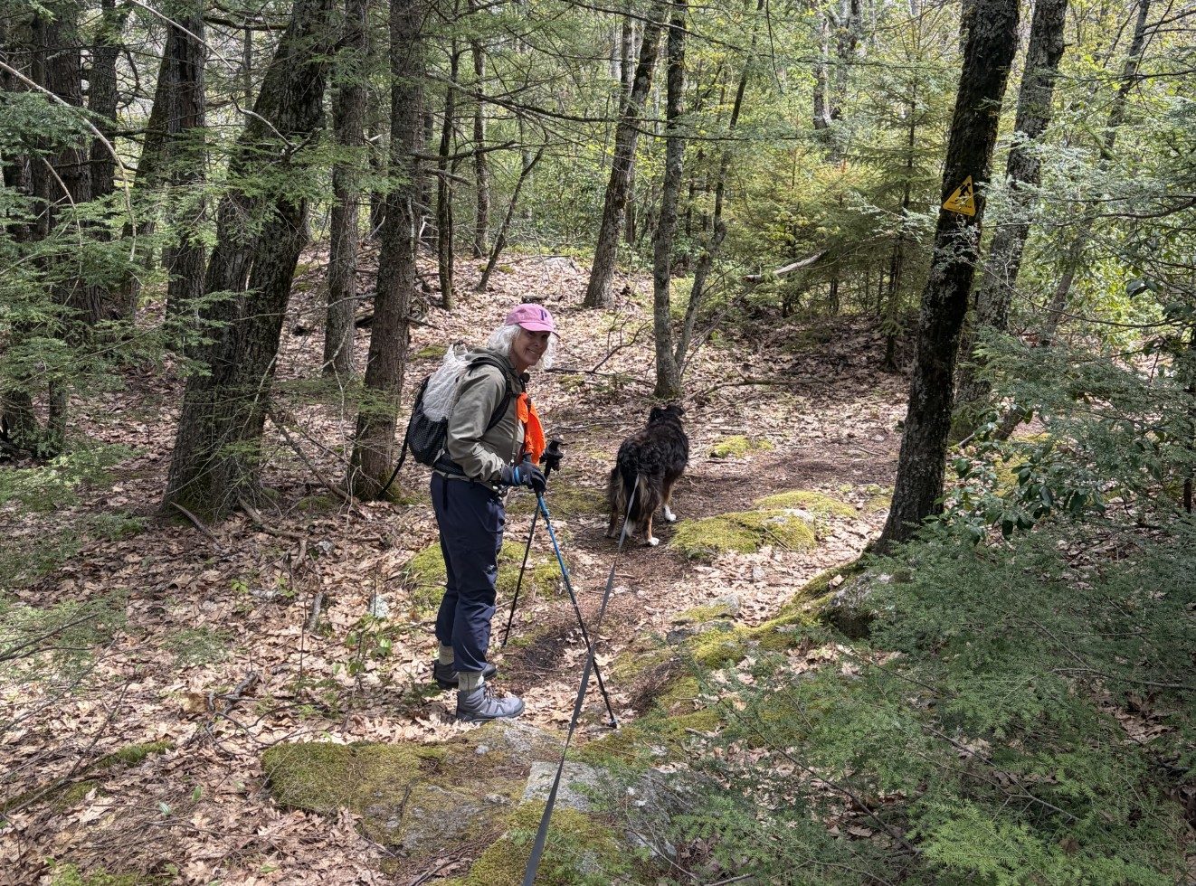
There really is a trail, if you look closely…
The day you become old is the day you’re not looking for new experiences anymore.
-Billie Joe Armstrong
It’s been 4 days and I’m still a little sore. For the last 3 days, my legs have been really stiff too. On the last trek, near Mount Watatic, it was my low back that bothered me the most, but after I was finally able to sit down for a long period of time, that eased off. Not so my quads. They’re still achy. But they’ve eased off enough that I decided I should take Waldo out on a walk and try to work it out. Sore muscle pain is caused by the production of lactic acid, a byproduct of anaerobic exercise, and increasing the circulation by exercising the sore muscles can help wash that out. We won’t go our usual six miles, but we will go.
The temps are in the high 50s, the ground is dry and the breeze light. The sky cover is broken and the trees are slowly becoming fully leafed out, providing lots of shade. Just before we go out the door, I notice a short footpath on the AllTrails app, called the Grove, that winds around a piece of Fort Meadow Reservoir, around 2 miles long. I’ve been aware of it for some time as people have told me they’ve taken their dogs over there to run off leash (they aren’t supposed to, but they do it anyway). It’s been in the back of my mind to check it out one day and I decide that day is today.
I also see on the AllTrails map, there is a trail that goes from Waldo’s rail trail over to the Grove. It passes through a piece of forest that a company in Texas wanted to develop into mixed-use commercial dwellings. However, it wasn’t zoned for it and locals put up an opposition that caused the town council not to rezone the land. I have, on rare occasion, seen people walk out of those woods, on a somewhat apparent beaten path, to the rail trail. So I have also had an inkling to explore in there as well. There you go. It’s decided. We’re doing an off-tarmac twofer.
We park about a mile and a half from the beginning of the rail trail and head for the trees. It’s no great effort to find a “path” that heads toward the reservoir and we step into primordial nature. Waldo is at first a little confused, because we’re not going down the blacktop, but when he realizes where we’re going, he’s off to the front end of the leash, eagerly urging me on. He’s following the trail as well as I can – it’s not much more than a suggestion that other boots have trod on this ground before.
The reservoir is somewhere in front of us, but we can’t see it because of all the foliage. Walking downhill to a small creek, we lose sight of where the trail goes. The creek is small and I’m able to step across it in a single stride. Up the hill, on the other side, we find a trail again and follow it toward the reservoir. It soon widens out to what appears to be a rough jeep trail. There is no evidence that any kind of motorized vehicle has been down here in a long time, but it looks like a hardy SUV could use it. In less that a mile, we come to Boulton St and, on the other side, is a parking lot with a sign that says, “The Grove.”
From the parking lot, a broad, well-manicured, crushed stone path wanders along the water’s edge. Not far from the start of the trail, there is a spot where one can put small boats into the water. I have seen, from the rail trail, people out on the lake, fishing, but not many and not often, so the fishing can’t be that good. There’s no one out there today.
As Waldo and I wind our way down the trail, we’re passed by a woman we don’t know, who’s walking her dog, named Trevor, off-leash. There are signs posted that make it clear that letting dogs off-leash is illegal, but neither the woman, nor Trevor, seem to care. I keep Waldo on leash, not because I’m a purist, but because he has OCD and if something caught his attention, he’d all too likely be so fixated on it that he’d soon be gone and out of sight, ignoring any commands. His recall is good, as long as he’s of a mind to do it, but if he’s distracted, I can’t be sure he’d be obedient. Besides, the leash is long and it’s almost like he’s off-leash anyway – and we’re both used to it.
After a bit more than a mile, the trail loops around and gets us back to the parking lot. We head back to the rail trail, the way we came, and we’re soon back at the car. Total distance traveled is just under 3 miles. This exploration has defined a nice little bicycle-less, pristine (sort of) path that is close by where we live, easy to get to, and not crowded. It’s something I’m sure we’ll use in the future when we’re up for a short walk in Mother Nature.
I’m feeling good and I think I’m ready to go back to Mount Watatic and finish what we started there.
Tomorrow, maybe.
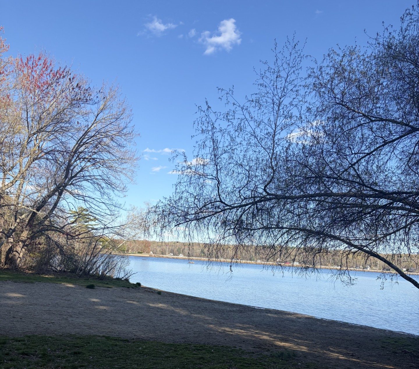
There’s even a beach!
The official beginning of the Midstate Trail — if you can get there…
It does not matter how slowly you go as long as you do not stop.
— Confucius
I needed to take a couple of days off to rest, after that last slog in the New Hampshire mountains. Then the temperature rose to the mid-80s and Waldo and I had to delay some more. But I’m committed to continue, although with some trepidation, until I’m shown that I can’t. Yeah, I know, there’s a strong element of denial there, but I’m just not ready to throw my life into the old-age ring. My body will not control me.
It does, however, carry the annoying power of veto…
It should be a good day for a mountain hike. The temps are in the mid-50s, the sky is partly cloudy and the ground is dryish. After a 1-hour drive, we arrive at the parking lot of the Mount Watatic trail head. It is completely full, no space to park. There must be 15 to 20 cars there. We cross the highway and park on the side of a dirt road running westward. There are around 10 other cars parked there as well. This trail must be a popular place to go on the weekend (it’s Sunday). I grab the pack that has Waldo’s water (around 10 pounds worth), my end of the leash and we’re off.
There is an option to the start of the trail. One can go straight up Mount Watatic and then down onto the ridge that runs to where we left off last time, but it’s kind of steep. Alternatively, there is a trail that runs around the base of the mountain, then up to the ridge. If we go up the mountain outward bound, then, when we’re tired, we could take the kinder, gentler route back to the car. But we’d probably be burnt out at the beginning of the trek and be worn out for the rest of the hike. Or we could go the easier way, then return going downhill on the steep part of the mountain. I opt for the latter.
The grade isn’t that steep and we make good time, going the 1-mile from the trailhead to the ridge. Once there, the ground is pretty flat. I’m feeling really good and thinking that this just might be an easy walk. We walk through forests of eastern hemlock, the predominant evergreen up here. There are also some spruce, but not many. The deciduous trees at the lower altitudes have already started to sprout their leaves, but not so up here (elevation around 1,200 to 1,800 feet), so it’s hard to get a feeling about just how many there are, without counting trunks. It seems like most of the trees, by far, are hemlocks.
We pass a few people going the opposite direction and some pass us going the way we’re going. No other dogs, though. Most of the people parked down below must be climbing the mountain and not hiking the ridge. Waldo is having a great time, sniffing all the new smells and enjoying the absence of bicycles (they aren’t allowed here). There are, of course, a lot of sticks around, but he doesn’t pick up any. He’s way too intent on following where the trail leads, which he, for the most part, follows unerringly. He pulls at the far end of the leash, going up and down the gentle rises we have to navigate, eager to get on with it. That’s pretty convenient – when we’re going uphill. Not so much on the downhill.
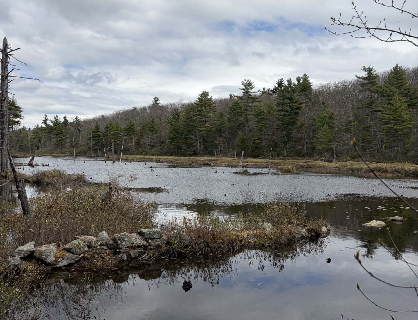
We work our way along the ridge close by Binney Hill Pond. It is large enough to be a lake, but it is shallow, allowing sunlight to penetrate to growing green things on its bottom. I’m thankful we’re not doing this later on in the season. I’d bet there are swarms of mosquitoes out here then. Just past the pond, the ground rises sharply. We’re at Pratt Mountain.
The going is steep, with lots of tree roots and rocks trying to trip me up. My pace drops dramatically, with frequent pauses to catch my breath and briefly rest my aging muscles. Waldo has gotten really good at sensing when to wait for me. I stop, then he stops and turns to look at me. If I take too long, he’ll roll in the dead leaves, or come back to where I am and lie down. As soon as I stand up, he’s off and at the end of the leash again, eager to get on with it.
At the peak, I’m tired, but not totally exhausted. We continue on along the now fairly flat ridge to the turn-around place, a rock where I sat and rested the last time we were here. I’m not absolutely sure it’s the right rock, so we go a little bit past it, then turn around. We’ve come 5 miles so far. I’m not stumbling-tired yet, so I mentally prepare myself for the trek over Mount Watatic on our return. It seems doable.
Then we come to the part where we have to go down the steep side of Pratt Mountain. That proves to be godawful. I’m just not used to using the muscles that are required for that. Going up isn’t as bad, because you can rest a bit from one step to another, even when you don’t stop. Going down, though, your muscles are taut the entire time, providing you with the tension that’s needed to keep you from falling forward. And my muscles are already tired from going up the thing. By the time we get to the bottom, my legs and low back are killing me.
Back on the more-or-less flat ridge, the going is easy, but now my muscles are cramping and very sore. I’m constantly on the lookout for a boulder or a fallen log I can sit on and rest. I can only go a hundred yards, or so, at a time – and we still have a good 4 miles to go to the car. Waldo continues to be good about my frequent pauses. He’s gotten used to walking with an old man. I grit my teeth and carry on. All thoughts of finishing by going over Mount Watatic are out the window. We’ll save that for another day.
After an eternity, we get back to the gentle slope just above the parking lot. Going up was easy, but coming down is excruciating. Finally, 9.7 miles, 7 hours and 40 minutes and 1,280 feet of elevation gain after we started, we’re back at the car. Sitting on the car seat never felt so damned good. Waldo is curled up on the passenger seat, his border-collie energy appeased — for the moment.
This experience might cause a more rational person to reconsider a commitment to continuing on with the Midstate Trail. But for me, it has showed me that, as painful as it might be, by God, I’ve proven I can do it.
I just gotta rest up for a few days…
Binney Pond
A beautiful, if strenuous , walk in the woods.
Even great men bow before the sun; it melts hubris into humility.
— Dejan Stojanovic
The weather has been clear and warm enough that I’m pretty sure there’s no snow in the mountains of New Hampshire, where the Midstate Trail begins. It’s been dry for the past few days, so the ground should be fairly solid and not too muddy, except in the low places. There’s only a short window of opportunity where Waldo and I can go hiking because it’s going to get too hot in the not-too-distant future. So I’ve decided we should go today.
The Midstate Trail is about 100 miles long and runs down the middle of Massachusetts, hence the name. There are some mountains to be climbed along the way, starting at the trailhead in New Hampshire, not far from the border with Massachusetts. The trail is often way off in the boonies, so there aren’t many places where it crosses roads where I might park. The next spot, after the trailhead, where I can park is 9 miles from the start. I couldn’t get anyone to go with us so Waldo and I are going to have to do a couple of 4.5-mile walks on separate days – 9 miles each in total. Now that’s not a lot for us, by any means, but the elevation gain will be around 1,400 feet. We’ve been mostly walking out on the flat, so that is likely to be a big deal. It’s a bit intimidating. I expect it to be hard, but that never stopped Waldo and I and it won’t now.
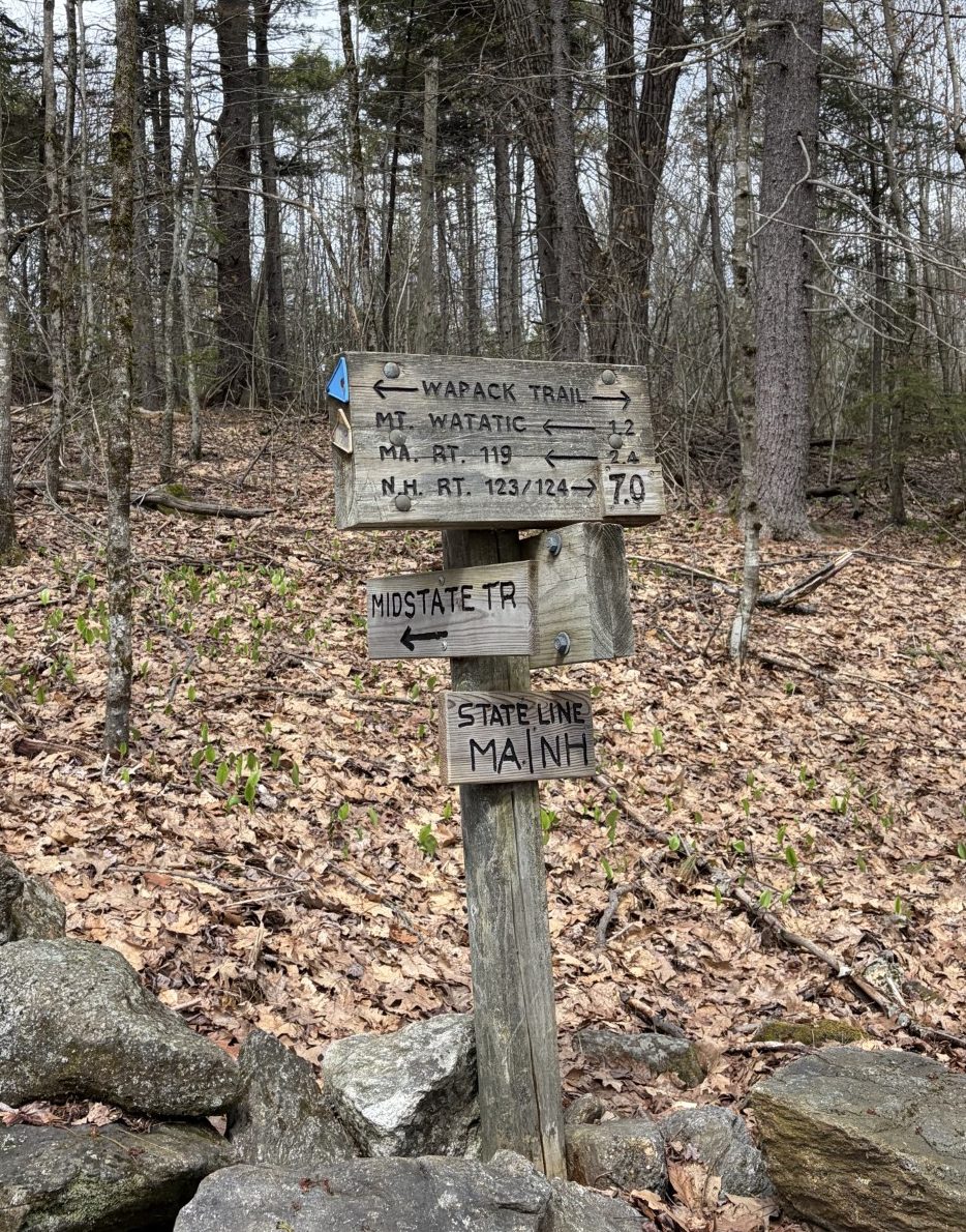
It takes us an hour and a half to drive to our launching point. I park the car and Waldo and I step out onto the dirt road that is the Wapack Trail (at this point, the trail goes by that name as well as the Midstate Trail). Within less than 0.1 miles, the road morphs into an old stage coach road, where no vehicles are allowed. The way is broad and fairly flat, so the going is easy.
The temperature is about 48℉, so I’m wearing a light jacket. The sky is partly cloudy, so there are periods when it’s nice and warm, and periods when I’m glad I brought the coat. Here and there are some muddy patches, but they are easy to navigate around and the rest of the ground is solid and dry. There is no snow or ice around. Because there are no bikes around (they are prohibited) Waldo is feeling confident and takes the lead at the forward end of the leash. After just under a mile, the trail turns left and passes under some high-tension power lines. Then the climb begins.
The slope is not terribly steep, but it’s a lot of work for my old muscles. I have to slow my pace way down to keep from running out of breath and I have to stop frequently to rest my poor legs. I soon work up a pretty good sweat. The coat comes off and I tie it around my waist. Waldo is patient with me and stops when I do, without much fuss. But, then, he has a lot of experience walking with me. Like, his whole life.
Step by step, we slowly climb Barret’s Mountain, the first of 3 mountains on today’s hike. The trail runs along a ridge that connects those mountains and causes the ridge to have an undulating profile. So far, we’ve gone around 2 miles and gained about 500 feet in elevation, most of that in the last mile. I’m tired already and that does not bode well. Waldo is having a great time and isn’t bothered by the effort at all. But, then, he is quite a bit younger than I am.
At the top, I turn around and look out over the panorama of southern New Hampshire. There aren’t any sizeable cities out here, so what I see is a lot of green rolling hills. There are some winter-denuded deciduous trees on the mountain around us and a lot of spruce. These mountains, in the fall, are covered with the most gorgeous red, yellow and orange foliage, but that’s all gone now. Still, the forested ground around us is beautiful. We head down the saddle that leads to the next mountain to climb – New Ipswich Mountain.
The top of New Ipswich Mountain is a little barer than Barret’s Mountain and I can see off to the west a bit better. There, just a few miles away, is Mount Monadnock, a mountain I trained on in preparation for climbing Kilimanjaro, about 16 years ago. It’s about twice as high as these mountains, quite steep in places, and full of huge boulders. So far, the climbing here is steep enough to make me work very hard, but not so steep I can’t do it in a walk, although it is a very slow walk. Waldo takes it all in stride. That would not be true on Monadnock. He would never be able to climb over the boulders.
We make it to the top of Stony Top and continue on down to the saddle to the next mountain, Pratt Mountain. We turn around at the bottom of the saddle, right where my phone says we’ve gone 4.5 miles. We have climbed 904 ft in total elevation gain and I am spent. I turn around and look where we have come. Damn, we have to repeat all that to get back to the car.
By this time, my legs are very sore because I’m using muscles I haven’t used much in years. I plod along the way we just came, stopping frequently and sit down whenever a likely-looking stump or boulder presents itself. I’m sweating profusely. Waldo is patient and comes over and lies down next to me as I gather the strength to keep on truckin’. I am so tired and fatigued that I fall into a near trance-like state and my walking becomes instinctual. I put one foot in front of the other, barely lifting each step above the ground, in a shuffle that’s not much more than a crawl.
Finally, we make it back to the stage coach road and the ground becomes flatter and more even, without the roots and rocks of the mountains. I’m able to recover a bit more and pick up the pace a bit. Still, I don’t think I’ve ever been closer to the limit of what I can do without having to stop in complete exhaustion. I sit down in the car when we get there and I’m overwhelmed by a sense of relief – albeit a painful one. Waldo curls up in the passenger seat and chills. It seems border collie energy can be burnt off, even if for only a little while.
An hour and a half later and we’re back home, drinking water, eating dinner and relaxing. Even though taxing, it’s been a good hike. Maybe it was a bit much to bite off on the first mountain hike of the season, but we did it. Now we just have to repeat it again, after a few days of rest.
I’ve learned that shear grit can take me a long way.
And then propel me right to my recliner.
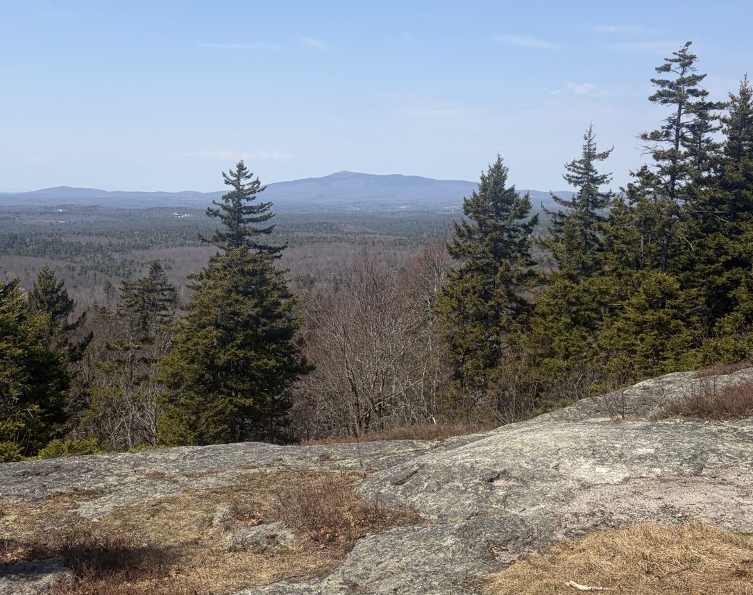
Mount Monadnock, in the distance