

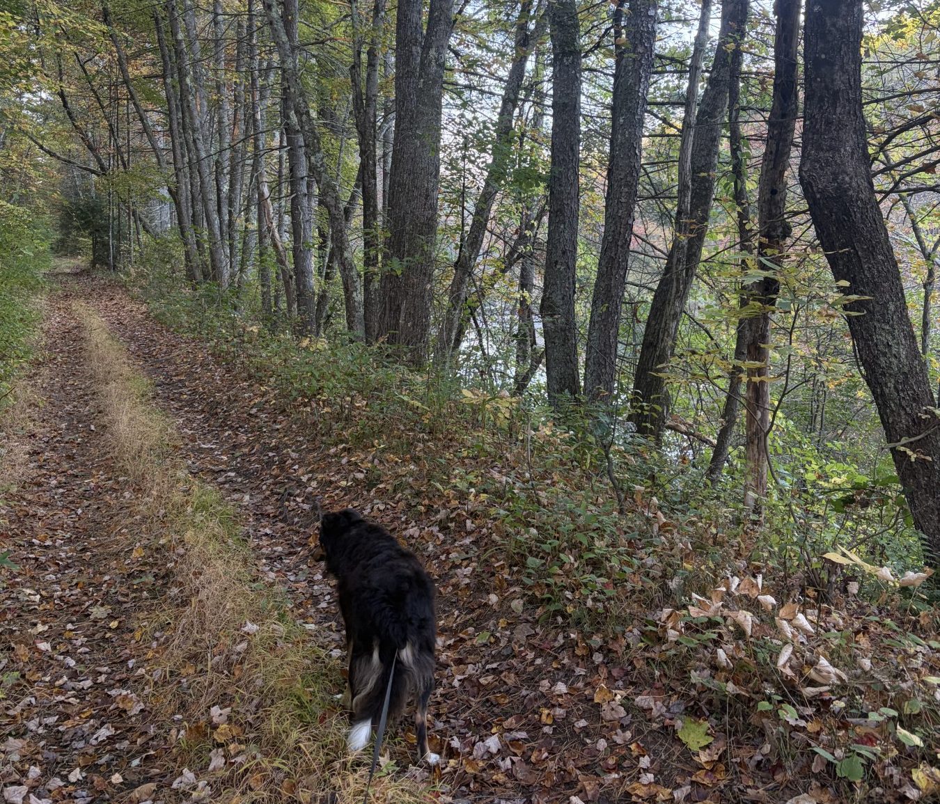
Next to the Ware River on a Protected/Unimproved part of the trail.
“The world is a book, and those who do not travel read only a page.
-St. Augustine
High temperatures in the low to mid 80s are back for the next few days, so Waldo and I get up predawn at 6 AM. It’s still sleepy out, but we have to drive a good hour before we can start our walk, so we just suck it up. After getting dressed, feeding and watering the dog, filling his water bottles and only then getting in the car, a half hour passed. We finally arrive at the place where we started our last walk, Barre Plains, at 7:30.
Unlike our previous trek, this bit of the trail is listed as “protected/unimproved.” I have high hopes that it will be an easy walk, and not just a line drawn on a map, because I saw it when we were last here. At least for as far as I can see down the trail, there are no significant obstacles and a clear path to follow.
It’s 55℉ when I step out of the car, wearing nothing heavier than a shirt with the sleeves rolled up. If there were a wind, it would be uncomfortably cold, but there is not even a breeze and the sky is absolutely azure. The sun is still low on the horizon, but it will be warming the day rapidly. I could have worn a light jacket, but, before we finish, I would have to carry the thing. Instead, I plan to walk briskly, with my free hand in my pants pocket to keep it from freezing, and generate enough body heat until the air gets warm. That’s how I rationalize my choice of no jacket and try to quiet the voice in my head that calls me a dumbass.
Waldo bounds out of the car, rearing to go, when I open the door. This, at least right now, is his kind of weather. He’s off at the end of the leash, looking this way and that, waiting for me to point out the direction to let ‘er rip. After a few false starts and dramatic changes of direction, we’re soon on our way down the old railroad bed in proper border-collie formation: Waldo out front at the end of the leash and me in the rear gently restraining his frenetic onslaught.
The path is covered in a thick solid carpet of tan and yellow leaves, mostly oak. I find this a little surprising because the trees and bushes, although showing a slight blush of fall color here and there, are still mostly green. Maybe the leaves are from a previous autumn? They do make a soft cushion to tread on and, with my quickened warming pace, we make good progress. There is an occasional tree that has fallen across our trail, but only a few and they are easily navigated.
All around us is dense New England forest, mostly oak and maple, but some ash and beech trees as well. The undergrowth is thick and I can’t see far to either side, no more that a few meters. Then a clearing appears close by, off to the left, filled cheek-to-jowl with some kind of red-leafed weed. I’m tempted to go over there and speciate the stuff, but I can’t see a way to do it without some significant bushwhacking and I’m not that curious. A little further on and we get close enough to the Ware River to see the water, to our right, through the bushes. This part of the railroad bed skirts along the river and there are places where it is only a few meters away. It isn’t much of a river here – it looks shallow, is slow moving, and only about 50 feet across.
I think this must have been what Massachusetts was like in the 18th and 19th centuries. Where we’re walking would have been called a highway, then, and I can imagine coming this way riding a horse or being in a buggy. The scenery would not have changed much when the railroad was completed in 1887 and I can daydream about being on a train being towed by a steam locomotive chug-chugging along at a whopping 40 miles an hour. Of course, if I were really on such a train, I would also be bathed in the smell of hot steam venting from iron vents, spent embers and ash from the smoke stack falling on my clothes and in my hair and the loud screech and rattling of steel on steel as the train car wallowed back and forth. But I don’t have to be that accurate to wonder what it was like to be live and travel here back then.
After just over 2 miles, we burst out onto the Tanner-Hiller Airport. It was closed last year to make way for the Mass Central Rail Trail that has yet to be built here. It was a small, single runway, backwoods airport servicing only small planes. The tarmac runway is still there, but it is full of cracks and small weeds. I could land a Cessna, or even a light twin Beechcraft, safely there, but its day has clearly passed. Off on the edge of the clearing are a few dilapidated hangars, one with what looks like an ultralight and one with a Piper Cub. There is even a single engine Piper, maybe a Cherokee, that looks like it is rotting in the weeds. Sad.
At the far end of the clearing, the trail becomes “proposed” and it quickly disappears. We batter our way forward until we come across the place where the river cuts across our path and turn around. There is no bridge, nor any obvious way to proceed without getting significantly wet. This part of the gap has now been thoroughly explored.
We backtrack to our car. I have an app that says we’ve done only 4.7 miles. But it has been a pleasant 4.7 miles. The temp is now touching the low 70s, I’m starting to sweat and Waldo’s tongue is out. Our day’s walk is done.
Our next piece of rail trail is somewhere around 11 miles long and is almost all paved, but there are short sections that are protected/unimproved, and some streets and highways. It should be a very nice walk. Christine has agreed to come with us, so we’ll be able to do it one-way. We just have to wait for a day when the temperature doesn’t get above the low 70s.
And that won’t be long from now.
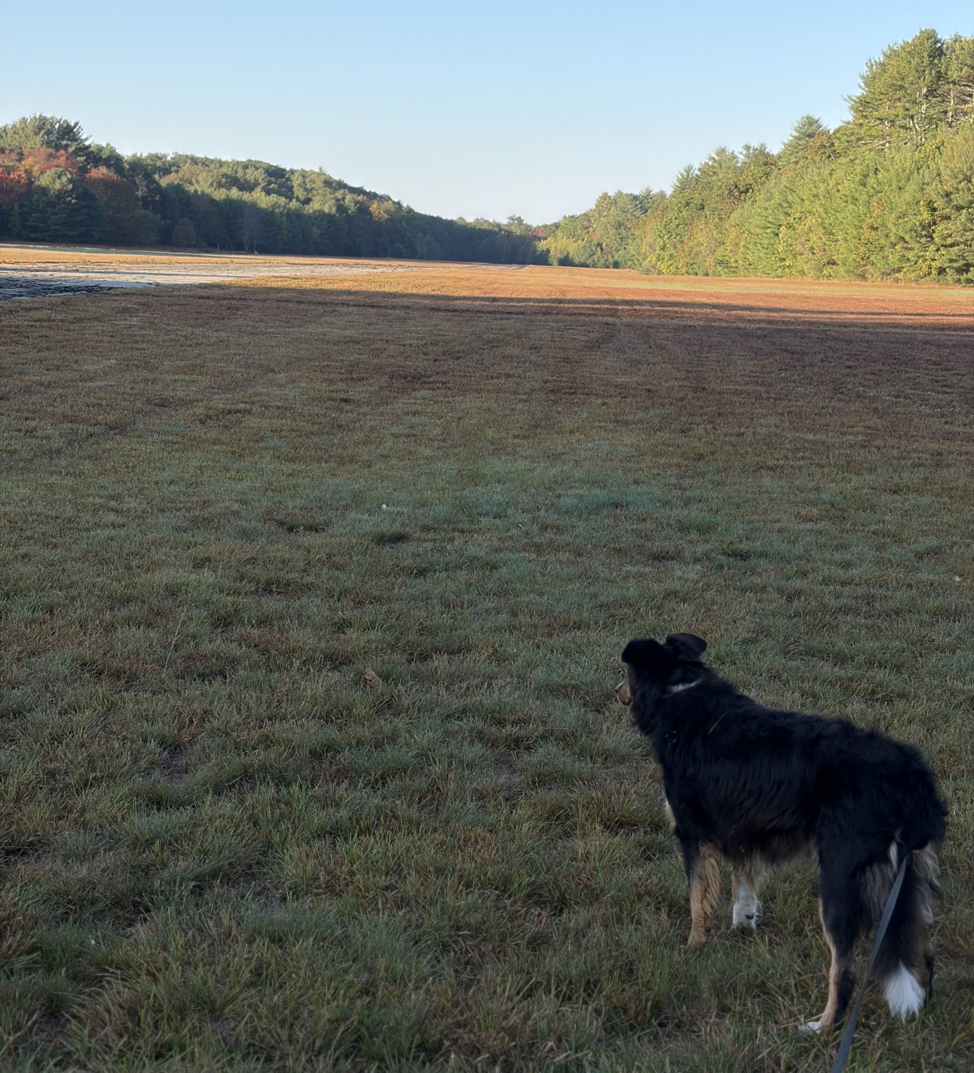
What’s left of the Tanner-Hiller Airport.