

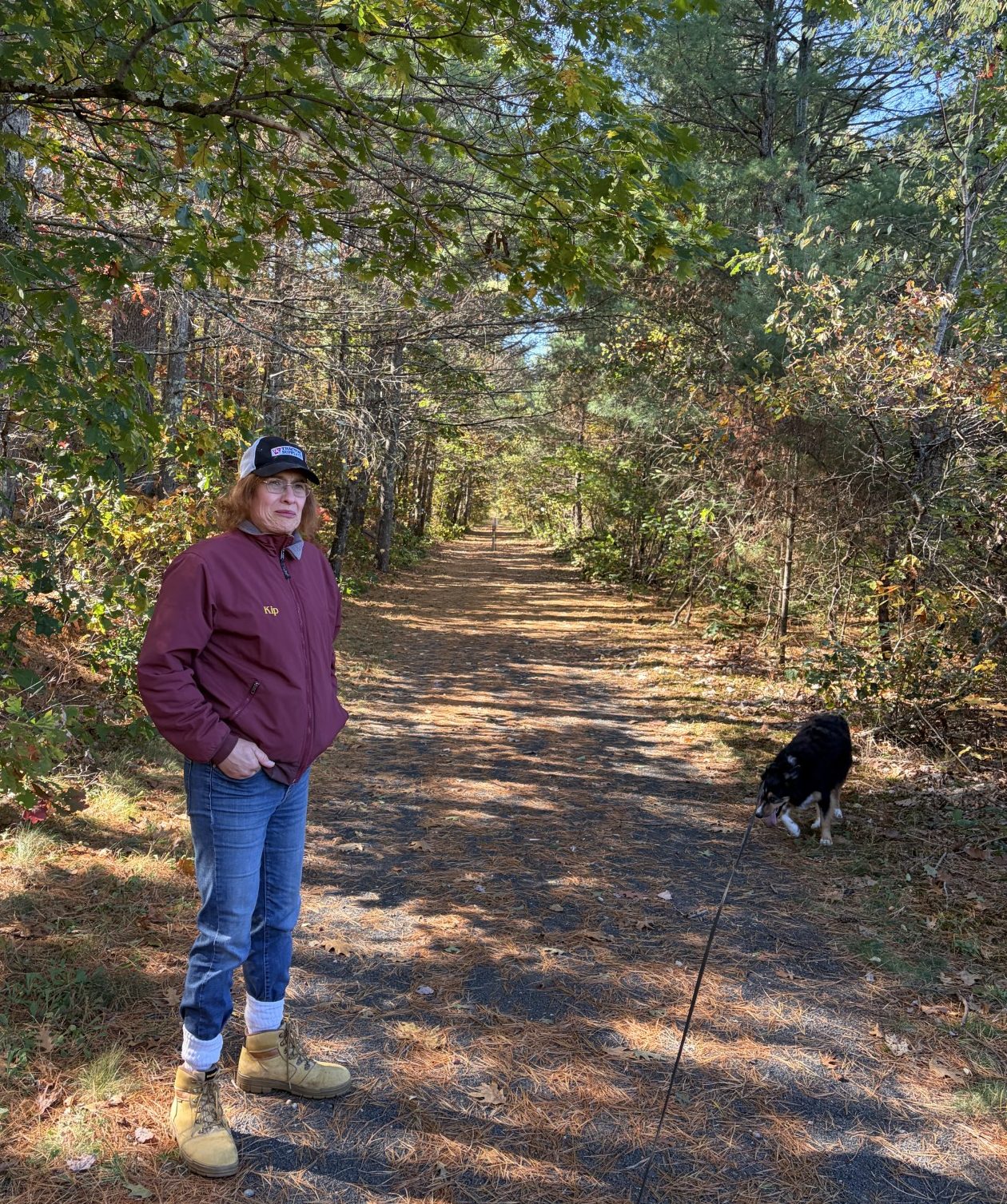
This part of the trail is easy going.
There are many ways of going forward, but only one way of standing still.
-Franklin D. Roosevelt
There is a 12-mile piece of trail that goes from the Tanner-Hiller Airport to the city of Ware. The map says this piece is mostly paved trail and city streets. There is a 100-foot piece of bushwack that isn’t even blessed with the designation of “proposed” and 1/3 of a mile of footpath, but the rest is easy going. Christine has agreed to go with Waldo and I, so we’re able to park a car at each end of our trek and do it one way. This will allow us to finish a piece of the trail that otherwise would take Waldo and I, on our own, as much as four separate days, doing round trip treks of 6 miles each. Plus, we get to share the walk with our good friend and fellow Waldo-walker.
The days have finally cooled off. The high is scheduled to be in the mid-50s with just a slight breeze and the sky is totally blue. The starting point is a little over an hour’s drive away and we start walking at just about 11 AM. At first, the temp is in the low 50s and I’m glad I brought my light Waldo-walking jacket. We start just across the Ware River from the Tanner-Hiller Airport. There is no bridge and we would have to take a 2-mile detour to go from the airport to where we are. I can see the environs of the airport, but not the actual runway because of all the undergrowth. That’s close enough, so we put the airport to our back, and head west.
This part of the trail is a broad stone-dust paved trail. It’s covered by a coating of pine needles that provides a soft cushion under our feet. We’re surrounded by deciduous trees, but there are not many dead leaves on the trail to keep the needles company. I guess the oaks and maples haven’t yet received the memo that fall is here. There is a splotch of yellow and brown in the trees, though, so I expect that’ll change in the next week or so. Especially with the cooler temperatures.
The trail follows along the Ware River and crosses it twice over a couple of foot bridges. In Gilbertville, we pass by a wooden covered bridge. Christine and I remember how Hurricane Irene destroyed a number of covered bridges in Vermont in 2011. It’s nice to see that some have survived. We wonder why people bothered to cover them and why they stopped. They are all made of wood and are subject to rot and other ways the elements can diminish their life-spans and we decide the roofs were put over them to increase their longevity. Many have lasted over a hundred years, so it must work. Modern building materials don’t benefit from the protection, but there still are a few wooden covered bridges being built even today.
Phyllis is still in Africa and it’s early enough in the day that we can exchange photos by SMS (she’s 6 or 7 hours ahead of us). We send her pictures of the three of us on the trail and she sends us pictures of lions, elephants, giraffes and cape buffalo. We can’t offer much competition there. But, hey, Waldo’s pretty photogenic! When I lived in Africa, we often didn’t even have a landline to call from and, when we did, international calls required long wait times and were expensive. Being able to send pictures back and forth on a whim wasn’t something we even dreamed of. Now, here we are, on a piece of nineteenth century technology, using twenty-first century tools to effortlessly communicate with someone on the other side of the planet, surrounded by our primordial origins. Today’s world truly has some magic in it, even if it has some malignancies too.
When we get to the 100-foot bushwhacking part, we ‘re walking along a narrow road. On both sides of us is a thick mat of weeds and bushes. There is no indication of where you can go to get onto the nearby next piece of trail. Except I was there exploring a couple of days ago and walked the connection going the other way. I marked where to launch off into the weeds by turning a large rock up on end. It was still there and we got onto the new piece of trail, after going down a steep embankment, without any problems.
When I was out doing that exploring, I met a guy who said the lower part of the trail was washed out in a hurricane in 1938 and in order to go from what was left up to the road required that one trespasses on a tiny triangle of private property. The owners don’t like it when people do that. The group trying to develop the rail trail are trying to buy that small triangle to get around the problem, but it hasn’t happened yet. You’d think it would be a slam-dunk. The only thing that piece of land is being used for, right now, is growing weeds and such. Waldo knew where to go and we followed him into the weeds, across the private property and down onto the other piece of trail. No one was around to complain.
The last part of our trek, about 2 miles long, is on surface streets in Ware. We get back to the car and we are sore. It’s been a long time since any of us has walked 12 miles. Waldo hops up in the passenger seat and lays down, comfortably stretched out. I’m just grateful to be sitting down. One thing for sure. Waldo and I are taking tomorrow off from any long walks.
Two days from now, a nor’easter is forecast to come our way, so it’ll be into next week before we can continue. The next 9 miles or so is probably all bushwhacking. After that there’s another 9 miles of what should be easy walking and then we are done! We will have walked the entire 104 miles of the Mass Central Rail Trail from downtown Boston to Northampton.
But we aren’t there yet.
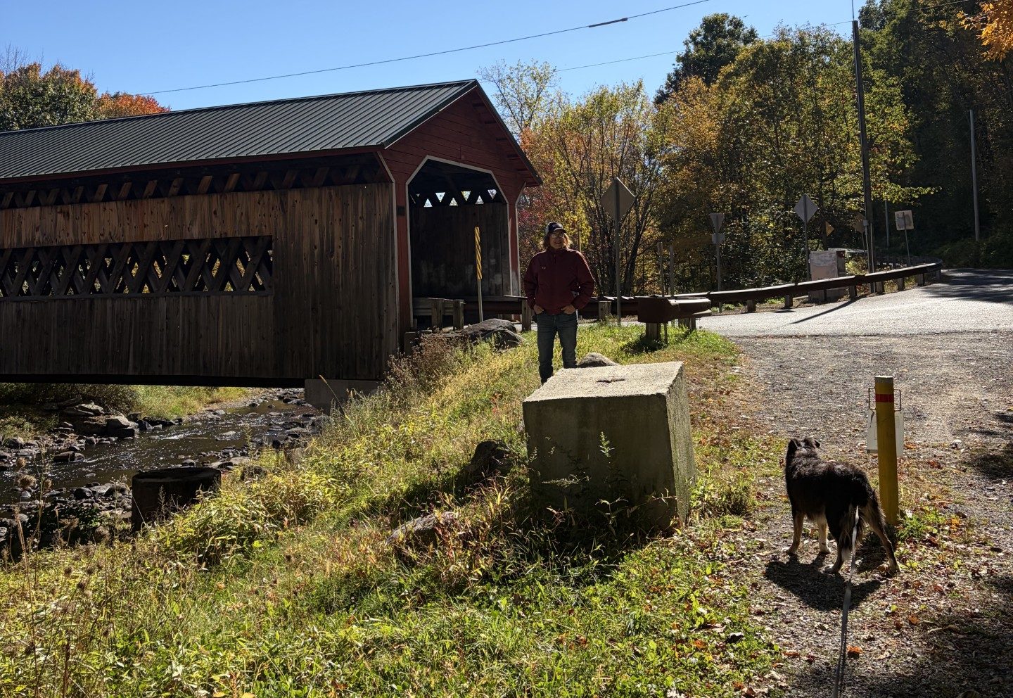
We even pass by a covered bridge.