

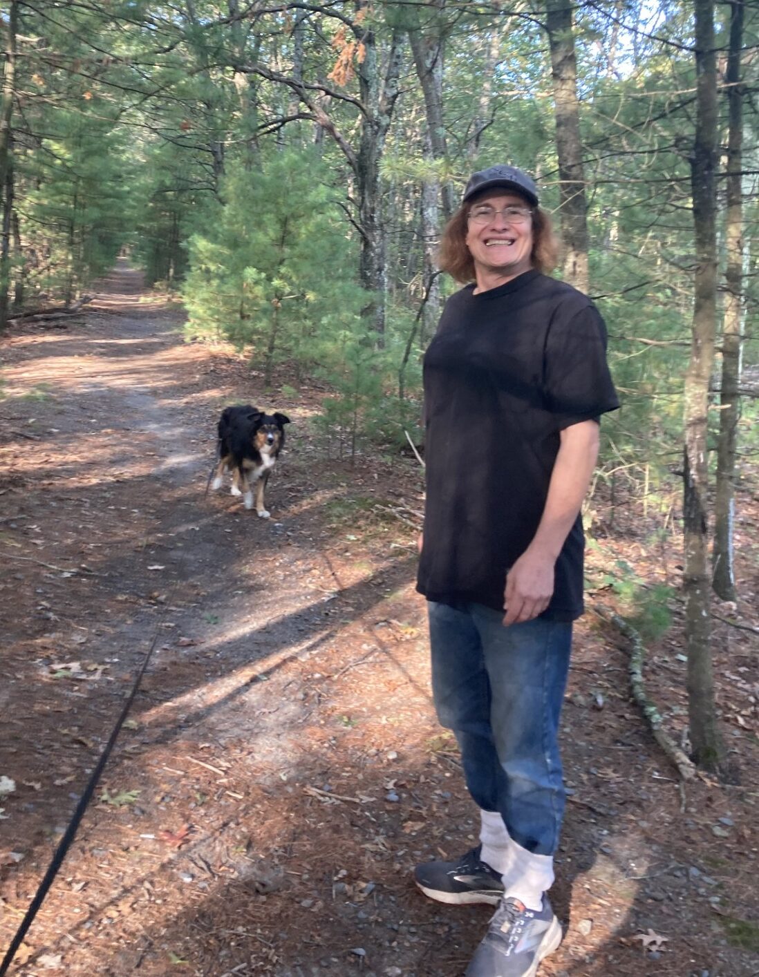
The beginning of the trail.
You have to motivate yourself with challenges. That’s how you know you’re still alive.
-Jerry Seinfeld
The next gap in the Mass Central Rail Trail goes from the Clinton Dam to West Boylston. I estimated the distance at about 6 miles. That would mean a roundtrip distance of about 12 miles – a bit much when I don’t know what kind of walk we’re going to have. So, I asked Christine to meet us in West Boylston where we will park our car and take us to the Clinton Dam where we will start. That way, we can do a one-way trip of 6 miles. Very doable under almost any circumstances.
Christine does not like bushwhacking the way Waldo does, so I didn’t expect her to want to join us. She lives just a 15-minute drive away, so I thought she would drop us off and we’d go on our own. But when we got to the dam, she decides to join us. Both Waldo and I like to walk with her, so we’re in for an unexpected treat.
You can see a footpath disappear into the undergrowth where we start. Just past the initial barrier of weeds, a well-trodden path continues on the old railroad bed, the ties and rails have all been removed. The sky is clear and the temperature is in the high 60s. The ground is dry and there is no one else on the path. We’re surrounded by new growth forest, few trees have a trunk wider than 9 inches, and the canopy is dense enough that there are very few bushes and undergrowth on both sides of the trail. There are a few fallen trees out there, but nothing like the tornado-driven rat’s nest we had to negotiate in West Berlin.
We don’t go far and we see another railroad bed off to our right. This is obviously still in use with shiny, well-polished rails on ties that float on a bed of large-rock gravel. There are scant weeds, only rarely present. It comes from someplace to the north, in Clinton, and parallels our route for a short distance. We wonder why they didn’t build the newer tracks on the older bed, only to find out in a short distance, they did. Our footpath converges with the active train tracks and then disappears. We’re left with walking on the gravel or the ties.
I don’t know if it’s by design or coincidence, but the ties are placed at an inconvenient distance that makes it impossible to walk on them easily. The gap between them is just low enough that it is uncomfortable to step with one foot on the gravel and one on a tie. It‘s just short of being one foot-length wide, so it’s either that, or step fully on a tie. The ties are separated by a distance that makes you feel like you’re taking baby-steps to go from tie to tie, or giant leaps, if you try going to every other tie. Waldo marches on out front, showing no difficulty in the walking at all. Bushwhacking, slugging through swap, or walking the rails, it’s all good to him.
There is no comfortable place to walk to the side of the railroad, due to weeds and undergrowth. In addition, every 50 feet or so is a pile of new ties, obviously meant to replace some of the ties that are already there, that block the way. Roughly every other to every second tie is marked by pea-green paint and they look like they need replacement – they’re cracked and rotting with the spikes backing out of the wood. Some of the spikes are so loose, you can reach down and lift them from the wood without much of a tug.
The online map shows that this is our route, but it’s not detailed enough to reveal whether or not we should be following the train tracks, or if there is another “path” nearby. If there is another way to go, it would be to our left across a drainage ditch. So, we climb down the steep grade of the dike the tracks are on, cross the ditch and explore. Christine happily plays along, despite her feelings about crashing through undergrowth. There is no obvious old roadbed there and the going is a bit rough, but who knows. We trek along parallel to the tracks for a while, until the drainage ditch widens and becomes pretty swampy. There is still no clear trail to follow, so we hike over the ditch, climb back up the dike, a good ten feet, and follow the train tracks the rest of the way. I now have a new category to add to the list of what “unimproved” means: actively used railroad tracks.
Not far from our endpoint, as we cross an inlet of the Wachusett Reservoir, we meet a man carrying a fishing pole. He says he was out here fishing a few weeks ago with his daughter and lost his little girl’s fishing pole in the water. He brought a large magnet and is going to try to retrieve it, hoping the magnet will attach to the metal reel. We wish him luck and continue on our way. There is a pontoon boat out on the reservoir that we see too, but we can’t tell what they’re doing. We pass no one else.
After something over 5 miles, we come to the place where the map says we should venture off the rails and into the weeds. It’s close to where our car is parked. We bushwhack through a wall of green and find a small footpath going in the right direction. Shortly thereafter, we’re in the parking lot and at our car.
One more piece of the Mass Central Rail Trail conquered.
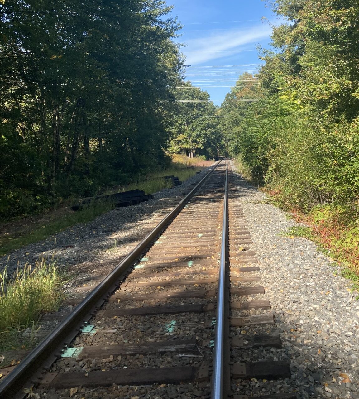
The active railroad.