But the beauty is in the walking – we are betrayed by destinations.
-Gwyn Thomas
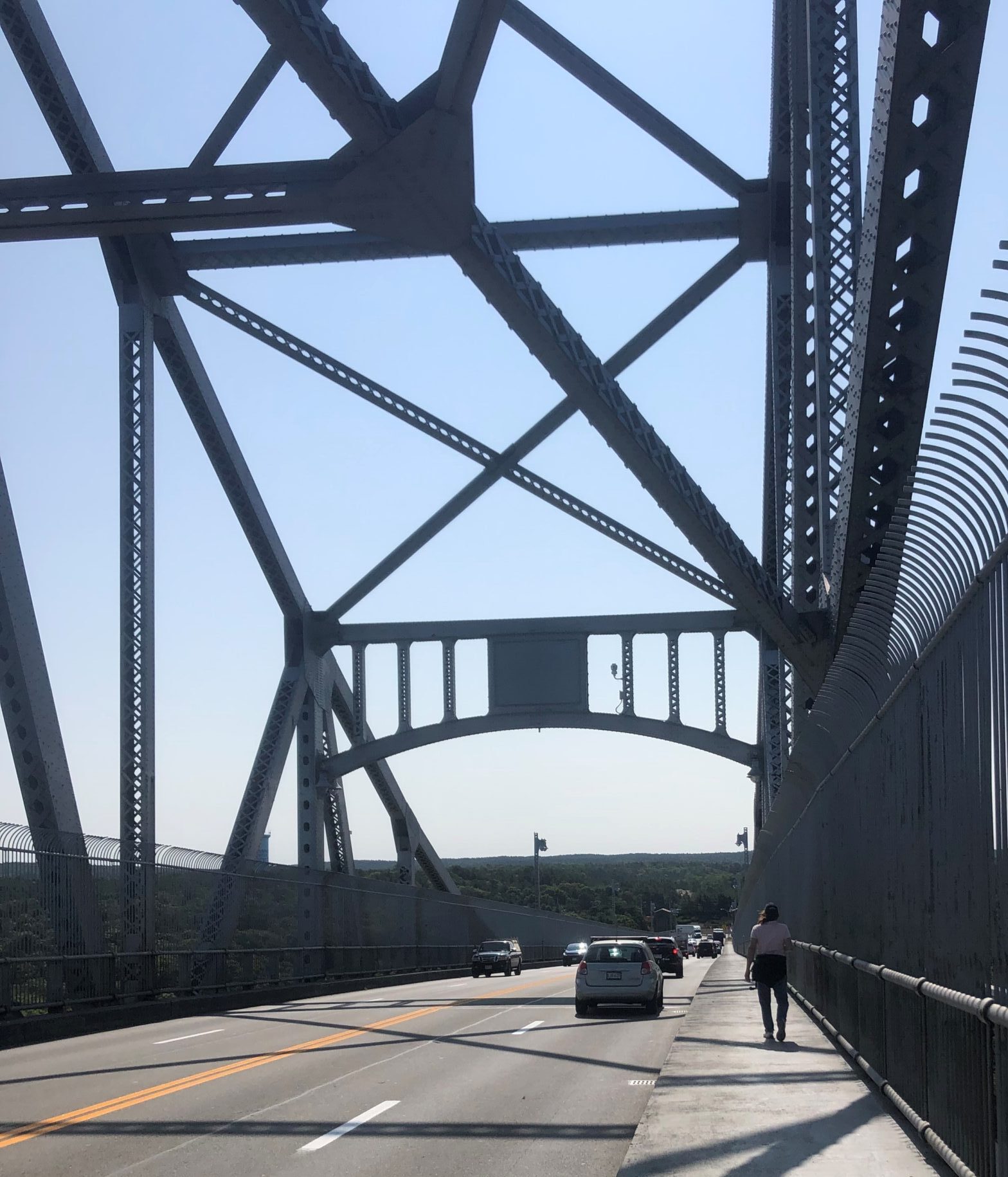
From Wareham, our trek finally leads to the Cape Cod Canal at Buzzards Bay, only 4.3 miles away. Cape Cod is a peninsula that juts straight out into the Atlantic Ocean, then bends around in the shape of a human arm flexed at a right angle. The elbow is near Chatham, and at the extreme end of the cape, where it curls around into Cape Cod Bay like a furled fist, is Provincetown. The Cape Cod Canal is a manmade slice of water that cuts the cape at the shoulder, passing between the towns of Sagamore and Sandwich in the north, and Buzzards Bay and Bourne in the south, making the cape an island. Without the canal, shipping would have to travel up to an additional 150 miles to get around the peninsula. Originally conceived by Myles Standish in 1623 and occasionally reconsidered afterwards, nothing much happened until dredging started in 1909. The canal was opened on a limited basis seventeen days before the opening of the Panama Canal on July 24, 1914. It is 7 miles long, the longest sea-level canal in the world, 480 feet wide and its maximal depth is 32 feet at mean low water. There are three bridges which span the watery gap, the Sagamore Bridge to the north and the Bourne Bridge, plus the Cape Cod Railroad Bridge, to the south. Construction for all three began circa 1933.
Our route takes us from Wareham along city streets to the canal at Buzzards Bay. There, we follow a bicycle path that runs next to the water, to the Bourne Bridge where we cross. At the bridge, the road rises in an arc and we pause at the apex, high above the canal. Behind us, mainland Massachusetts stretches west some 200 miles in the sidewalks, streets, highways, trails, rail-trails, and foot paths we pounded step by step. In front of us lies about 60 miles of more of the same. Beneath us flows a wide body of water that served as a beckoning milestone for almost seven months. A body of water that, in one direction, bends around in a gentle curve and then gets lost in trees. In the other direction, it passes under the nearby railroad bridge, then widens out into Buzzards Bay and the Atlantic Ocean. We take one more step east and, finally, after all this time, we’ve made it to the Cape! Filled with a sense of accomplishment, but with our eyes on the prize, we continue on to another bike path, also running next to the water. We’ve made it to the cape, but we still have more to go.
The three of us just keep plodding along until, 13.6 miles from Wareham, exhausted and sore, we finally make it to our car in Sandwich. Sandwich was settled in 1637 by approximately sixty families from Saugus. It was named after Sandwich, Kent, England. It and Yarmouth are the oldest towns on Cape Cod. In the 1650s, the Religious Society of Friends (Quakers), were attracted to the area. The Massachusetts Bay Colony banished them and in 1659, executed some. Despite the persecution, the Quakers never completely left and, today, Sandwich’s Quaker Meetings are the oldest continuous Monthly Quaker Meetings in America. In 1826, the Boston and Sandwich Glass Company arrived and doubled the population. In 1854, the factory was open 24 hours a day, employed 550 workers and produced 5,200,000 pieces of glassware annually. Today, the town is part of the Cape Cod resort industry and sees thousands of itinerant visitors each year. The population as of 2020 is 2,866.
Three days later, we walk from Sandwich to Centerville. I look for routes on Google maps that have back roads or, when possible, walking trails. In order to select such a route, I have to force the program to make it track where I want to go. This splits up the route into segments and the software does not list an overall distance. I have to guess the distance from the time Google says it will take us to walk it. My guess for this leg was about 13 miles. I am wrong. It turns out to be 15 miles. Man, I thought the last leg was long! Unfortunately, there are no places to park a car that wouldn’t significantly shorten the trip. Even though it proves to be longer than desirable, we did find and follow interesting trails, some of which didn’t appear on non-Google map software. Christine, Waldo and I just keep plodding along, putting one foot in front of the other, until we finally make it to our destination, a Dunkin’ Donuts in Centerville, after over five hours. Man, was I ever glad to sit in the car seat when we got there.
These last two legs have been brutal, but we are getting close to our goal. We definitely want to get to the P’town beaches before the wintery cold weather sets in. I don’t think I want to go swimming in the Atlantic, but I would like to wiggle my bare toes in the seawater and wet sand without them getting frostbit. Christine just might brave a dip, wearing a wetsuit. And Waldo, he’s never seen so much water!
It’ll be really interesting to find out how Waldo reacts to the surf when we get to the end of our trek.


