

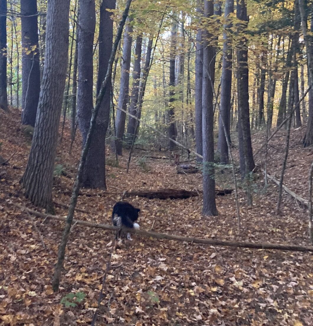
In some places you can kinda, sorta see where the railroad bed used to run…
The greatest adventure is what lies ahead. Each day brings new possibilities for exploration and discovery.
-J.R.R. Tolkien
The next little gap in the Mass Central Rail Trail that Waldo and I have to walk is about 3 miles long (6 miles round trip) and runs west from a small community, called Barre Plains, to somewhere just south of Barre and west of Oakham. Our turnaround point is in the middle of the woods and I’m not sure what town would claim it, but I think it’s technically in Barre (there are no signs of any town nearby). Christine and I ended up there, coming from the east, a couple of years ago, after walking on a paved part of the MCRT. Now Waldo and I are going to approach it from the west, on a bit that’s listed as “proposed.”
I’ll have to admit to feeling a little trepidation about where we’re going, because this part of the railroad has not been used for about 85 years and it’s in the middle of nowhere. I’m not sure what “proposed” means, but it just might be that it’s nothing more than a line drawn on a map, running where the old railroad used to go. Its location makes it far enough out of the way that it’s unlikely to have been used for hiking, biking or ATVing. So, probably, it has just been abandoned and left to Mother Nature to reclaim what’s left. As I planned this part of our trek, I worried that there would be places that were not navigable and, being so deep in the country, there may not be any roads close by to engineer a convenient go-around.
My fears proved well-founded. From the start, the old railroad bed was swallowed in woods and could not be seen. We trespassed over someone’s back yard toward where the map said it should be. Pushing aside some undergrowth, I finally found our “path” at the bottom of a cut. It had drainage ditches on the sides and, although curating bushes, weeds, saplings and some small bole trees that made our walking a chore, it was walkable. After no more than a quarter mile, it just disappeared. I couldn’t see any evidence that it continued any further. Off to our left was a creek that the map said we would have to cross. Given the state of what we were walking on, I seriously doubted there would still be a bridge that crossed it. However, the map also showed that the old railroad coalesced with a railroad that is currently in use, just on the other side of the creek. So, Waldo and I backtracked and walked on paved roads to the newer railroad.
The rails were not as polished from use as those we walked on near the Wachusetts Reservoir. Walking between them was just as much a pain, though. The rails ran about a half-mile, then just stopped. They were replaced by a couple of ruts laid down in deep grass. We followed the ruts until we came to a road that crossed our path. On the other side of the road was nothing but weeds. After searching around for a bit, I again found what was left of the railroad bed and we continued on.
After another quarter-mile or so, the railroad bed, once again, disappeared. We were surrounded, on three sides, by waist-high weeds. I knew there was a road not far ahead, so I encouraged Waldo to plunge through the foliage in the same direction we’d been going. He couldn’t have been able to see more than a foot in front his nose, but he was more than game. He loves walking in weeds and bushwhacking in general. After a hundred yards, or so, we broke out into the town dump.
The dump was surrounded, except by the way we came, by a fence. The fence had a couple of gates, but they were padlocked. The gap in one gate was large enough for Waldo to fit through, but not me. I toyed with the idea of climbing the fence, but I’m not nearly as spry as I used to be, and I decided, instead, to look for another way out. Just as I was about to explore the fence on the other side of the property, a van showed up at the gate. Waldo and I sauntered down thataway and left as they were entering. Problem solved.
We crossed another street and looked for the continuation of the railroad bed. We had to look for a little while, but finally found, off in the weeds, a serviceable path. We followed it for only a short ways until it, too, disappeared into the brush. I could see no way forward, so we backtracked and headed for the highway, Route 122. We were only a half-mile, or so, from our turnaround point.
The traffic on the highway was busy, but there was a wide shoulder, so Waldo and I could safely walk to our destination. Once there, I decided to travel a short ways on the trail Christine and I walked before. I remembered there was a place where the paved part of the trail diverted from the railroad bed. At that point, Waldo and I left the pavement and walked down what was left of the old railroad bed. We headed west, trying to approach the route from the other end. We followed a footpath about a half mile and then it turned to the south, away from where the tracks used to run. I could not see any evidence of the continuation of the roadbed, so we turned around and headed back to the car. Going back was a lot easier because I knew where we could and could not go. Back at the car, we headed home.
Today’s slog gave me a pretty good idea of at least one meaning of “proposed” and it ain’t pretty.
Next time, we’re walking a “protected/unimproved” piece of trail that runs from the Tanner-Hiller Airport to where we started today. I expect it will be somewhat easier, but who knows?
And that’s what makes it an adventure.
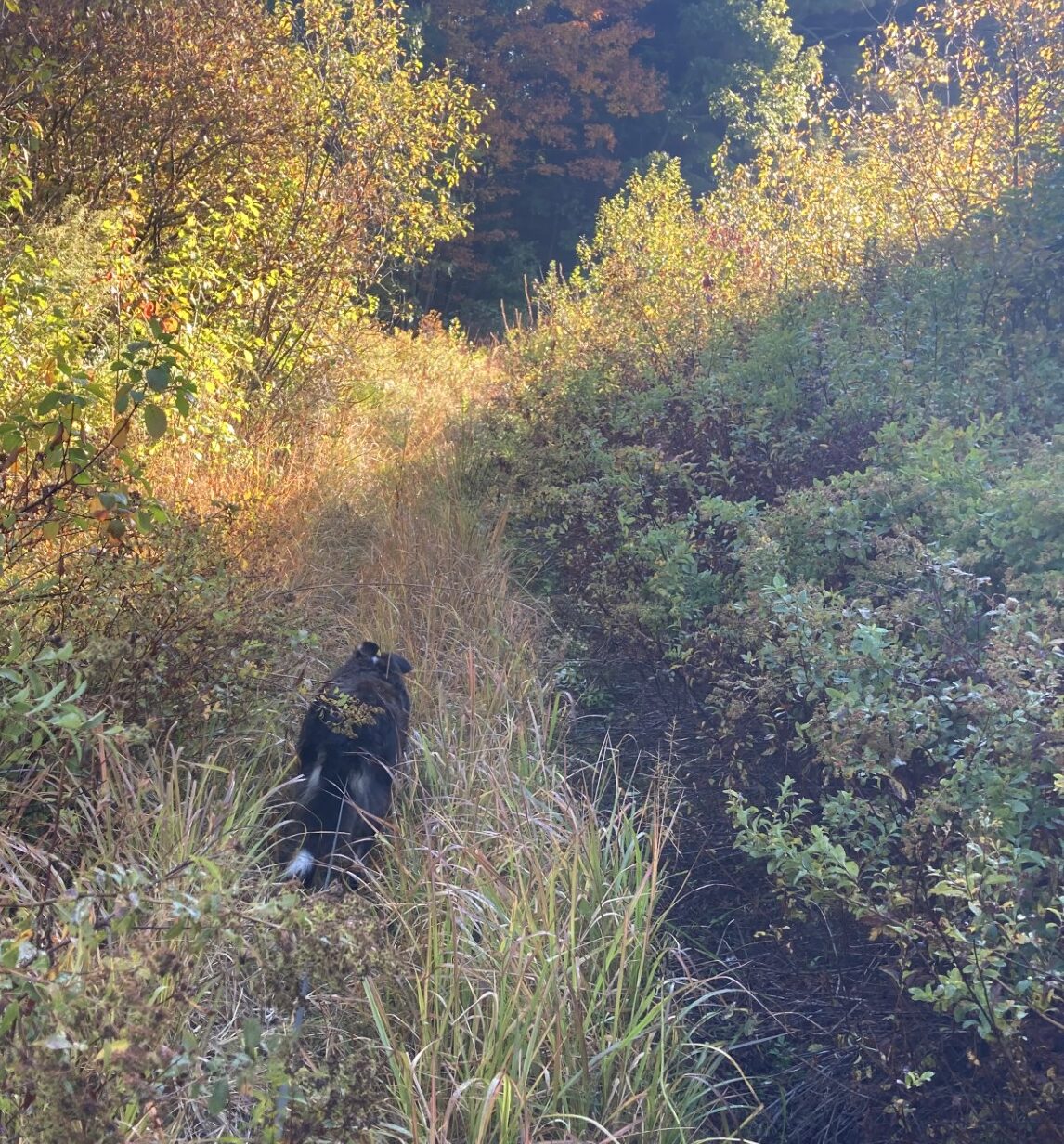
And in others, not so much.