

Sometimes things can get kinda funky.
“It’s a dangerous business, Frodo, going out your door. You step onto the road, and if you don’t keep your feet, there’s no knowing where you might be swept off to.”
-J.R.R. Tolkien
Karen decided to stop coming with us on our trek. Everything is fine, she is healthy, life just got in the way. We’re going to miss you, Karen, and your superb navigational skills.
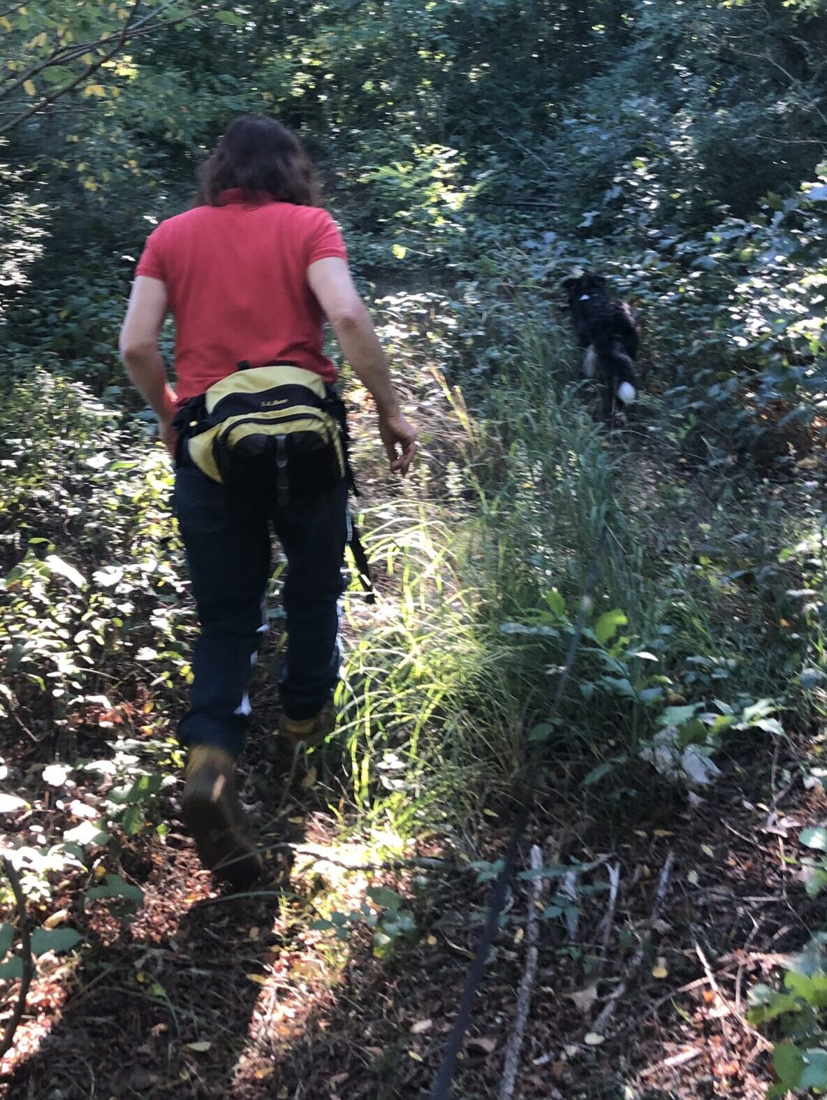
Over the past week, Christine, Waldo and I have walked almost twenty miles (19.3 or so). We started in Millville, walked to Franklin on the SNETT (9.3 miles), then, a couple of days later, took to the streets and walked another 10 miles to North Attleborough.
Franklin was first settled by Europeans in 1660, then incorporated during the Revolutionary War in 1778. It was named after Benjamin Franklin, who donated 116 books to the settlers. The Franklin Public Library has been open to the public since. It is supposed to be America’s first public library.
Franklin is also home to America’s father of public education, Horace Mann, as well as to the country’s oldest continuously operational one-room schoolhouse. It was operational from 1792 until 2008. Franklin’s population is 34,087.
The SNETT changes its nature between Millville and Franklin. In places, it’s paved and busy, in other places, it is graveled and less traveled, and it has spots where it is little more than a footpath. While on the path, it’s hard to get lost – but it also has its funky spots.
There’s a place on the edge of Woonsocket, just barely in Massachusetts, where the trail leads up to the Blackstone River and stops. No bridge. We bushwhacked around some fences then left the SNETT for city streets. Wandering into Connecticut for a bit, we crossed the river on a street bridge. Here, asking directions proved better that asking the GPS and after some educated guesses, we again looked for the trail. There was this piece of sidewalk that the GPS said was where the trail was supposed to be, but there were no indications that it was anything other than a sidewalk. We walked on in faith, then found something that looked more like a trail that peeled off to our left and was going in the right direction. Soon, we were away from the city and it was clear we were where we were supposed to be.
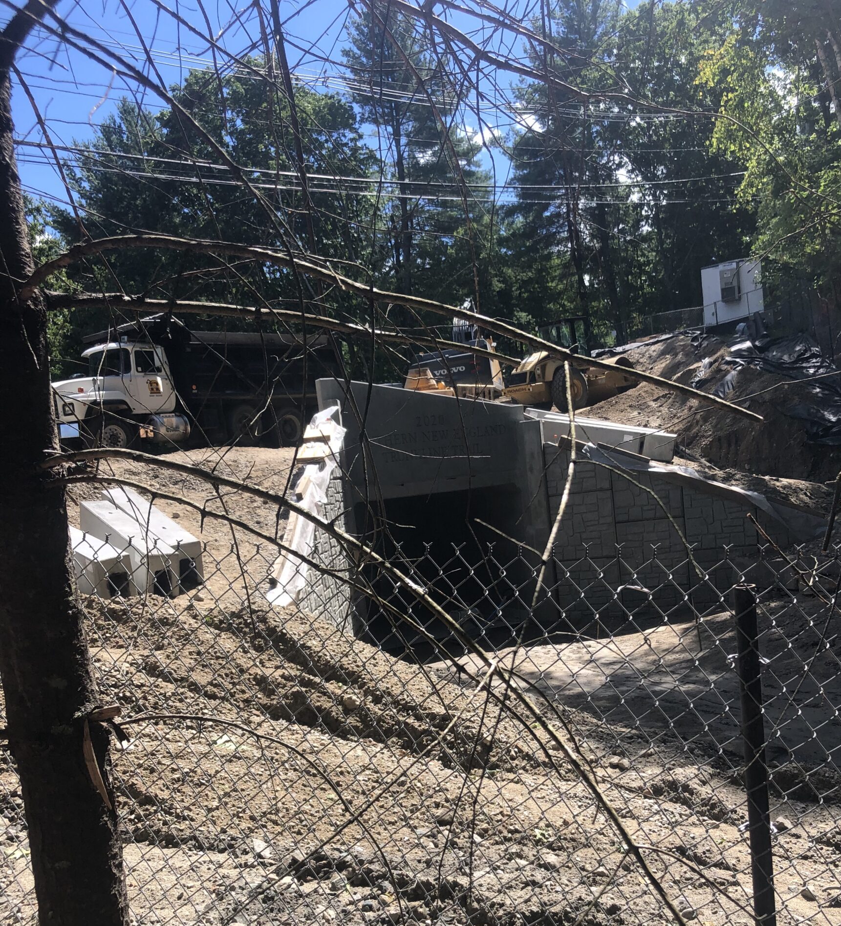
Another funky spot, about a mile from the end of the trail in Franklin, is where a tunnel is being constructed under a street. The trail and street are fenced off until the work is done. We clamored up one side of the embankment and down the other, right next to the fence, and had little trouble – except Waldo was wondering what we were doing. We could see where we had to go, it was just a matter of getting there. Even today, there are places where you have to fight the underbrush to get to where you’re going.
The next bit of our week’s journey, after a day of rest, is to take to the city streets 10 miles to North Attleborough. In precolonial times, the area was the site of the Bay Path, a major Native American trail to Narragansett Bay, the Seekonk River, Boston and parts of Rhode Island. The English settled in the region in 1634. Originally, the settlers subsisted on agriculture, fishing and hunting. George Washington slept there with his army as they moved to Boston to rid the city of General Thomas Gage’s troops. There were some mills and factories in the area early on, including button and nail manufacturing, textiles, jewelry, and cotton spinning. Due to its proximity to Gillette Stadium, just 5 miles away, it is now home to many professional athletes. Its population is 29,349.
We are able to follow back streets most of the way, the day is cool and there is plenty of shade from the abundant trees lining the road and the walk is very pleasant. Waldo is a little nervous, being so close to traffic, but the traffic is slow and not at all heavy. I’m sure he misses the rail-trails. Most of the way, we have sidewalks to follow, something that has been a bit of a luxury so far on our trek. Though there aren’t street signs everywhere we walk, we are able to muddle through without our getting lost, or GPS losing us. We just make the little triangle go along the trail of blue dots on Google Maps, you know?
In a sense, we’re wandering, roaming into places we may have been, but never afoot. It wasn’t too many years ago and we might be going to the same places by following maps. Maps are great, as long as, every once in a while, you come across a “sign” that tells you, “You are here,” in some form or another. There were many times in my past when I had little idea of where I was on the map, so it was of little use. Even in the twenty-first century, you can have the same problem. Your map is on your phone instead of a large piece of paper, but GPS can only locate you on the map when it can get a good satellite signal. It didn’t happen to us on our last few trips, but in the past, we’ve gotten lost because GPS lost us. We sorta knew where we were, but GPS didn’t. It cost us a good three-mile detour in Dalton. That was painful.
Ah, the trials and tribulations of the twenty-first century. I can only imagine what walking in this country was like before there were maps or GPS.
Even with all the fancy gizmos, though, it’s still an adventure.
And sometimes things can get REALLY funky.