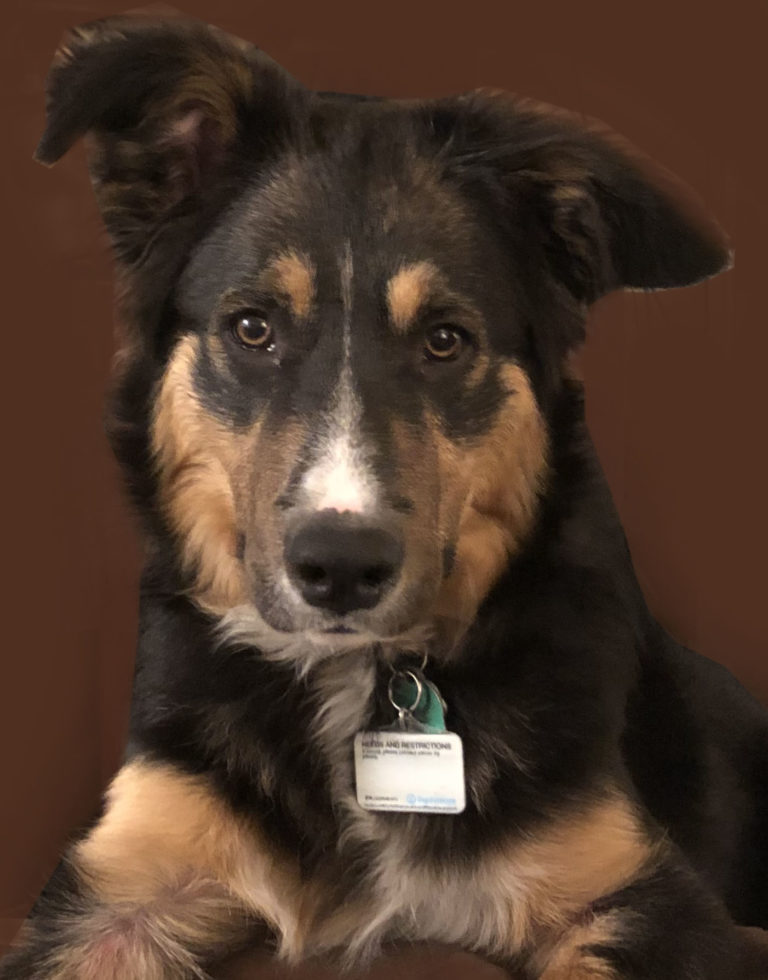
Want Walking with Waldo in your inbox?
Subscribe today to get news about Byron and Waldo delivered to your inbox. You can unsubscribe at any time.
Subscribe to get Walking with Waldo in your inbox!
Join 24 other subscribers


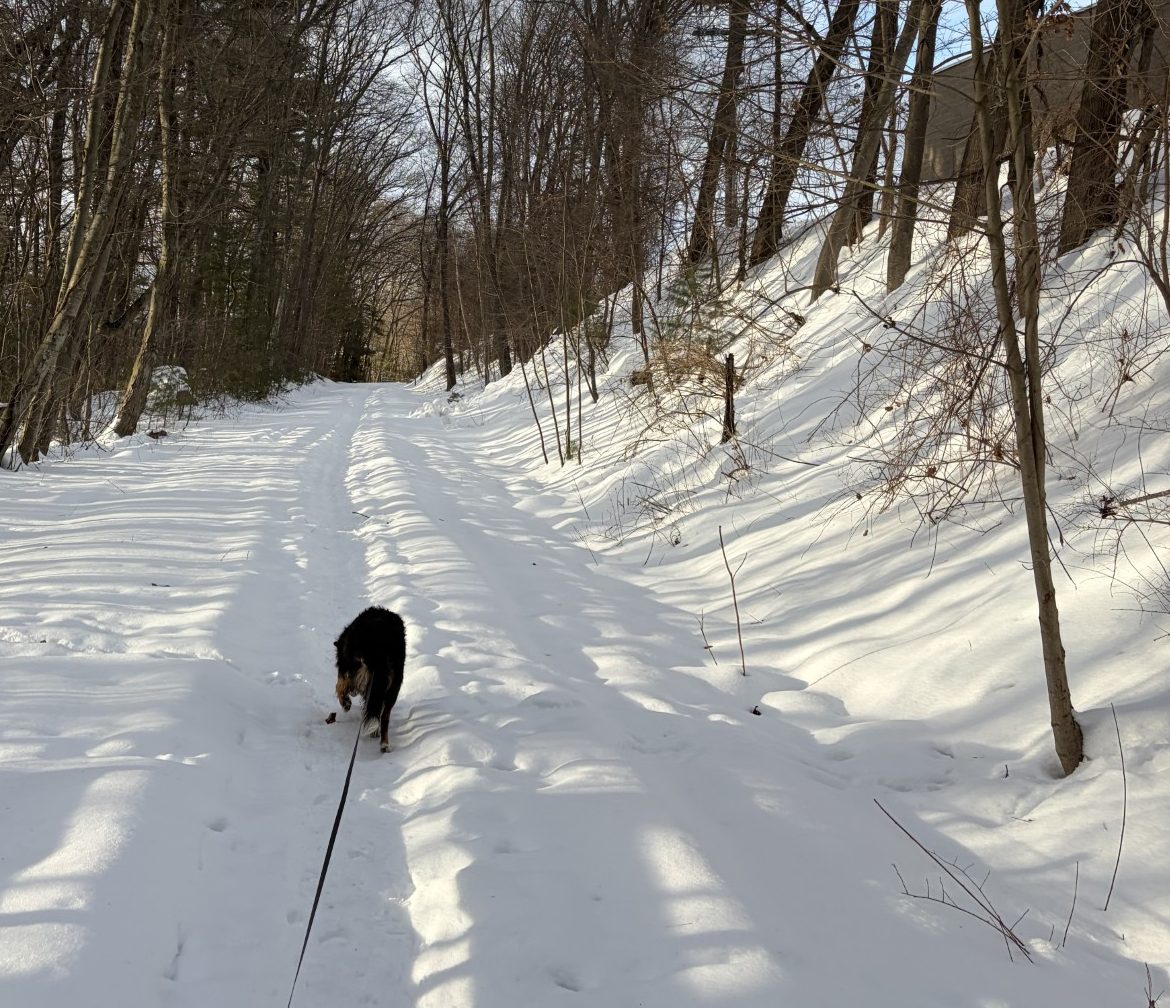
In some places, the snow isn’t that deep.
A bird does not sing because it has an answer, it sings because it has a song.
-Maya Angelou
–
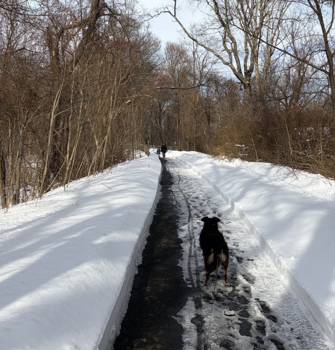
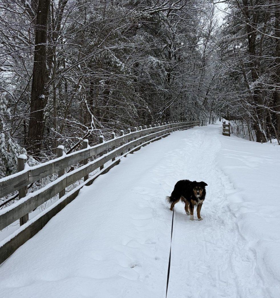
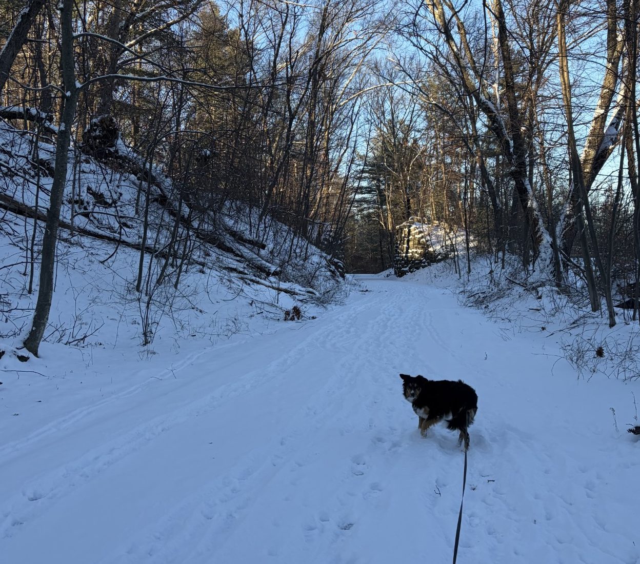
The nor’easter blizzard blew through and left 16.6 inches of new snow in Marlborough. Woonsocket, RI, got over 55 inches. Because it was a blizzard, there are drifts that are much deeper and places with only around 6 inches of new snow. Schools were closed for two days and it took the plows that long to clean off just the major streets. The rail trail remained unplowed for three days, but was surprisingly easy to walk on where people packed the snow down in passing. At least for the first mile or so. After that it was passable, but too much work for me to attempt.
Four days have now passed and the trail is plowed — up to Fitchburg Street, that is. That’s right around 1 and 5/8 of a mile. At least we have that far we can go without completely bleeding off my old-man energy in a flurry of achy muscles and dripping sweat. The temperatures have harmed up as well, with highs well into the 30s. And the birds are out, even though it is still winter, making their sweet music.
To date, I have, with the help of the app on my phone, identified 14 different species. It’s amazing to me that there are so many different species out in our little patch of woods, and, even then, it’s only a small sampling of nonmigratory birds. All-in-all, there are between 10,800 to 11,200 species of birds in the world. That’s almost twice as many species as the number of mammalian species (6,500 to 6,759). That is on the path to change, however. Over 160 avian species have gone extinct since 1964 and it’s projected that over 500 species will become extinct by the end of the century. 3 billion birds have vanished, from North America alone, since 1970, mostly from man caused climate change and eradication of habitats. Birds are one of the 21st century’s canaries-in-the-coal-mine and what’s happening does not bode well for humanity.
As Waldo and I walk down the path, occasionally serenaded but our feathered friends, I can’t help but shudder at the consequences of the damage humans are doing to the environment. Birds are the last remnant of the dinosaurs. They made it through Earth’s last great extinction event (the fifth), the Cretaceous-Paleogene extinction, in large part caused by the massive Chicxulub asteroid impact, some 66 million years ago. Some 75% of species did not make it through, but some dinosaurs did, namely the ancestors of all birds. And now, we’re on the edge of the next great extinction, the Holocene extinction, caused by human activity. I can only hope that some birds will make it through that too. They are such wonderful animals.
The ancestors of present-day mammals who survived the last great extinction, were thought to be small burrowing animals, like Purgatorius (what a great name!). They ate worms, insects and other surviving small animals. So I guess there were two main ways of surviving the catastrophe – burrow under the ground, or fly above it. It’s hard to guess what strategy will allow the survival of the current Holocene extinction, though I’m pretty sure some life will make it through. One thing is for sure. The planet Earth, and the life that survives on it, will not be the same as it is now. One can hope that there will evolve some greater intelligence than ours who knows better than to shit in their own living room. Or maybe intelligence isn’t what is required. After all, even Waldo knows better than to do that and he can’t even add.
For now, and, most likely, for the rest of my and Waldo’s lives, we can still enjoy life, pretty much as we’ve always known it, and at least some birds. Walking in the woods, especially in the spring, summer and fall, would not be nearly as beautiful and awe inspiring if there were no birds. Now, as far as I can tell, Waldo pretty much ignores the birds (believe it or not, he also ignores the squirrels that run across our path). I guess he’s decided that neither birds nor squirrels can be herded and therefore don’t require any attention. Even so, I’d bet he, too, enjoys the ambience birds create, at least subliminally.
Migratory birds will soon be making their way through here, so I’m likely to find many more species as the season progresses.
I know I’ll delight in listening to their varied and cheery songs.
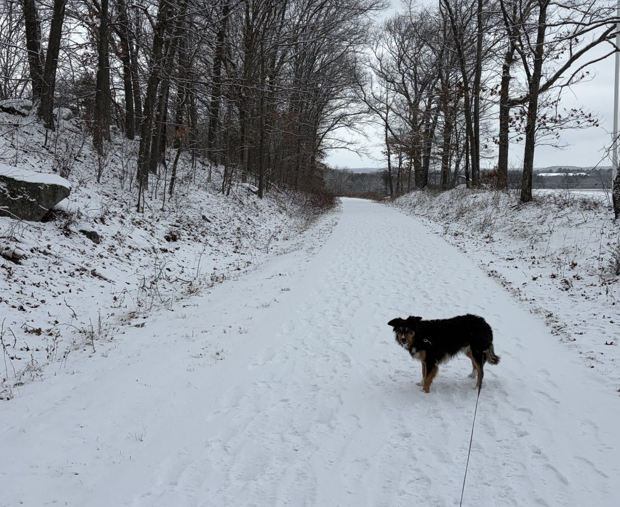
While in other places… Somewhere off to the left is a large rock and next to it the 1.0-mile marker.
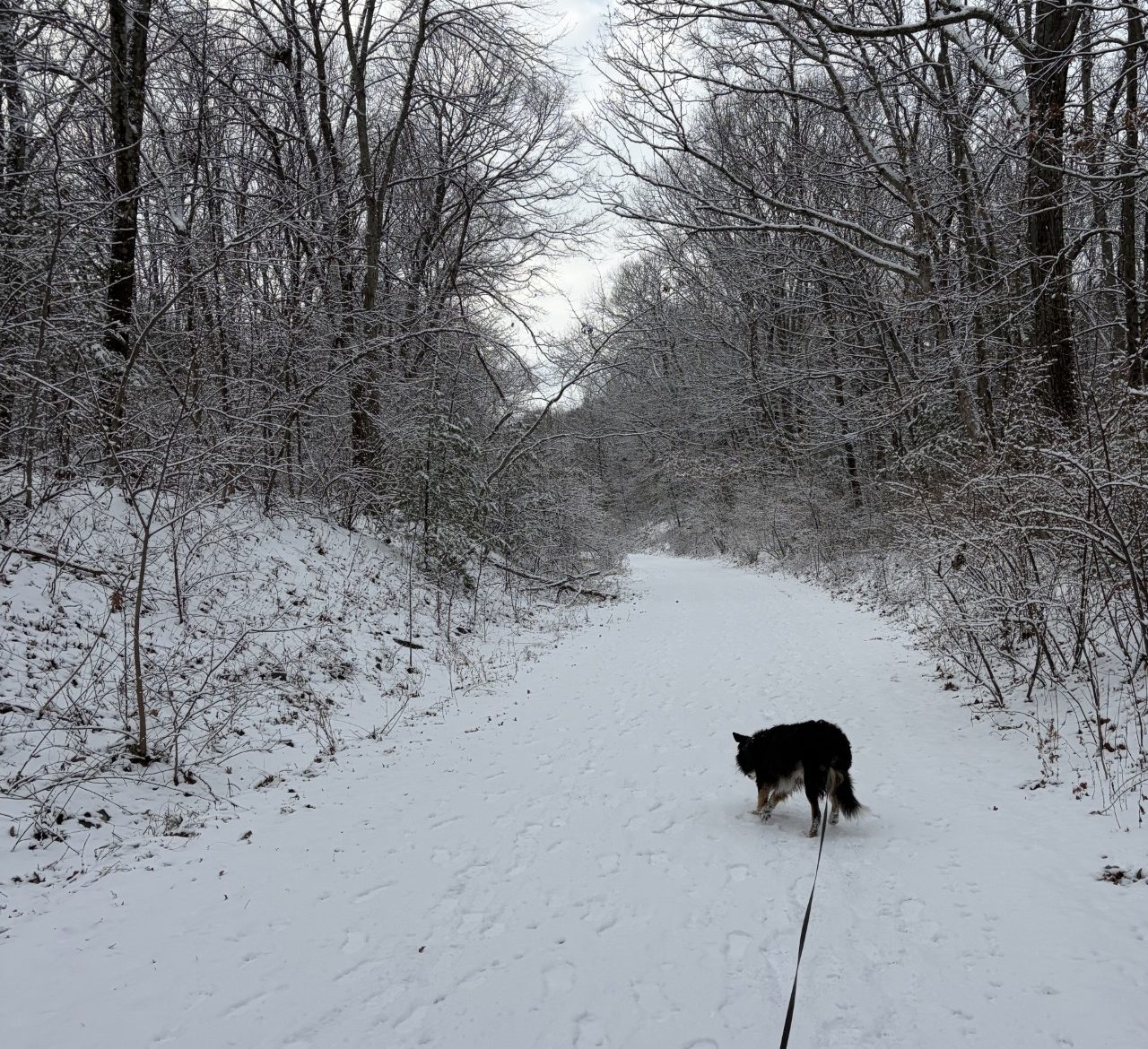
More snow, but still walkable.
Winter is begun here, now, I suppose. It blew part of the hair off the dog yesterday and got the rest this morning.
-Mark Twain
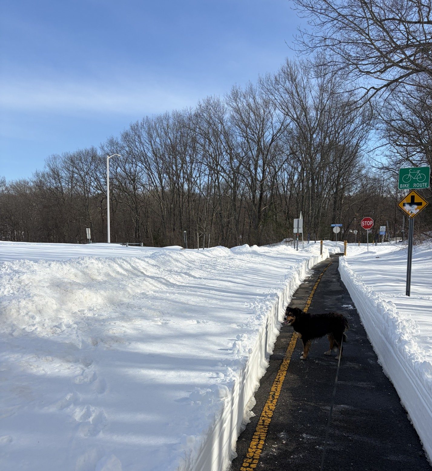
Another 2 or 3 inches of snow fell over the past 24 hours. That’s just enough to bury the distance markers on the rail trail, but not enough to make the walking much harder. The temp is in the high 20s, with wind chill, and the sky is overcast. The storm laid down a layer of white on the tops of tree branches, squirrel dreys (nests) and the tarmac. The effect is to make the world look like a white piece of paper on which Mother Nature judiciously drew a few well-placed squiggly lines of sepia ink to give the impression of a wintry landscape. She did a beautiful job.
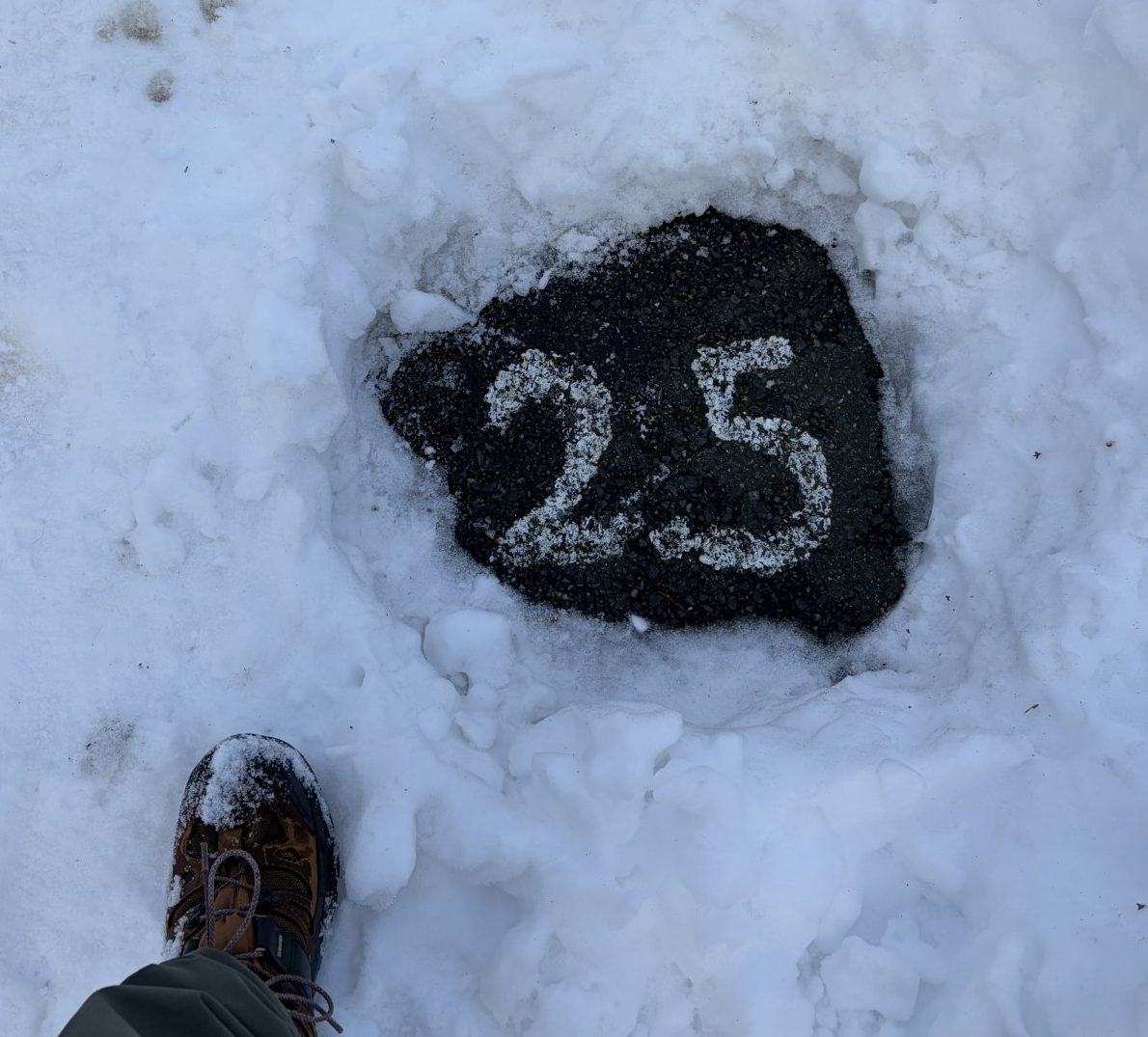
By kicking at the snow in strategic places, I can find the 0.5, 1.5, 2.0 and 2.5, but not the 3.0, nor the 1.0 distance markers. The 3.0 marker remains elusive and, I suspect, under the hardpack where it’s difficult to dislodge the snow with my boot. The only hint I have to the location of the 1.0 marker is a large rock at the edge of the new park. Unfortunately, the rock is buried under so much snow, I can’t see where it’s hiding. There’s not even a telltale bulge in the white to give away its presence. Tomorrow, there’s a nor’easter scheduled to dump about 20 more inches of snow in a blizzard, so finding all the markers just might have to wait for the spring thaw.
Last year was a light-snow year and I didn’t have to do much trailblazing at all to get Waldo and I through the drifts. This year is a bit more average, maybe a little above, but not the worst New England has seen. That honor goes to “The Great Snow” of 1717. Over the course of 9 days, 5 storms inundated the area with up to 5 feet of the cold icy stuff, with drifts up to 16 feet deep. People in New Hampshire could only leave their homes by crawling out of their second-floor windows and there were places where people tunneled through the snow to get between buildings. Some, in Boston, walked around on stilts (I’m not sure how that worked – how could they lift the stilt out of the snow to take a step?).
The Great Snow may have been the worst (in recorded history), but it wasn’t entirely unique. In 1888, 50 inches fell and there have been heavy snow falls in my life time. There was “The Blizzard of 1978,” when up to 19 inches fell on top of 21 inches already on the ground. In 1993, we had the “Storm of the Century,” that closed all the major airports on the Atlantic seaboard. During my time in Massachusetts, we had “The April Fool’s Day Storm” that dumped 3 feet of snow, where I lived in Sterling, on April 1st, 1997. There was the 2003 “President’s Day Storm” that left up to 30 inches of new snow and holds the all-time record for snowfall in Boston, of 27.5 inches, in a 24-hour period. I remember well having to stay in the hospital where I worked, in 2013, because of “Winter Storm Nemo” that was so severe that the governor of Massachusetts issued a state-wide travel ban. In 2015, “Winter Storm Juno” produced hurricane winds and buried nearby Worcester in 34.5 inches and Hudson in 36 inches of snow.
I can’t mention these storms without thinking about the “Year Without a Summer,” in 1816. From 1808 to 1814, five volcanic eruptions put some amount of ash and dust into the atmosphere. Then, in 1815, Mount Tamburo, in Indonesia, had a mega-eruption that put so much additional stuff in the air that the sun was significantly blocked out all around the northern hemisphere, causing crop failures and famine, and cooling the Earth, making it colder than normal all summer. It even snowed up to 9 inches in Maine on June 1st! There were supposed to have been some gorgeous sunsets, though. (As an aside, Percy Bysshe Shelley, Lord Byron and Mary Shelley were in Switzerland at the time. It rained so much they had to stay inside for days. Byron challenged the 3 of them to a contest to see who could write the scariest story. Mary Shelley won with “Frankenstein.”)
So, I guess, New Englanders have weathered through worse winter storms than what is predicted for the next few days. For Waldo and I, the ugliest part will be that we won’t walk on the rail trail until it’s plowed.
But we shall return!
And more snow yet to come.
God bless Marlborough and her snow plow.
If the path be beautiful, let us not ask where it leads.
-Anatole France
Waldo has been on antibiotics now for six days. If what is bothering him is due to anaplasmosis, it is because the organism can cause kidney inflammation. Something that’s called glomeluronephritis. Even once the anaplasma has been irradicated by the antibiotics, it takes longer for the body to heal the inflammation. Now it could just be wishful thinking, but I do think Waldo is doing better. It’s not dramatic, but it seems he is peeing a bit less, a little less often and isn’t as frantic when he has to go. I’ve talked it over with his vet and it may take as long as a month of antibiotics to get back to normal. I’m just happy that what ailed him was easily corrected and transient. It could have been worse.
My energy has returned as well. Not getting much exercise for almost a month has made it hard to get back into daily long walks, but I’m getting there. Even the weather has cooperated, with temps in the high 20s and low 30s, no more deep snow and even some bright sunny days. At last, we are back on the trail. Things are looking up.
Now that we’re back, I notice the birds are rousing from their torpor in the warmer weather. I heard none for a few weeks when it was so cold and, now, I hear several different species. I can’t see them, usually, but I can identify their unique songs using an app I have on my phone. So far, I’ve identified American crows, house sparrows, northern cardinals, tufted titmice, black-capped chickadees and house finches. I even heard some Canadian geese. In the past, on occasion, I’ve seen the crows, cardinals and sparrows, but I’ve never seen the titmice, chickadees or finches. They hide in the bushes too well. But they do contribute nicely to the musical ambience. No Emmy birds yet. They don’t show up until late spring to early summer. Anyway, it is nice to be serenaded by birdsong once again, while out walking in the woods.
The path in Hudson is still quite walkable – no ice has formed yet. As I come near to the place where the 3.0 marker has been painted on the tarmac, I kick at the hardpack snow, trying to find it. Waldo watches me, wondering, no doubt, what I’m up to, then rolls around in the snow, waiting for me to finish doing whatever thing it is that I’m doing. I can get down to the blacktop surface in narrow trenches, as wide as my boot, but I’ve yet to find anything painted there. Each time I come out here, I dig away a bit more and I’m sure I’ll find it soon. But not today.
As we walk along, we pass a friend out walking a black and white border collie puppy. She and her husband are from Sweden and have been living and working here for decades. They used to have another border collie named “Svea,” which means “Swede.” She was about 15 years old and died a few months ago. The new puppy’s name is “Loki,” and, I would guess, is about 4 months old. He is quite excited to meet Waldo and jumps on him, runs around with a playful bark and is generally beside himself with rollicking glee. Waldo plays a more subdued, aloof, adult role, but obviously enjoys it a lot. I am so happy to see that Svea’s parents got another border collie. They’re a lot of work, but it is so rewarding to share your life with the little furry balls of inexhaustible fervent energy. And it means Waldo and I will be seeing them out here in the woods frequently again.
We pass several other people and dogs that we know. There are dogs who are eager for a treat, little dogs who are yappy and the occasional big dog who is unfriendly. Over the years, we’ve passed just about every breed and temperament you could imagine. There is a community of frequent walkers out here and, over the years, we’ve gotten to know one another a bit. Interactions are usually cursory and in passing, but still, we are a group with a common interest – walking out here. I know very few of the peoples’ names, but I do know a little of their stories. I’m on a first name basis with most of the dogs and, of course, nearly everybody knows Waldo. There are people that we pass that I don’t remember seeing before, but they know Waldo.
So, we’re back, Waldo and I, after a brief hiatus, and not much has changed.
It feels like home.
Meanwhile, in Hudson…
ta-dah!
I used to be Snow White, but I drifted.
-Mae West
Today’s forecast calls for high temperatures that will be tickling 40℉. With windchill, that should translate to something around 31℉, definitely something Waldo and I don’t want to miss on the rail trail. The sky is pale blue and sunny. We had an inch of snow fall last night, but the tarmac, at least the Marlborough part, should be clear enough for an easy stroll. I feel recovered enough from my recent illness to be able to do at least that much, so we head out. Waldo is still peeing a lot, but that’s no problem out here.
Once we get to the trail, I see that the plowed swath is completely clear of snow and ice. I’m not surprised. If the sun is out and its rays can make it to the blacktop, enough heat will be absorbed to melt an inch of snow in no time. The snow off to the side is still quite deep, though, at least 12”. Waldo tries to wander into the deep stuff so he can take a poop. He comes right back to the tarmac, though, because, even when standing, his butt is in the snow. There just isn’t enough room to squat and go. That does make it easier for me to pick up, but I doubt he takes that into consideration. Once done, and I have collected what he has deposited for reposit, he goes to the front end of the leash and we’re off.
Waldo is really happy to be back out here, going for a real walk. He’s prancing around, sniffing at the yellow snow and taking mouth-sized bites of the white stuff. Whenever I stop, he rolls over on his back and makes snow-doggies. We pass several other dogs and their people. Waldo always enjoys a good butt-wiggling, tail-wagging greeting, accompanied by a good sniff in places I would choose to avoid. He also demands his head-pat toll from the people we meet along the way.
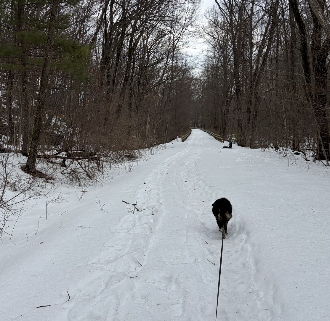
The trail in Marlborough is now plowed all the way through the tunnel at the Hudson border. After that, though, it’s deep snow with a narrow trench, just wide enough for one person to walk, of hardpack made by the passage of many feet preceding us. It looks very doable, so I continue on. Waldo is already out front, having not even considered the idea that we might not forge ahead. The going is a bit uneven and a little slippery, but not a slog.
Someone, sometime in the past, painted mile-markers on the trail, every half-mile, from the beginning in Marlborough to 3.0 miles in Hudson. I don’t know why, nor do I know why they stopped at 3.0, but they’re there, on the northbound side of the trail, measuring about 6”, or so, in height. In Marlborough, the plow has exposed them, but they are still buried under more than a foot of snow in Hudson. The 2.5-mile marker, I can find with extreme accuracy, so I dig a hole in the snow and expose it to the daylight. I’ve always wondered what others might think of seeing a deep hole in the snow, perfectly centered around the numbers, “2.5”, in the midst of undisturbed whiteness. While I’m doing that, Waldo is making snow-doggies, not far away. I can’t find the 3.0-mile marker, though I do kick the snow around a bit.
After we turn around, somewhere around 3.125 miles from the start, and head back, we pass our friend the bicycle enthusiast and his bike. We’re still in Hudson, in the no-plow zone, so he’s not riding it, he’s carrying it. He may be intrepid, but he’s not crazy. Waldo gives him a a tail-wag and he and I exchange comments about the Hudson no-plow zone. I didn’t ask, but I wonder if he lives in Hudson and walks his bike until he gets to Marlborough and then rides it there. I didn’t think to ask him because I’ve come to feel that such behavior is the most natural thing in the world. Why would anyone question it? I’ve certainly seen more bizarre stuff out here, like a 2.2-mile-long path cleared by a snow shovel.
By the time we get back to the car, I’m tired and sore. It’s been just over a month since the last time Waldo and I have done the whole 6 miles. At my age, I find that I lose my physical conditioning fast and it takes a while to regain it. The long-term forecast predicts no significant snow and temps in the 30s and 40s for the next two weeks, so I’ll have a chance to get back into shape before the spring thaw.
Right now, Waldo seems quite pleased with our walk and ready for dinner.
I’m looking forward to my recliner.
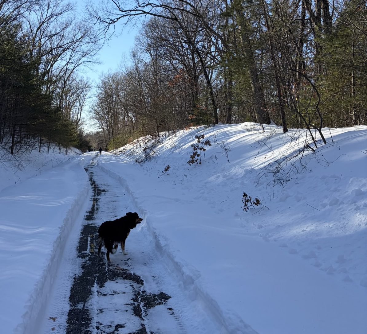
Out there somewhere, under all that snow, is a 3.0 marker.
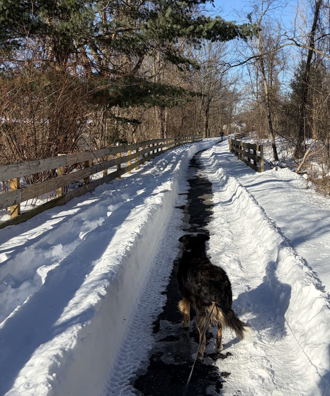
At last, the trail is plowed!
The best-laid schemes o’ Mice an’ Men
Gang aft agley.
-Robert Burns
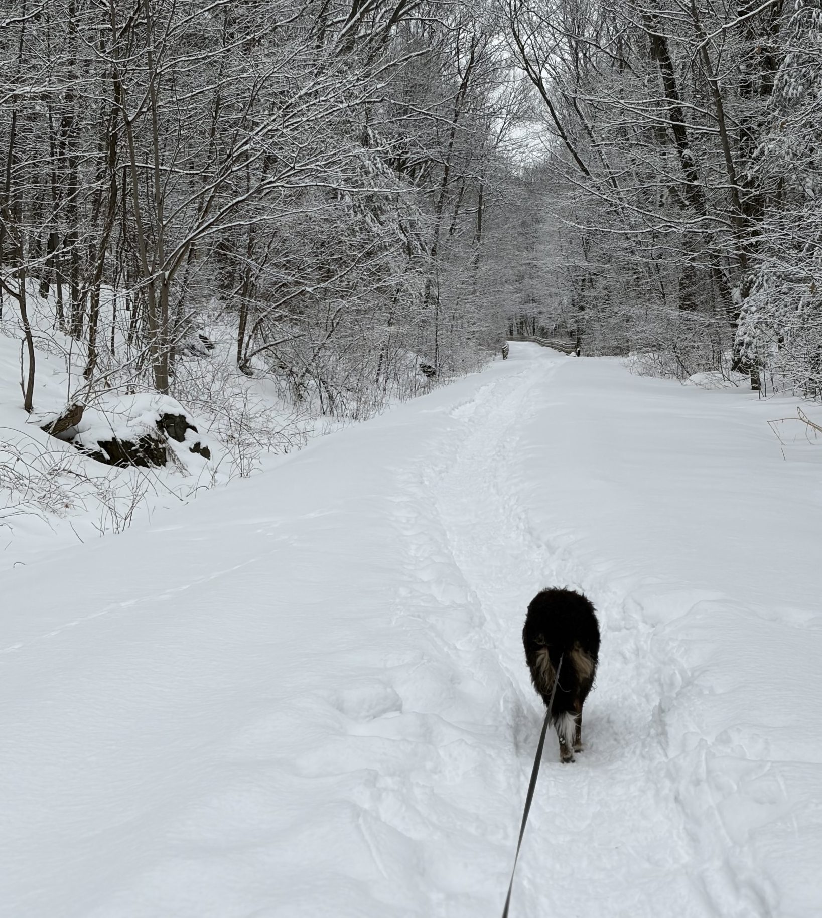
I came down with a virus. I don’t know if it was the flu, or Covid, but whatever it was, it kicked my butt. Sinus pain and drainage, muscle aches and pains, low grade fever and serious malaise and lethargy hit me hard. It drained me of what elderly energy I had to the point where it was difficult to take Waldo out for a short jaunt to do his business. It lasted for 3 weeks, during which time it snowed a good 2 feet. Then the temperature dropped into the mustache-icicle and ice-between-the-toes range – too cold for long walks with Waldo.
After the first week, I started to feel a bit better, so Waldo and I ventured to the rail trail for two days. Because of all the snow, the trail was plowed only for the first 1 ½ miles. After Fitchburg Street, about 7/8ths of a mile from the tunnel under the Rte 85 Connector, the Hudson border, it remained unplowed. Except for the inevitable boot, paw, snowshoe and cross-country ski tracks left by younger and more energetic souls, the snow was untouched, deep and not worth the effort required to continue. So we settled for a 3-mile round-trip trek on the plowed portion only.
The next day, the virus came back with a vengeance, so we were reduced, once again, to pee and poop walks around the property. Waldo took it all pretty well. It was clear that he had plenty of energy that wasn’t adequately burned off, but other than tugging at the leash more than usual, he did okay. Except… He developed polyuria.
Usually, Waldo can hold his urine for a good 6 hours without any accidents. Over the past 3 weeks, that has been reduced to 2 to 3 hours (interestingly, he can go up to 9 hours at night without accident, as long as I don’t let him drink before bed and take him out just before we hit the sack). Now, when he has to go, he really has a powerful urge and he sometimes can’t hold it until we get outside. Along with that, he’s developed a powerful thirst, called polydipsia.
The list of things that can cause this kind of thing is large. It includes urinary tract infection, diabetes mellitus, diabetes insipidus, Grave’s disease, kidney failure and other nasty conditions. One of the nice things about border collies is that they don’t have a predisposition for developing the worst of these, but none of them are impossible. So now the search is on to find the cause and come up with a treatment before things develop into a chronic problem.
Not long after Waldo and I started living together, something similar happened. Routine blood work showed that he picked up a tick-born disease, called anaplasmosis, that can cause frequent urination. The polyuria went away after a week or so and I forgot about it. This certainly isn’t the season to pick up tick bites, but it’s not impossible. Urine tests made UTI and diabetes mellitus unlikely, so, next, the vet and I are going to try a course of antibiotics to see if anaplasmosis can be ruled out.
Diagnosing dogs with subtle conditions is much harder than it is for humans. They can’t tell you their symptoms and some tests are harder to perform on them. Monitoring a 24-hour fluid intake is easy, but how in the world would I ever be able to collect a 24-hour urine? I certainly can’t make him pee in a bottle and nowhere else. Add to that how much Waldo hates being poked by a needle and the process of finding out what ails him becomes a real burden. As it is, he has to be given drugs to make him sleep, on his annual vet visit, just so they can draw his blood. Sigh. To quote Roseanna Roseanadanna, that SNL paragon of philosophical perspicacity, “It’s always something — if it’s not one thing, it’s another.” Funny how, the older Waldo and I get, the more applicable that seems to become…
At least I’m feeling better, the trail is plowed, in some places, and the temperature has warmed to being above 10℉. Of course, Waldo peeing a lot is no problem when we’re out walking.
So we can at least enjoy the rail trail again.
Of course, some places are better plowed than others.
There’s a lot of snow out there!
The light made the snowballs look yellow. Or at least I hoped that was the cause.
-Gary D. Schmidt
Doggy-duty knows no snow days.
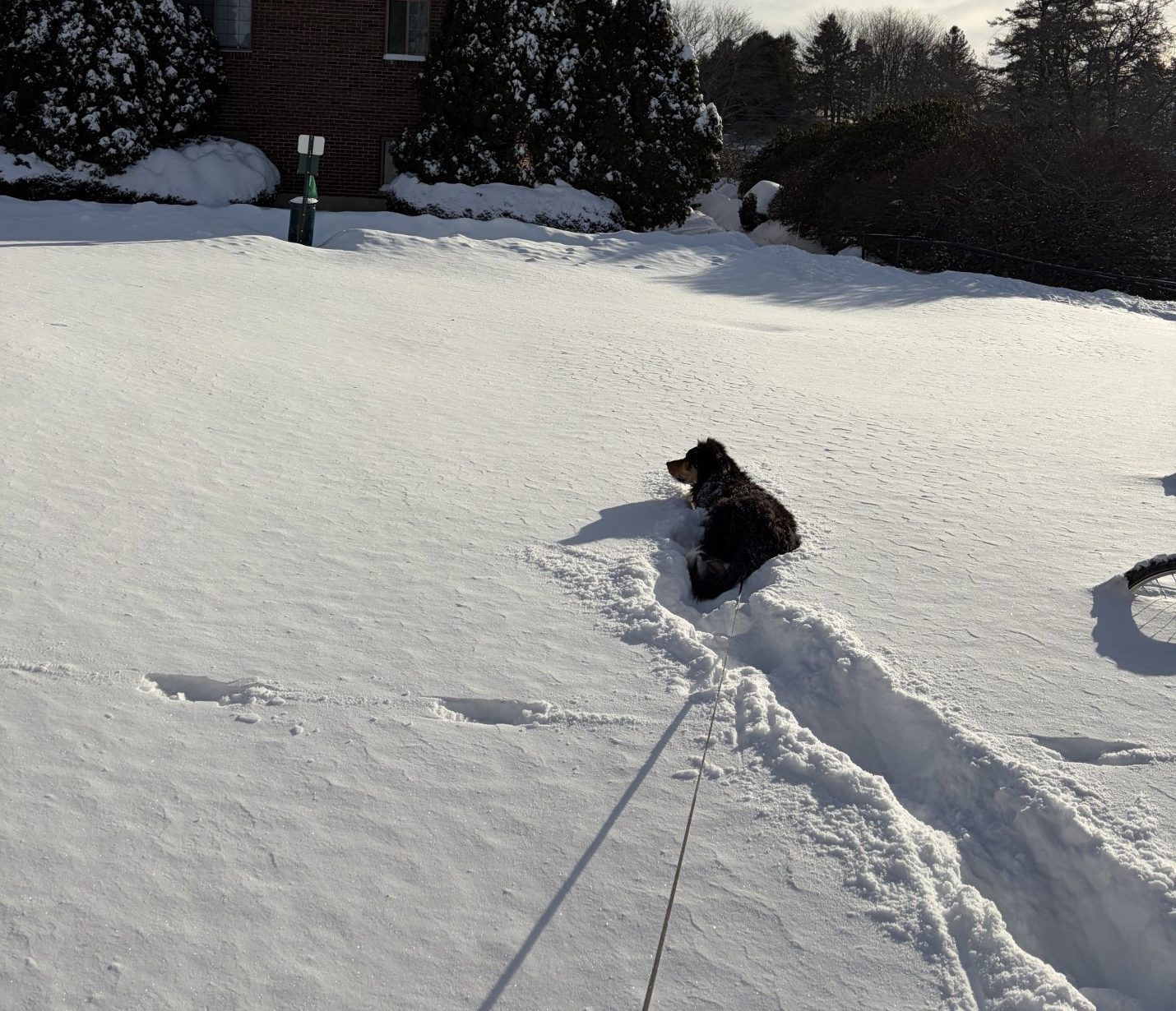
Mother Nature, in her infinite wisdom, decided to leave us 2 feet of snow. All at once. Some people prepped by loading up with groceries and essentials so they could spend the following 3 days cloistered away at home. Waldo-daddies don’t have that luxury. Waldo’s gotta get OUT! Although I did fill the larder well enough so I wouldn’t have to drive for a while, hunkering down in a hidey-hole is not an option. So, here we are, plowing through deep snow, leaving a white glistening wake, more than a path, behind us, and “Lara’s Theme” flowing out from my subconscious with visions of Omar Sharif plodding through the frozen wastes of Siberia.
Waldo’s loving it. Whereas I leave a sort-of trench behind me (albeit a collapsed one) wherever I go, sometimes Waldo leaves big gaping holes in the snow where he has porpoised, leaping completely out of the stuff and landing a good six feet away, without disturbing the sparkling whiteness in between. Damn! I wish I had 10% of that energy. When standing still, only his black back shows above the smooth ivory surface, almost as if he’s floating. Then he stares at a particular spot, as if an idea was forming in his head, and suddenly jabs his nose and face deep in the snow and snorts. It sounds like he let out a long fart. When he pulls his face out and continues on, he’s covered in a dusting of what looks like confectionary sugar. If I pause for a brief respite, to replenish my will to continue, Waldo is over on his back, making snow-doggies. Yep, he’s really gotta get out.
It’s been three days since the storm hit. Looking at the progress being made at cleaning the streets, I decided it was unlikely the rail trail would be plowed yet. I wanted to get a picture for the blog, so, later on, Waldo and I went to a place where we could leave the car and get a good scenic shot without having to walk too far. The lot was being plowed as we parked. The trail itself looks like it was plowed in the recent past – there is a swath of snow that isn’t quite as deep as that next to it, but it’s still a good foot deep and a lot of work to plod through.
Once on the trail, Waldo surges up ahead, pulling the leash out to its full extent, eagerly bounding along. Of course, because it is the rail trail, other people and dogs have been here and left their spoor, recognizable only as a vague disturbance in the snow. But no bikes. No way. That means that Waldo’s spirit is completely unencumbered by angst and he is letting it all out. It does the soul good to see a dog enjoy himself so much.
As for me, I’m struggling along, huffing and puffing, sweating bullets under all the layers I’ve put on, despite the temperature being below 10℉, having to take frequent pauses to quell exhaustion. After ¼ mile, we come to a place that is surrounded by trees and brush and I decide, this is good enough. I take my photos and turn around. That’s far enough. In fact, it’s too far. I really don’t look forward to the slog all the way back. There is a business parking lot just a few yards from the trail, so we cross-country it through drifts up to my knees and break out onto icy tarmac. We have passed neither man, nor beast. Waldo, he’s down with following where I lead. Anything is good as long as we’re outside walking.
We walk on city streets back to the car. Literally. There are canyons in the drifts where some people have shoveled the sidewalk, but not many and they are not contiguous. These are back streets and the traffic is slow and intermittent. Drivers are understanding and give us a wide berth. The streets themselves are plowed, but covered with a thin layer of compacted snow. It is not very slick and, compared to the rail trail, the going is easy.
It looks to me like the city finally has the back streets cleared well enough so it’s likely the trail will be plowed tomorrow. Then we will walk all the way to Hudson (about 2.25 miles), but probably not much farther. I have no doubt that at some point, younger, stronger souls with better endurance than mine, and snow shoes and cross-country skis, will beat the snow down to hard-pack. Once that happens, Waldo and I can go back to our usual trek. But, for now, we head back home.
Me to my blessed recliner and Waldo to his balcony throne.
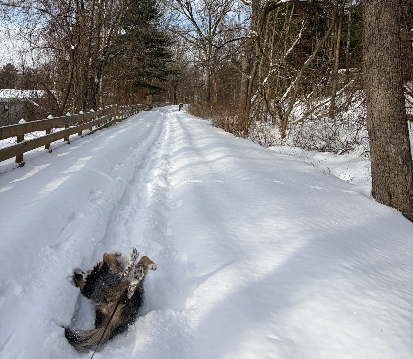
Waldo will make snow-doggies anywhere, even in paths through deep snow.
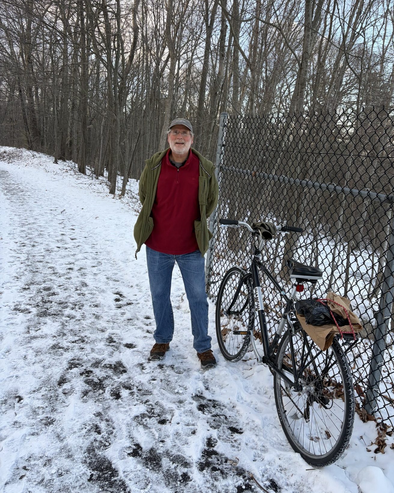
Proof there are intrepid souls out on the rail trail.
They who sing through the summer must dance through the winter.
-Italian Proverb
Waldo and I got a little bit of a late start today. I got involved in some writing and lost track of time. We won’t be finished before about 5:30 PM. The sun will set at 4:26 PM, so I expect it will be a little dark by the time we get back to the car. There’ll be a full moon tonight and the sky is pretty clear, though, so I’m not that worried. We’ve been out here when it’s been darker.
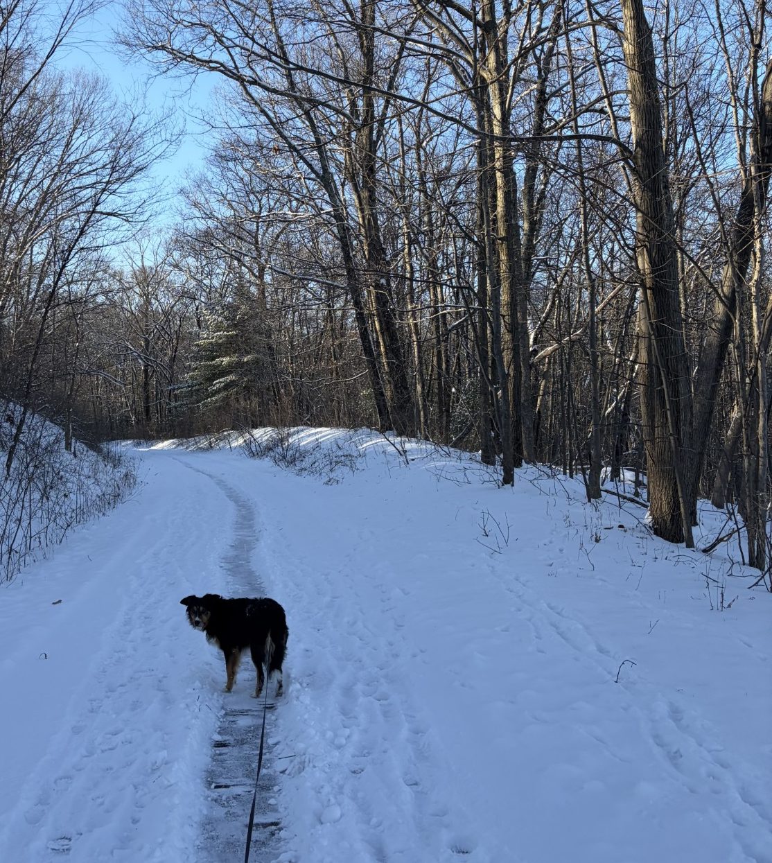
We had a dusting of snow again, no more than an inch, so the trail is covered in white, with many, many footprints. No plow has been this way yet, though I’m sure it will in the near future. The snow fell yesterday, so it has had time to bond a little to the underlying ice. Things are still somewhat slick, but the going is easy with no real danger of falling. The ice at the bottom was thoroughly pockmarked from lots of boots and paws and that makes the path very lumpy and a bit hard to walk on, but it’s not that bad.
Waldo and his four-paw drive, with built in cleats, doesn’t seem to have any problem at all. He’s on the trail, off the trail, in front of me and behind me, nose to the ground, seeking out interesting pee-mail and sticks. He really likes to grab long branches, some as much as 9 feet. Holding one end (usually the thinner end) in his mouth, he drags it behind him, and in front of me, where it’s hard for me to walk without stepping on it. That’s his way of enticing me to grab the heavier end and play tug-of-war. If I’m recalcitrant, he sometimes tries to poke me with the free end. Once, he missed and jabbed it between my legs, causing me to trip and fall. He may be 7 ½ years old, but he’s still a puppy. I grab the bigger end and we pull each other down the trail. After a while, I tire of the game and drop the stick. Waldo then repeats his ploy in remonstration. I’ve explained to him that sticks don’t appeal to me like they do to him, but he can’t fathom it. Finally, he gives up, directs his attention to what’s in front of his nose, and continues on down the trail, odar on.
We’ve gone just over a mile, just past the new park at the Fort Meadow Reservoir overlook, when I see a bicycle leaning up against the hurricane fence that borders the trail there. I know there are bikers out here this time of year because I can see the tracks they leave behind in the snow and ice. But this is the first time I’ve actually seen one on the hoof. A man stands a few feet from the bike, doing I-can’t-tell what. “Hello!” I say as Waldo and I get close. “Is that your bike?”
“Yes, it is,” he answers.
“Can I take a picture of you and your bike? Just to prove that there are bikers out here this time of year.”
“Sure,” he says and gets closer to his bike, as I dig my phone out from my zipped-up and sealed-tight parka.
“How the hell do you keep from falling?” His bike is a thin-tired touring bike. Not even a balloon-tired mountain bike.
“It isn’t easy. This stuff isn’t too bad, but Hudson is impossible.”
“You mean in the no-plow zone.”
He smiles. “So, you know the path well.”
“I’ve been there, once or twice.”
I get my picture and Waldo and I continue on our way. After a few minutes, he passes us, rolling down the trail as if there were no snow and ice there at all. Amazing.
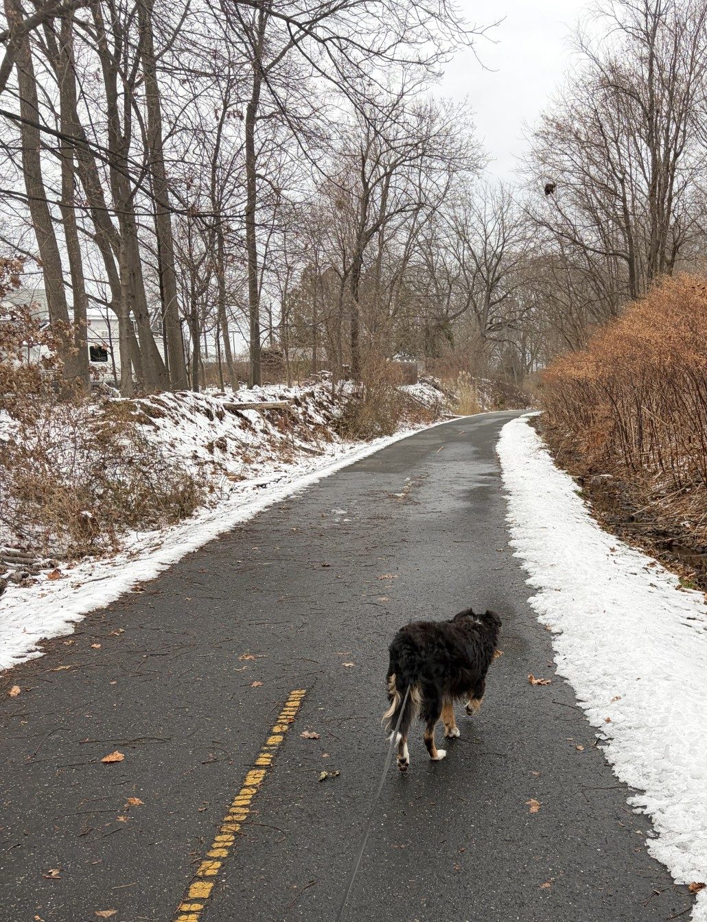
I was a little concerned about how the going will be in Hudson. I needn’t have worried. The snow has covered the ice I studiously avoided yesterday, before the storm, but it is very walkable today. I don’t have to take to the swaths of white ice on the sides of the trail, like I did the last time we were here. I can walk anywhere and get enough traction. It is lumpy and a little slippery, but not that much different from the trail in Marlborough. Maybe the biker could have negotiated it after all. I see no tracks saying that he tried.
A couple of hours have passed by the time we get back to the overlook. It’s 5 PM and the sun set more than a half-hour ago. The day’s afterglow lingers as twilight in the mostly clear sky. Beyond snow-covered fields, lights shine in distant buildings and houses and along the Route 85 highway. They provide a splash of color to the white and beige landscape and, not much more than 10 degrees above the horizon, is a gorgeous full moon, just risen. It’s cold, the temperature has dropped to about 10℉, so we don’t linger, but I do take another picture so I can relish the sight later in the warmth of home. Winter has its own kind of beauty.
All you have to do is get out into it to experience it.
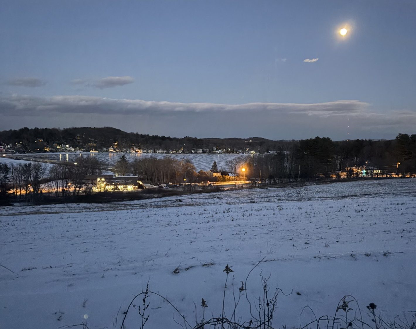
There are advantages to being out here after dark – moonrise over Fort Meadow Reservoir.
No plow? No problem. Get a shovel.
It is the time you have wasted for your rose that makes your rose so important.
-Antoine de Saint-Exupéry, The Little Prince
This year, winter came like Mother Nature flipped a switch. We were having a chilly New England late fall, with temps in the 30s, and then, whammo! came snow, ice and blasts of arctic air, making it feel like it was 2℉. I can dress for the cold, and Waldo comes equipped with a sable birthday suit, but the worst of it is the ice. Watching Waldo do a four-footed river dance on the stuff is amusing (he hardly ever falls), but my bipedal stance is significantly more metastable. It makes walking over a sheet of mirror-smooth frozen water pretty close to impossible, without doing an unintentional limb-flailing, death-defying aerobatic maneuver, resulting in an unavoidable hard, wheels-up, uncontrolled ground-pound, with the potential for serious damage.
In Marlborough, the city plows the rail trail up to the Hudson border. This has always happened, albeit a day or two after the storm is over. Although not perfect, that helps quite a bit, as long as the plow isn’t forced to remove snow that has been deposited over a pre-existing sheet of black ice. In that case, the only hope is for some salt, which is sometimes laid down (they try to avoid adding salt to the forest environment). Once we get to Hudson, the trail is a never-plow zone and we sometimes have to turn around because the conditions are so bad. Usually, though, I can find a narrow swath of “white” ice (signifying that it contains air and will crush when stepped on) that gives me enough traction to avoid a fall.
After the last snowfall, someone made a somewhat serpentine, two-foot-wide path through the inch or two of snow accumulation left behind. Surrounding that was some white ice, and foot and pawprints, smashed into clear ice, that was marginally walkable. I was curious about what and how that path was made. There were no tread marks on the sides, that indicated a snowblower, nor any piles of snow resulting from snow being blown. The thing is, it went on from the beginning of the trail to only a few feet shy of 2¼ miles, just past the Hudson border.
Thinking about that yesterday, as Waldo and I were but a mile from the car and the end of our walk, a man passed us going the other way. “It looks like the plowman got lazy and could only do a narrow path,” I said to him, trying to be clever.
“Oh, no,” he answered. “I did that with a plastic snow shovel.”
“Damn!” I said, in awe. “That’s a helluva lot of work. It’s almost 2¼ miles long!”
“Yeah, my wife thought it would be a good idea.”
Talk about honey-does!
“Well, thank you. It makes the walking a lot easier.”
“You’re welcome.” He nodded and continued on his way.
You know, there are people out here who truly love this place and are willing to go out of their way to take care of it. There’s the elderly couple who maintains the Covid Garden. Even the city put up a sign, encouraging people to make and maintain a rock garden. I know of one man who carries an empty shopping bag to hold the garbage he picks up, as he walks along, that thoughtless people have left behind. And I have been known to pick up dog poop, that wasn’t left by Waldo, to reposit in the trash barrels the city puts out on the side of the trail. These acts are not done merely out of a sense of duty, I believe. I think the motivation is based on loving what we share and enjoy. After all, what better way is there to actively love something than to take care of it?
That was yesterday. Waldo and I didn’t go out on the rail trail today. Winds in excess of 20 mph dropped the affective temp well down into the single digits. What killed the idea was when Waldo bit at his feet as we walked on the apartment grounds, doing the poop and pee loop. When he does that, it means he’s growing ice between his toes and it really hurts (I can attest to that because I know what it feels like to grow icicles on my mustache). It’s also true that it snowed a couple of inches last night. That’s just enough so that, if the trail isn’t plowed, the pre-existing ice will be buried out of sight and hard to avoid. Sigh.
I wonder if the plowman came along and decided that the shoveled path was good enough.
The no-plow, no-shovel zone in Hudson.
It’s a gray day on the rail trail.
A stroll through a winter forest is a stroll through one’s soul.
-Robbie George
A light numbing-cold breeze dances over the exposed skin on my face. My fingers, although protected in thick ski gloves, are a bit achy in the icy temperature. The rest of me is snug in my down parka and rain pants over trekking trousers. There is about a three-inch deep blanket of snow on the ground, except on the trail itself, which is pocked with footprints. The snow is powdery and crunches underfoot as I walk along, providing adequate, although not perfect traction. Clouds of white waft in front me as I exhale from the mild exertion of walking on snow.
One could do a fine rendering of what I see in front of me, using only sepia ink on the whitest of paper – along with a dash of thin light green watercolor, here and there, to suggest the occasional presence of white pine drowning in a sea of spindly, barren, beige limbs. I suppose, the artist would also need a pinch of black to show Waldo’s sable birthday suit and the leash that connects us. Oh, and a slightly meandering path, about two feet wide, where the underlying tarmac has been exposed by some means of snow removal. It’s overcast, so no robin’s egg blue for the sky, and no yellow for the sun, is needed, either. Just sepia ink on white paper with a smidgeon of green and a bit of black is all the palette that would be needed.
It all feels so subdued. Mother Nature at rest. On today’s walk, I have only seen one squirrel, and he was just a fast, furry, beige blur, as he scurried across the trail and out of sight. No other denizens of the woods are out and about. No rabbits, no deer, no foxes, no chipmunks, no mice — no one else is showing up in the quiet stillness. I know there are birds that continue to live around here during the winter, but they’re not advertising their presence. No crow’s caw, songbird lilt or woodpecker rattle. It’s quiet.
Some animals hibernate, of course. But even some of those that don’t, go into a state of torpor when it gets cold out. It’s not as deep as hibernation and it doesn’t last as long, but it does conserve heat and energy. Songbirds are an example, as are raccoons and chipmunks. Many of those animals that do neither will still hole-up in the warm nests they’ve either created or found, until needs, like hunger, require them to stir. Then there are animals, like Waldos, who never do any of the above. Oh, it might be cold enough that they don’t want to go outside for long, but border collie energy does not abate by just laying around, you know.
I think people are somewhat similar to Waldos, although on a different scale, as we get cabin fever too. Oh, it’s not beyond us to fall into prolonged states of physical torpor, even take a nap, now and then. And when it gets nasty out, we do cloister away and assume trance-like states in front of TVs, computer screens or a good book (of course, bad weather is not a prerequisite for that). But, sooner or later, the bottoms of our feet get an itch and we have to go, not only because we need to feed ourselves, but because we need to get out and live.
Today, Waldo and I are out here in the cold and white and beige, not for survival, but to satisfy the need to do. At times, I’m here to simply put one foot in front of the other and be open to let life happen. Although Waldo is spontaneous, he’s always doing more than just walking. He’s looking for pee-mail, the perfect stick and the answer to that most disturbing of questions, what the hell is that smell? That’s something that I, personally, would often be more than happy to just walk away from. But not Waldo. It seems that, even in winter, if you have the nose for it, the odor palette is much more varied, and possibly enticing, than what nature offers the eyes.
The still, muted quietude of winter swaddles me as I walk along. Mother Nature’s repose penetrates into my soul and I can’t help but embrace her placidity. It’s a lovely walk, without riot of color, furor of sound, or distraction of movement.
It’s a wonderful walking meditation.
A nearly monochromic landscape.
You comin’?
In order to really enjoy a dog, one doesn’t merely try to train him to be semi-human. The point of it is to open oneself to the possibility of becoming partly a dog.
-Edward Hoagland
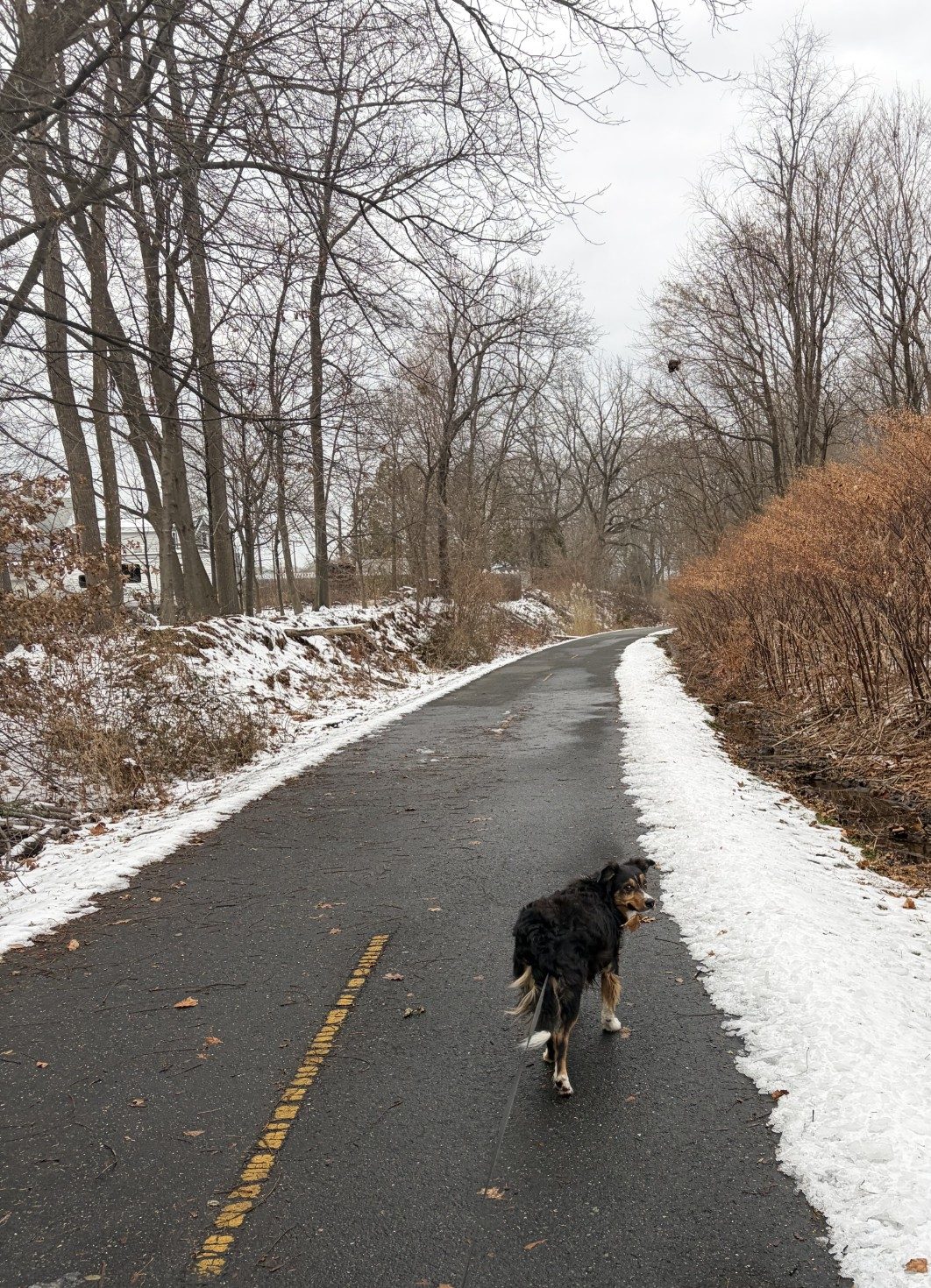
Yesterday, a warm front came through our little patch of woods, The Assebet River Rail Trail, and raised the temperature to 58℉. It rained about 0.6 inches and the two together melted all the snow and ice on the tarmac. Last night, the temperature dropped well below freezing and I was afraid that I’d awaken to iced-over puddles. But that didn’t happen. There are a few small, shallow ice-skating rinks on the rail trail, maybe a foot in diameter, but nothing that can’t be easily negotiated. The temperature today, with windchill, is in the low twenties and the winds are blowing around 10 – 14 miles per hour. So, it is a little chilly, but easily dressed for. Waldo’s enjoying the cool.
Still, it’s cold enough that there aren’t many animals about. On other days, I see the occasional deer and, sometimes, an adventurous squirrel, but not today. No rabbits anywhere. I know there are skunks around here, but I’ve never seen any (I can smell them when they’re around). The air is clear and brisk today, however. I neither hear, nor see, any birds, whatsoever. It’s quiet. It’s just me, Waldo and a few fellow intrepid walkers, who pass us by. We have no hibernacula (a word I just learned that means the place where animals hibernate) — we gotta get out and fight cabin fever, you know. Oh, and, of course, there’s also the sleeping woods.
Waldo is doing his Waldo thing, nose inches off the ground, searching the environs with his odar (odor detection and ranging). He trots along in S-turns, back and forth across the trail, and stops, on occasion, when he finds something particularly interesting that requires a more prolonged and intensive sniff. That might be pee-mail, some other dog’s poop, a dead animal, or God knows what. When he does find that peculiar, enticing whiff that requires his focused attention, he sometimes falls behind. When he catches up, he almost always goes around me on my left. I’ve often wondered why.
Border collies are known for doing something the community calls “spinning.” They often walk around you – falling behind, passing you on one side, then falling behind again on the other side. It’s thought to be an expression of their herding instinct. When they’re on a leash, the result can be that you get all wrapped up in their tether. I am constantly passing the leash handle from one hand to the other to prevent that. When we’re out bushwhacking and Waldo gets in front of me and on the wrong “path,” I call him back. If there is a tree between me and him, he seldom comes back the way he went. He spins the damn tree. That means I have to plow through the weeds some distance (the leash is long) to where he is and unwrap the leash. We then backtrack to get on the course I want us to follow. It’s just one of the many ways I feel like I’m constantly trying to get us over what he’s put asunder.
One thing that I find puzzling about Waldo’s spinning is that it’s almost always in a clockwise direction. He falls behind me on my right, passes me on the left, and so on. Why in the world would he have a predilection for clockwise spinning? In nature, wind moves from a high pressure to a low pressure so the pressure can be equalized. This can’t happen directly because the Earth is rotating which creates a pseudoforce, called the Coriolis force, that makes wind blow clockwise out of the high-pressure region and then counterclockwise into the low-pressure area. That’s why all hurricanes and tornadoes spin counterclockwise in the northern hemisphere (in the southern hemisphere, the same force makes tornadoes and hurricanes spin in the opposite direction). But, as far as I know, there’s no counterpart to the Coriolis force that governs dog behavior. Maybe I should test that and take Waldo to Australia to see if he spins me in a counterclockwise direction.
After many S-turns and clockwise circles, Waldo straightens out his path and tugs a bit at the leash. He’s anxious to get back to the car and home. I don’t think that’s because he’s tired or cold. I think he’s looking forward to supper. And, of course, passing on dicta to his dogdom from his balcony throne. He does have responsibilities, you know.
Me, I’m tired and cold and looking forward to warming up in my beloved recliner. Until tomorrow, that is, when we do it all over again.
And share the joy of being in the woods.
Let’s go, then.