

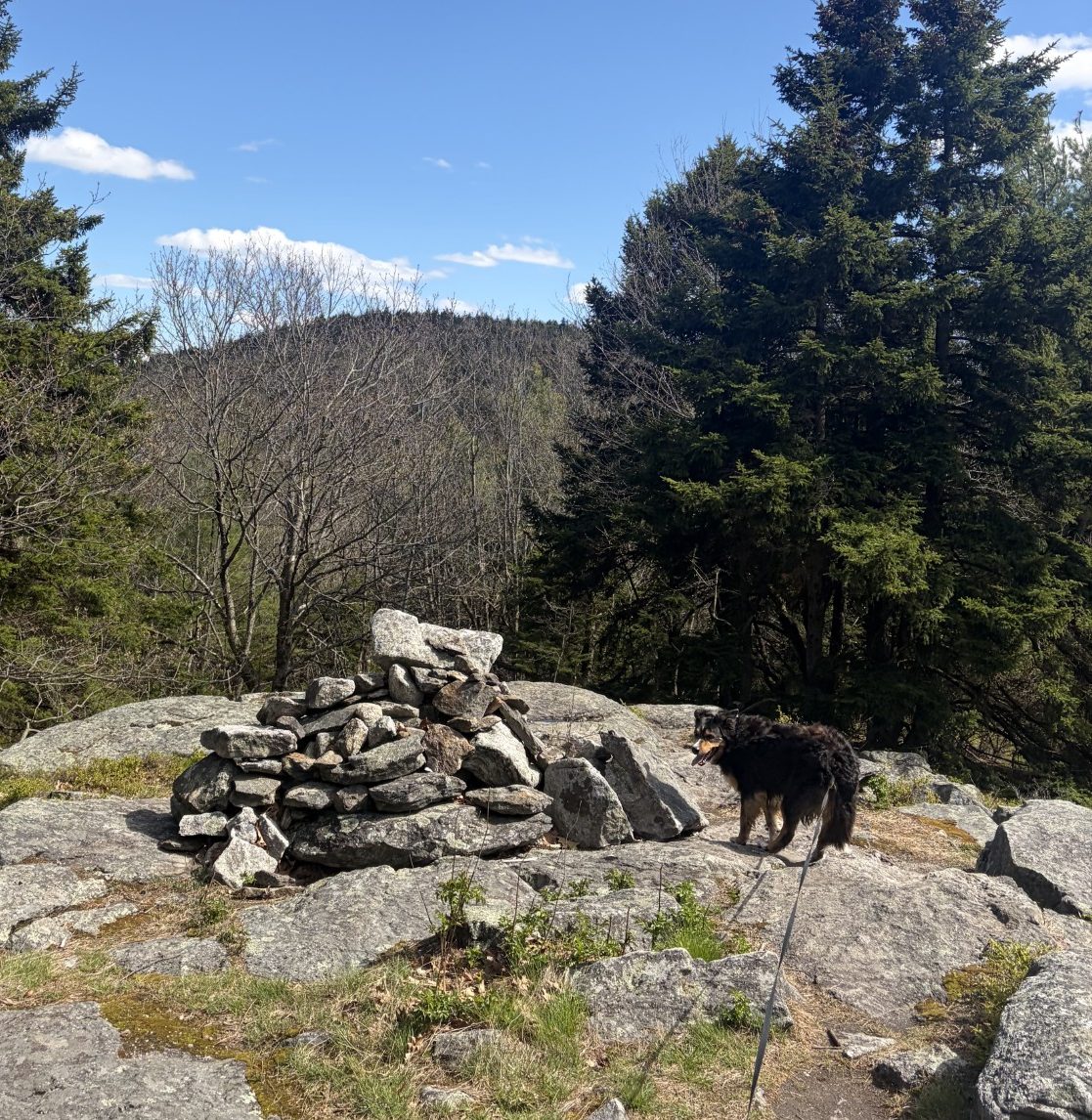
A cairn en route.
Walking With Waldo
There are two fatal that keep great projects from coming to life:
- Not finishing
2) Not starting
— Buddha Gautama
Today is the day Waldo and I are going to complete the part of the Midstate Trail that goes over Mt Watatic. It’s a weekday, so there’s room to park in the lot at the trailhead. I once again opt for the route that has a gentler slope for the uphill slog. This is now the third time Waldo and I have walked here and its rocks and roots are familiar. The going is a bit strenuous, but I don’t have to take any breaks, just adjust my pace so I don’t run out of breath. I take one breath for every 3 steps. I’m reminded of the time I hiked up Mt Kilimanjaro — at 19,000 ft, I had to take 3 breaths for every step. That mountain is huge, and we climbed it on a 5-day hike up, 2-day hike down trip. Still, although not as arduous as Kilimanjaro, the going is slower on these hills than on flat ground.
Waldo is enjoying himself out at the front end of the leash. His nose is close to the ground, sniffing the smells left by all the previous passersby and whatever else is out there. He adjusts his pace to fit mine, slowing down as necessary, when the leash gets taut. He lifts a leg now and then, but most of his time is spent seeing the world through his nose. The trail is broad enough for a jeep to use it, so it’s not the canine equivalent of rocket science for him to know where to go. I only need to adjust his path with a simple, “Over here!” when he decides to go on the opposite side of a tree from where I want to go.
The temperature is in the high 50s and there’s adequate sun shining down through the arboreal canopy to keep me warm without a jacket. In fact, we haven’t gone very far before I’ve worked up a sweat. As arduous as the route is, it’s only three miles long and I’m pretty sure Waldo can wait until we get back to the car before being in serious need of water. So I left the backpack in the car and I hike unencumbered.
After about a mile, we come to the shoulder of the ridge that connects Watatic with the mountains to the north that we’ve already hiked over. I recognize the path that heads that way, off to our left, and continue on to the right, up the backside of Mt Watatic. It’s uphill, but not as steep as the path on the other side of the mountain.
The ground is often treeless, covered by large slabs of granite. Here and there, someone has placed trail-markers, large solid triangles of yellow paint, on the stone. In other places there are huge cairns that even a blind man can find. I’m able to maintain a decent pace, without too many stops to catch my breath. After another hour or so, we’re at the apex. Waldo’s nose may be drawn to the ground beneath him, but my eye is driven to scan the vast panorama of the green rolling hills of New England spread out before and below me. I understand why people like to hike to the tops of mountains.
I look to the north, where we started the Midstate Trail, and over the mountains we’ve already hiked and the ridges between them. It’s interesting that, with very few exceptions, mountain ranges in the US run north/south. The Uintah Mountains in Utah are an exception and there are only a couple of others. This is probably due to plate tectonics and glacier motion during the last ice age. So mountains are lined up (more or less) mostly in a north/south direction and are connected by ridges that are higher than the mountains’ bases. It makes sense, then, if you want to hike north/south up several mountains in a row, you would want to stay on the ridge between them, rather than go all the way to the bottom of each mountain, then up the next. That way, you limit the amount of up/down hiking you have to do. I’ve done this before, hiking on a piece of the Appalachian Trail over the Presidential Mountains, further north in New Hampshire. I was preparing for going up Mt Kilimanjaro, some 16 years ago, and wanted to get used to hiking over steep terrain. On one hike, I followed the north/south running ridge that connects Mountains Monroe, Franklin, Eisenhauer, Pierce and Jackson. There are more mountain tops on that ridge, but I had to call it quits because it was getting dark. Mt. Watatic is the last of the big mountains on this ridge and we now have to go down to its base to continue on the trail.
We turn and head down the steeper side of the mountain. Once off the top, we’re surrounded by eastern hemlock trees and brush. The ground is quite steep, uneven and lumpy, with exposed roots and rocks, and I have to step carefully. Unlike Waldo, who, in his youthful exuberance, is jumping and bounding down the hill with abandon. He must get frustrated by the tug of the old-man anchor that creeps down the hill slowly and haltingly. Still, he only occasionally tugs at the leash when he over-estimates how much freedom he has before reaching the end of his tether.
After another hour or so, we’re back to the car. My legs are a bit tired and a little sore, but my back is hardly bothering me at all. I must be getting in some kind of shape after all this mountain climbing! I suppose that my ease could be due to the fact that today, Waldo and I only hiked 3 miles instead of over 9, taking us 3 hours rather than more than 7 and had to go up only 700 feet of elevation gain as opposed to 1,300.
Nah! I’m getting in shape!
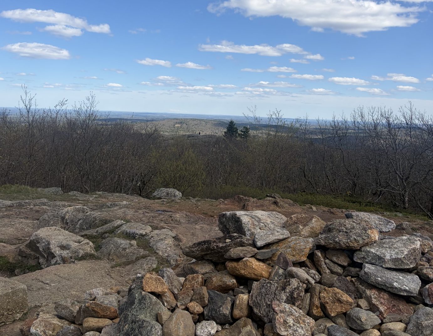
The view from the top of Mt. Watatic.